Croker Hill
| Croker Hill | |
|---|---|
| Highest point | |
| Elevation | 402 m (1,319 ft) |
| Prominence | 98 m (322 ft) |
| Parent peak | Shining Tor (559m) |
| Listing | List of hills in the Peak District |
| Coordinates | 53°12′22″N 2°06′03″W / 53.206133°N 2.1007°WCoordinates: 53°12′22″N 2°06′03″W / 53.206133°N 2.1007°W |
| Geography | |
| Location | Cheshire, UK |
| Parent range | Peak District |
| OS grid | SJ933677 |
| Topo map | OS Landranger 119 |
Croker Hill stands just outside the western edge of the Peak District national park, overlooking Congleton in Cheshire. Near the summit stands the Sutton Common BT Tower that was built during the 1960s.
Popular with hill walkers, Croker Hill offers fine views of the Cheshire plain and on clear days, Manchester city centre and as far away as Snowdon can be seen.
Peaks of the Peak District of England | ||
|---|---|---|
| Marilyns | 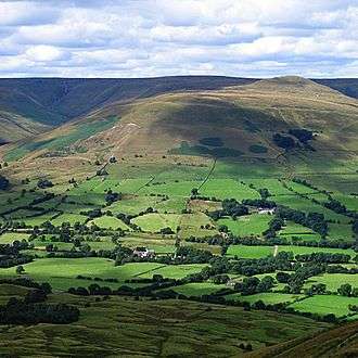 | |
| Other peaks |
| |
This article is issued from
Wikipedia.
The text is licensed under Creative Commons - Attribution - Sharealike.
Additional terms may apply for the media files.