Brown Knoll
| Brown Knoll | |
|---|---|
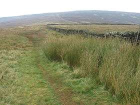 Looking towards Brown Knoll | |
| Highest point | |
| Elevation | 569 m (1,867 ft) [1] |
| Prominence | 36 m[1] |
| Parent peak | Kinder Scout |
| Listing | Dewey, TuMP |
| Coordinates | 53°21′48″N 1°52′32″W / 53.36333°N 1.87556°WCoordinates: 53°21′48″N 1°52′32″W / 53.36333°N 1.87556°W |
| Geography | |
| Location | Derbyshire, England |
| Parent range | Peak District |
| OS grid | SK083851 |
| Topo map | OS Landranger 110; OL1W |
Brown Knoll is one of the highest hills in the Peak District in central England. It rises to a height of 569 metres (1,867 ft)[1] above the head of the Edale valley and about 3 kilometres (1.9 mi) south-southwest of the Peak's highest point, Kinder Scout.[1]
Description
Brown Knoll is a treeless, domed summit covered in moorland vegetation. A track between the Pennine Way and Pennine Bridleway runs past the summit to the northwest and a footpath branches off from that track crosses the summit itself and heads southeast to the hills lining the southern side of the valley of Edale.[1] The area is designated Open Access land,[2] but is outside the National Trust's High Peak Estate.[3]
References
- 1 2 3 4 5 Brown Knoll at www.hill-bagging.co.uk. Retrieved 10 Mar 2016.
- ↑ OL1 Dark Peak area (Map). 1:25000. Explorer. Ordnance Survey.
- ↑ "Follow the history of our places with Land Map". National Trust. Retrieved 28 April 2018.
Peaks of the Peak District of England | ||
|---|---|---|
| Marilyns | 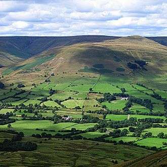 | |
| Other peaks |
| |
This article is issued from
Wikipedia.
The text is licensed under Creative Commons - Attribution - Sharealike.
Additional terms may apply for the media files.