Karakoyunlu
| Karakoyunlu | |
|---|---|
 Karakoyunlu | |
| Coordinates: 39°58′21″N 44°10′22″E / 39.97250°N 44.17278°ECoordinates: 39°58′21″N 44°10′22″E / 39.97250°N 44.17278°E | |
| Country | Turkey |
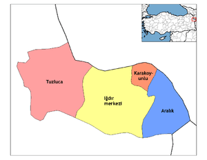
| Province | Iğdır |
| Government | |
| • Mayor | Kurban Kaya (CHP) |
| • Kaymakam | Elif Canan Tuncer Ersöz |
| Area[1] | |
| • District | 193.91 km2 (74.87 sq mi) |
| Elevation | 448 m (1,470 ft) |
| Population (2012)[2] | |
| • Urban | 2,664 |
| • District | 14,264 |
| • District density | 74/km2 (190/sq mi) |
| Post code | 76700 |
| Website | www.karakoyunlu.bel.tr |
Karakoyunlu (Azerbaijani: Qaraqoyunlu) is a town and district of Iğdır Province in the Eastern Anatolia region of Turkey. Part of the district forms the international border between Turkey and Armenia.
Statues with ram heads
Gravestones with ram heads existing in almost all old cemeteries in Iğdır Plain are remnants from Kara Koyunlu period. These commemorate brave, heroic persons and young persons who died at a young age.[3]
Population
| Year | Population |
|---|---|
| 2007 | 2,649 |
| 2000 | 4,760 |
| 1997 | 5,384 |
| 1990 | 4,110 |
| 1985 | 3,220 |
| 1980 | 2,950 |
References
- ↑ "Area of regions (including lakes), km²". Regional Statistics Database. Turkish Statistical Institute. 2002. Retrieved 2013-03-05.
- ↑ "Population of province/district centers and towns/villages by districts - 2012". Address Based Population Registration System (ABPRS) Database. Turkish Statistical Institute. Retrieved 2013-02-27.
- ↑ "Introduction of Iğdır", Iğdır Municipality Publishing, 2003
External links
| Wikimedia Commons has media related to Karakoyunlu. |
- (in Turkish) Official website of the Karakoyunlu Municipality - this website is partially accessible.
- (in Turkish) Official website of the Karakoyunlu Karakoyunlu District
- (in Turkish) Iğdır's News website (in Turkish)
This article is issued from
Wikipedia.
The text is licensed under Creative Commons - Attribution - Sharealike.
Additional terms may apply for the media files.