Nwoya
| Nwoya | |
|---|---|
 Nwoya Location in Uganda | |
| Coordinates: 02°38′06″N 32°00′00″E / 2.63500°N 32.00000°E | |
| Country |
|
| Region | Northern Region of Uganda |
| Sub-region | Acholi sub-region |
| District | Nwoya District |
| Elevation | 3,220 ft (980 m) |
Nwoya is a town in Nwoya District in the Northern Region of Uganda. It is the main municipal, administrative, and commercial centre of the district.
Location
Nwoya is on the main Gulu-Arua road, approximately 44 kilometres (27 mi), by road, southwest of Gulu, the largest city in the Acholi sub-region.[1] This is approximately 330 kilometres (210 mi), by road, northwest of Kampala, the capital and largest city of Uganda.[2] The coordinates of the town are 2°38'06.0"N, 32°00'00.0"E (Latitude:2.6350; Longitude:32.0000).[3]
Points of interest
The following points of interest lie within the town limits or close to the edges of the town:
- headquarters of Nwoya District Administration
- The offices of Nwoya Town Council
- Nwoya central market
- Acholibur–Gulu–Olwiyo Road, arriving into town from Gulu in a north-south direction and leaves towards Olwiyo in a northeast-southwest direction
See also
References
- ↑ "Map Showing Gulu And Nwoya With Distance Marker". Globefeed.com. Retrieved 3 June 2014.
- ↑ "Road Distance Between Kampala And Nwoya With Map". Globefeed.com. Retrieved 3 June 2014.
- ↑ Google (21 July 2015). "Location of Nwoya at Google Maps" (Map). Google Maps. Google. Retrieved 21 July 2015.
External links
Capital: Nwoya | ||
| Towns and villages | 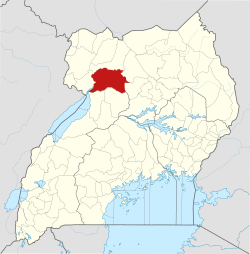 | |
| Geography |
| |
| Economy | ||
| Energy | ||
| Transport | ||
| Health | ||
| Notable landmarks | ||
| Notable people | ||
This article is issued from
Wikipedia.
The text is licensed under Creative Commons - Attribution - Sharealike.
Additional terms may apply for the media files.