Anaka
| Anaka | |
|---|---|
| Town Council | |
 Anaka Location in Uganda | |
| Coordinates: 02°36′03″N 31°56′52″E / 2.60083°N 31.94778°E | |
| Country |
|
| Region | Northern Region |
| Sub-region | Acholi sub-region |
| District | Nwoya District |
| Elevation | 3,000 ft (1,000 m) |
Anaka is a town in the Northern Region of Uganda. It is the site of the Nwoya District headquarters.
Location
Anaka is on the Acholibur–Gulu–Olwiyo Road, the main highway between Gulu and Pakwach. It is about 53 kilometres (33 mi) south-west of Gulu, the largest city in the sub-region.[1] The coordinates of the town are 02°36'03.0"N, 31°56'52.0"E (Latitude:2.600839; Longitude:31.947775).[2]
Points of interest
The following points of interest lie within the town limits or close to the edges of the town:
- The offices of Anaka Town Council
- Anaka General Hospital - A 120-bed public hospital, administered by the Uganda Ministry of Health[3]
- Anaka central market
- The Acholibur–Gulu–Olwiyo Road, the main highway between Gulu and Pakwach
- Pope Paul VI Senior Secondary School
- Anaka Catholic Church
See also
References
- ↑ Globefeed.com (25 June 2016). "Distance between Gulu, Northern Region, Uganda and Anaka, Northern Region, Uganda". Globefeed.com. Retrieved 25 June 2016.
- ↑ Google (25 June 2016). "Location of Anaka, Nwoya District, Northern Region, Uganda" (Map). Google Maps. Google. Retrieved 25 June 2016.
- ↑ Makumbi, Cissy (29 January 2015). "Anaka Hospital repairs to be completed in June". Daily Monitor. Kampala. Retrieved 5 May 2016.
External links
Capital: Nwoya | ||
| Towns and villages | 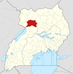 | |
| Geography |
| |
| Economy | ||
| Energy | ||
| Transport | ||
| Health | ||
| Notable landmarks | ||
| Notable people | ||
This article is issued from
Wikipedia.
The text is licensed under Creative Commons - Attribution - Sharealike.
Additional terms may apply for the media files.