Jinning District
| Jinning 晋宁区 | |
|---|---|
| District | |
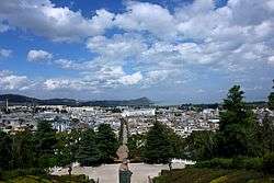
 Kunyang Town in Jinning | |
.png) Location of Jinning (pink) and Kunming City (yellow) in Yunnan province | |
| Country | People's Republic of China |
| Province | Yunnan |
| Prefecture | Kunming Prefecture |
| Established | 1956 |
| Area | |
| • Total | 1,391 km2 (537 sq mi) |
| Population (2003) | |
| • Total | 270,000 |
| • Density | 190/km2 (500/sq mi) |
| Time zone | UTC+8 (CST) |
| Postal code | 650600 |
| Area code(s) | 0871 |
| Website | http://www.jinning.gov.cn/ |
Jinning District (simplified Chinese: 晋宁区; traditional Chinese: 晉寧區; pinyin: Jìnníng Qū) is a district of Kunming, the capital of Yunnan province, China. The district is located at the southern tip of Dian Lake and is well-known within China as the birthplace of Zheng He.
Administrative divisions
Kunyang Town, Jincheng Town and Baofeng Town, Erjie Village, Shuanghe Yi Nationality Village, Xiyang Yi Nationality Village, Shangsuan Village, Xinjie Village and Lujie Village
Ethnic groups
According to the Kunming City Almanac (1997:476), ethnic Hani are found in Gaoliangdi (高粱地)[1] and Xiyang (夕阳)[2] of Xiyang Township (夕阳乡), Jinning County.
Transport
Social issues
In October 2014 Fuyou village (Chinese: 富有村) in Jinning was the scene for a violent clash between construction workers and villagers, leading to death of eight people. The residents had been unhappy about a land deal related to building of a trade and logistics centre.[3][4]
Monuments

The Shizhaishan Tombs (Shizhaishan gumuqun 石寨山古墓群), and the grave of Ma station Hazhi (Ma Hazhi mubei 马哈只墓碑) in the greater community Kunyang, the father of Zheng He, are since 2001 and 2006 respectively on the list the monuments of the People's Republic of China.
References
- ↑ http://www.ynszxc.gov.cn/villagePage/vIndex.aspx?departmentid=104450
- ↑ http://www.ynszxc.gov.cn/villagePage/vIndex.aspx?departmentid=104441
- ↑ "China building site clash leaves eight dead". BBC News. 15 October 2014. Retrieved 24 October 2014.
- ↑ "China 'punishes 17 officials' after deadly village clash". BBC News. 24 October 2014. Retrieved 24 October 2014.
External links
- jinning.gov.cn - official
- Master mariner's genealogy comes to light
- Zheng He's pedigree
- Cheng Ho went around the world in 28 years
- Zhenghe Park
- Zheng He gongyuan
Coordinates: 24°40′00″N 102°35′30″E / 24.66667°N 102.59167°E