Pilar, Cebu
| Pilar | |
|---|---|
| Municipality | |
| Municipality of Pilar | |
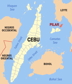 Map of Cebu with Pilar highlighted | |
.svg.png) Pilar Location within the Philippines | |
| Coordinates: 10°48′N 124°33′E / 10.8°N 124.55°ECoordinates: 10°48′N 124°33′E / 10.8°N 124.55°E | |
| Country |
|
| Region | Central Visayas (Region VII) |
| Province | Cebu |
| District | 5th district of Cebu |
| Barangays | 13 (see Barangays) |
| Government [1] | |
| • Type | Sangguniang Bayan |
| • Mayor | Eufracio Maratas |
| • Vice Mayor | Grace Japlit |
| • Congressman | Red Durano |
| • Electorate | 8,613 voters (2016) |
| Area [2] | |
| • Total | 32.42 km2 (12.52 sq mi) |
| Population (2015 census)[3] | |
| • Total | 11,308 |
| • Density | 350/km2 (900/sq mi) |
| Time zone | UTC+8 (PST) |
| ZIP code | 6048 |
| PSGC | 072236000 |
| IDD : area code | +63 (0)32 |
| Climate type | Tropical climate |
| Income class | 5th municipal income class |
| Revenue (₱) | 46,686,755.44 (2016) |
| Native languages |
Cebuano Tagalog |
Pilar, officially the Municipality of Pilar, (Cebuano: Lungsod sa Pilar; Tagalog: Bayan ng Pilar), is a 5th class municipality in the province of Cebu, Philippines. According to the 2015 census, it has a population of 11,308 people.[3]
The municipality is contiguous with Ponson Island, one of the four Camotes Islands in the Camotes Sea (along with Pacijan Island, Poro Island, and Tulang Island). The island is about 10.6 kilometres (6.59 mi) long and 3.7 kilometres (2.30 mi) wide.
Pilar is bordered to the north by the Province of Leyte in the Camotes Sea, to the west is by the island of Poro Island With the town of Tudela, to the east is the Camotes Sea facing the Province of Leyte and to the south is also the Camotes Sea
Barangays
Pilar comprises 13 barangays:
| PSGC | Barangay | Population | ±% p.a. | |||
|---|---|---|---|---|---|---|
| 2015[3] | 2010[4] | |||||
| 072236001 | Biasong | 3.1% | 345 | 360 | −0.81% | |
| 072236002 | Cawit | 17.0% | 1,925 | 1,892 | 0.33% | |
| 072236003 | Dapdap | 5.0% | 563 | 781 | −6.04% | |
| 072236004 | Esperanza | 7.2% | 815 | 851 | −0.82% | |
| 072236015 | Imelda | 5.1% | 582 | 616 | −1.08% | |
| 072236005 | Lanao | 9.1% | 1,029 | 990 | 0.74% | |
| 072236006 | Lower Poblacion | 6.6% | 745 | 578 | 4.95% | |
| 072236007 | Moabog | 9.1% | 1,034 | 1,007 | 0.51% | |
| 072236008 | Montserrat | 10.6% | 1,202 | 1,303 | −1.52% | |
| 072236011 | San Isidro | 4.3% | 482 | 570 | −3.14% | |
| 072236012 | San Juan | 6.5% | 730 | 799 | −1.70% | |
| 072236013 | Upper Poblacion | 7.6% | 865 | 770 | 2.24% | |
| 072236014 | Villahermosa | 8.8% | 991 | 1,047 | −1.04% | |
| Total | 11,308 | 11,564 | −0.43% | |||
Demographics
| Population of Pilar | |||||||||||||||||||||||||||||||||||||||||||||||||
|---|---|---|---|---|---|---|---|---|---|---|---|---|---|---|---|---|---|---|---|---|---|---|---|---|---|---|---|---|---|---|---|---|---|---|---|---|---|---|---|---|---|---|---|---|---|---|---|---|---|
|
| ||||||||||||||||||||||||||||||||||||||||||||||||
| Source: Philippine Statistics Authority[3][4][5] | |||||||||||||||||||||||||||||||||||||||||||||||||
Language
People in Pilar mainly speak Cebuano with an accent similar to the locals of Bohol. Like most Filipinos, Pilaranons may also speak Tagalog and English. Waray is also spoken due to its proximity to Leyte.
The town is home to the Porohanon language, one of the most endangered languages in the Visayas. The language is only used in the Poro islands. The language is classified as distinct from Sebwano (Bisaya) by the Komisyon ng Wikang Filipino and is vital to the culture and arts of the Porohanon people.
References
- ↑ "Municipality". Quezon City, Philippines: Department of the Interior and Local Government. Retrieved 31 May 2013.
- ↑ "Province: Cebu". PSGC Interactive. Quezon City, Philippines: Philippine Statistics Authority. Retrieved 12 November 2016.
- 1 2 3 4 Census of Population (2015). "Region VII (Central Visayas)". Total Population by Province, City, Municipality and Barangay. PSA. Retrieved 20 June 2016.
- 1 2 Census of Population and Housing (2010). "Region VII (Central Visayas)". Total Population by Province, City, Municipality and Barangay. NSO. Retrieved 29 June 2016.
- ↑ Censuses of Population (1903–2007). "Region VII (Central Visayas)". Table 1. Population Enumerated in Various Censuses by Province/Highly Urbanized City: 1903 to 2007. NSO.
Places adjacent to Pilar, Cebu | ||||||||||
|---|---|---|---|---|---|---|---|---|---|---|
| ||||||||||
Cebu City (capital) | |
| Municipalities |
|
| Component cities | |
| Highly urbanized cities | (Administratively independent from the province but grouped under Cebu by the Philippine Statistics Authority. However, qualified voters in Mandaue are allowed to vote in elections for Cebu provincial officials as part of the 6th Sangguniang Panlalawigan district.) |