Interstate 40 in Oklahoma
| ||||
|---|---|---|---|---|
|
I-40 highlighted in red | ||||
| Route information | ||||
| Maintained by ODOT | ||||
| Length | 331 mi (533 km) | |||
| Existed | 1957[1] – present | |||
| Major junctions | ||||
| West end |
| |||
|
| ||||
| East end |
| |||
| Location | ||||
| Counties | Beckham, Washita, Custer, Caddo, Canadian, Oklahoma, Pottawatomie, Seminole, Okfuskee, Okmulgee, McIntosh, Muskogee, Sequoyah | |||
| Highway system | ||||
|
Oklahoma State Highway System
| ||||
.svg.png)
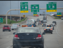
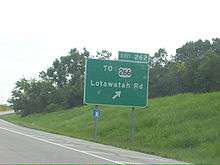
Interstate 40 (I-40) is an Interstate Highway in Oklahoma that runs 331 miles (533 km) across the state from Texas to Arkansas. West of Oklahoma City, it parallels and replaces the old Route 66, and east of Oklahoma City, it parallels US-62, 266, and 64.
Cities along the route include Erick, Sayre, Elk City, Clinton, Weatherford, Oklahoma City and its suburbs (El Reno, Yukon, Del City, Midwest City, and Shawnee), Okemah, Henryetta, Checotah, and Sallisaw.
Route description
Interstate 40 enters Oklahoma near Texola in Beckham County. It crosses the North Fork of the Red River near Sayre and runs through southern Elk City. It then cuts across northwest Washita County before entering Custer County. There, it passes through Clinton and Weatherford. After leaving Weatherford, I-40 then runs across northern Caddo County. After that, it enters the Oklahoma City Metro Area at Canadian County.
I-40 runs through the south side of El Reno as it enters the Oklahoma City metro. It then passes through Yukon before entering Oklahoma City city limits. In west Oklahoma City, I-40 has a junction with Interstate 44. It then runs just south of downtown Oklahoma City on a new ten lane section.[2] I-40 then interlines with Interstate 35 at the Dallas Junction complex. This forms a concurrency with it for two miles (3 km). After the Dallas Junction, I-40 then passes through Del City and Midwest City on the Tinker Diagonal. This provides access to Tinker Air Force Base in east Oklahoma City.
In far eastern Oklahoma City, I-40 meets Interstate 240 in a partial junction. Afterwards, it passes through the north side of Shawnee. This markes the eastern end of the OKC metro area. In Henryetta, I-40 serves as the northern terminus of the Indian Nation Turnpike. In McIntosh County, it crosses the northernmost arm of Lake Eufaula. Afterwards, it meets US-69 south of Checotah.
Near Webbers Falls, I-40 is the southern terminus of the Muskogee Turnpike. It then crosses the Arkansas River before passing through southern Sallisaw. The interstate crosses into Arkansas north of Moffett.
History
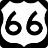
West of Oklahoma City, Interstate 40 parallels and replaces Old US-66. US-66 was decommissioned in Oklahoma in 1985.

Bridge collapse
The I-40 bridge over the Arkansas River/McClellan-Kerr Navigation System near Webbers Falls was struck by a barge on May 26, 2002, causing the bridge to collapse and resulting in the death of 14 people.
Westbound I-40 traffic was detoured through Gore and Webbers Falls along SH-10, US-64, and SH-100, while eastbound traffic was diverted through Porum and Stigler along SH-2, SH-9, and US-59.[3] Delays of thirty to fifty minutes on the 12-mile (19 km) westbound detour were typical, although trains passing through Gore could lengthen wait times by 15 minutes. The eastbound detour added 40 miles (64 km) and two hours to the typical trip. Some travelers chose to avoid the area entirely; one Tulsa trucking firm detoured trucks via Springdale, adding 70 miles (110 km) to the trip.[4][5]
The detour significantly impacted the town of Gore. Local firefighters directed traffic there 24 hours a day, with daytime temperatures approaching 100 °F (38 °C). Businesses in Gore reported loss of revenue due to the traffic; one gas station reported a 30% decline in revenue while traffic was detoured through town.[5]
2015 shootings
On December 17, 2015, a Pasadena, Texas man allegedly shot and killed two people on Interstate 40 near Weatherford, Oklahoma. He was arrested by police in Clinton, Oklahoma.[6]
Oklahoma City Crosstown realignment
The original I-40 Oklahoma City Crosstown Expressway was built in 1966 mostly as an elevated route; however, this former stretch was too narrow for existing traffic, and was frequently in disrepair. In response, the I-40 Crosstown Expressway has been relocated a few blocks south of the original route, and the original bridge torn down. The project was completed in February 2012.[2]
The new I-40 Crosstown Expressway has been designed to carry 170,000+ vehicles-per-day traveling at 60 miles-per-hour (97 km/h) using at-least ten lanes for traffic, and has breakdown lanes for disabled vehicles and future lane expansion.
When the new crosstown opened in 2012, nearly 95% of non-rush hour traffic was considered 'through traffic'; not transferring to or from downtown streets.
A landscaped boulevard is currently under-construction (circa 2016) replacing the original I-40 Crosstown Bridge right-of-way through downtown Oklahoma City; similar to the I-30 reconstruction through downtown Fort Worth, Texas.
Business routes and old alignments
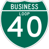
I-40 has eight business routes in Oklahoma, six of which are old alignments of US-66. A number of other old alignments of US-66 are also present west of Oklahoma City.
Erick I-40 Business Loop (formerly US-66) is a Business Loop that runs from I-40 two miles (3 km) west of Erick to the old alignment of US-66, through Erick, and back to I-40, four miles (6 km) east of Erick.
Sayre I-40 Business Loop (formerly US-66) is a Business Loop that begins two miles (3 km) south of Sayre at US-283, runs north into the city, and then leaves Sayre to the east, rejoining I-40 two miles (3 km) east of US-283.
Elk City I-40 Business Loop (formerly US-66) is a Business Loop that begins at Exit 32, seven miles (11 km) west of Elk City. It runs for ten miles (16 km) through Elk City, rejoining I-40 at Exit 41.
Clinton I-40 Business Loop (formerly US-66) is a Business Loop that begins at Exit 65, runs five miles (8 km) through Clinton, and rejoinds I-40 at Exit 69.
Weatherford I-40 Business Loop (formerly US-66) is a Business Loop that exits I-40 at Exit 82B, runs four miles (6 km) through Weatherford, and rejoins I-40 at Exit 82.
El Reno I-40 Business Loop (formerly US-66) is a Business Loop through El Reno. It exits I-40 at Exit 119, runs eight miles (13 km) through El Reno, and rejoins I-40 at Exit 125, the interchange with US-81.
Henryetta I-40 Business Loop (formerly US-62/US-75) is a Business Loop that leaves I-40 at Exit 237, runs four miles (6 km) through Henryetta, and rejoins I-40 at Exit 240, the interchange with US-75 and the Indian Nation Turnpike.
Sallisaw I-40 Business Loop is a Business Loop that leaves I-40 at Exit 308, US-59, runs four miles (6 km) through Sallisaw, and rejoins I-40 at Exit 311, US-64.
Exit list
| County | Location | mi | km | Exit | Destinations | Notes |
|---|---|---|---|---|---|---|
| Oklahoma–Texas line | 0.00 | 0.00 | ||||
| Beckham | | 1 | Texola | |||
| | 5 | |||||
| Erick | 7 | |||||
| | 11 | |||||
| | 14 | Hext Road | ||||
| Sayre | 20 | |||||
| 23 | ||||||
| 25.11 | 40.41 | 25 | ||||
| | 26 | Cemetery Road | ||||
| | 32 | Western terminus of SH-34 concurrency | ||||
| | 34 | Merritt Road | ||||
| Elk City | 38 | |||||
| 40 | East 7th Street | |||||
| 41 | Eastern terminus of SH-34 concurrency | |||||
| Washita | Canute | 47 | Canute | |||
| | 50 | Clinton Lake Road | ||||
| Foss | 53 | |||||
| Custer | | 57 | Stafford Road | |||
| | 61 | Haggard Road | ||||
| | 62 | Parkersburg Road | ||||
| Clinton | 65 | No eastbound entrance | ||||
| 65A | 10th Street, Neptune Drive | |||||
| 66 | ||||||
| | 69.16 | 111.30 | 69 | Westbound exit and eastbound entrance | ||
| | 71 | Custer City Road | ||||
| Weatherford | 80 | |||||
| 80A | Eastbound exit and westbound entrance | |||||
| 82 | ||||||
| 84 | Airport Road | |||||
| Caddo | | 88 | ||||
| | 95 | Bethel Road | ||||
| | 101 | |||||
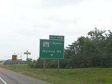
| Canadian | | 104 | Methodist Road | |||
| | 108 | |||||
| | 115 | Western terminus of US-270 concurrency | ||||
| | 119 | |||||
| El Reno | 123 | Country Club Road | ||||
| 125 | ||||||
| 127 | Radio Road | |||||
| | 130 | Banner Road | ||||
| Oklahoma City | 132 | Cimarron Road – C.E. Page Airport | ||||
| Oklahoma City–Yukon line | 135 | Frisco Road | Planning underway, bid letting projected for 2017[7] | |||
| Yukon | 136 | Garth Brooks Boulevard | ||||
| Oklahoma City | 137 | Cornwell Drive, Czech Hall Road | Eastbound exit and entrance on Czech Hall Road, westbound exit and entrance from Northwest 10th Street | |||
| 138A | Westbound exit via exit 139 | |||||
| 139 | Eastbound I-40 exit 138B | |||||
| 140 | Morgan Road | |||||
| Oklahoma | 142 | Council Road | ||||
| 143 | Rockwell Avenue | |||||
| 144 | MacArthur Boulevard | |||||
| 145 | Meridian Avenue | |||||
| 146 | Portland Avenue | Eastbound exit and westbound entrance | ||||
| 147 | Signed as exits 147A (westbound I-44) & 147B (eastbound I-44); I-44 exits 120A-B | |||||
| 147C | May Avenue – Fair Park | Merged with exit 148A upon I-40 Crosstown realignment; was westbound exit and eastbound entrance | ||||
| 148A | Agnew Avenue, Villa Avenue, May Avenue | May Ave. not signed eastbound | ||||
| 148B | Oklahoma City Boulevard east | Eastbound exit and westbound entrance; former Oklahoma City Crosstown Expressway alignment | ||||
| 148C | Pennsylvania Avenue | Formerly exit 148B (that was eastbound exit and westbound entrance only) on old alignment | ||||
| 148C | Virginia Avenue | Closed upon I-40 Crosstown realignment; was westbound exit and eastbound entrance | ||||
| 149 | Western Avenue | Formerly also served Reno Avenue and Sheridan Avenue on exit 149A of old alignment | ||||
| 149B | Classen Boulevard | Closed upon I-40 Crosstown realignment; was westbound exit and eastbound entrance | ||||
| 150A | Walker Avenue – Downtown Oklahoma City | Closed upon I-40 Crosstown realignment; was eastbound exit and westbound entrance | ||||
| 150B | Harvey Avenue | Closed upon I-40 Crosstown realignment; was eastbound exit only | ||||
| 150A | Shields Boulevard | No eastbound exit | ||||
| 150B | Robinson Avenue | Westbound exit only; formerly exit 150C on old alignment | ||||
| 151A | Oklahoma City Boulevard west | Westbound exit and eastbound entrance | ||||
| 151A | Lincoln Boulevard | Closed upon I-40 Crosstown realignment; was eastbound exit only | ||||
| 151B | Western terminus of I-35/US-62 concurrency | |||||
| 151C | Signed as exit 126 westbound, due to I-35 concurrency | |||||
| 127 | Eastern Avenue, M. L. King Avenue | Eastbound exit and westbound entrance; exit number follows I-35 | ||||
| 153 | Eastern terminus of I-35/US-62 concurrency | |||||
| Del City | 154 | Reno Avenue, Scott Street | ||||
| 155A | Sunnylane Road – Del City | |||||
| 155B | SE 15th Street – Del City, Midwest City | |||||
| Midwest City | 156A | Sooner Road | ||||
| 156B | Hudiburg Drive | No eastbound entrance | ||||
| 157A | SE 29th Street – Midwest City | Eastbound exit only | ||||
| 157B | Air Depot Boulevard – Tinker Gate | |||||
| 157C | Town Center Drive – Eaker Gate | |||||
| 159A | Hruskocy Gate | |||||
| 159B | Douglas Boulevard – Lancer Gate, Liberator Gate, Marauder Gate | |||||
| Oklahoma City | 162 | Anderson Road | ||||
| 165 | Western terminus of SH-3 concurrency; westbound exit and eastbound entrance | |||||
| 166 | Choctaw Road | |||||
| 169 | Peebly Road | |||||
| Eastern Oklahoma County Turnpike north | Proposed trumpet interchange[8] | |||||
| 172 | Newalla Road – Harrah | |||||
| Pottawatomie | McLoud | 176 | Western terminus of SH-102 concurrency | |||
| 178 | Eastern terminus of SH-102 concurrency | |||||
| | 181 | Eastern terminus of US-270/SH-3 concurrency, western terminus of SH-3E concurrency; SH-3 splits into SH-3E and SH-3W | ||||
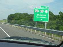
| Shawnee | 185 | Kickapoo Street – Shawnee | ||||
| 186 | Eastern terminus of SH-3E concurrency | |||||
| | 192 | |||||
| Seminole | | 200 | ||||
| | 212 | |||||
| Okfuskee | | 217 | ||||
| | 221 | Western terminus of US-62 concurrency | ||||
| | 227 | Clearview Road | ||||
| | 231 | Western terminus of US-75 concurrency | ||||
| Okmulgee | Henryetta | 237 | ||||
| 240A | Indian Nation Turnpike exits 104A-B | |||||
| 240B | Eastern terminus of US-62/US-75 concurrency | |||||
| McIntosh | | 247 | Tiger Mountain Road | |||
| | 255 | Pierce Road | ||||
| | 259 | |||||
| | 262 | |||||
| | 264 | Signed as exits 264A (south) and 264B (north) | ||||
| | 265 | |||||
| | 270 | Texanna Road – Porum Landing | ||||
| Muskogee | | 278 | ||||
| | 284 | Ross Road | ||||
| | 286 | |||||
| | 287 | |||||
| Sequoyah | | 291 | ||||
| | 297 | |||||
| | 303 | Dwight Mission Road | ||||
| Sallisaw | 308 | |||||
| 311 | ||||||
| | 321 | |||||
| | 325 | |||||
| | 330 | Eastbound exit and westbound entrance | ||||
| Oklahoma–Arkansas line | 331.00 | 532.69 | ||||
1.000 mi = 1.609 km; 1.000 km = 0.621 mi
| ||||||
Auxiliary route
I-40 has one auxiliary route in Oklahoma:
.svg.png)
See also
References
- ↑ Froehlig, Adam. Scans from the "Yellow Book". Froggie's Place. URL accessed September 20, 2006.
- 1 2 "OKC I-40 Crosstown". Okladot.state.ok.us. Archived from the original on August 31, 2011. Retrieved September 19, 2011.
- ↑ "I-40 Webbers Falls Local Detour Route & Map". Oklahoma Department of Transportation. Retrieved 2014-01-10.
- ↑ Stewart, D. R. (May 29, 2002). "Truckers weigh cost of detours". Tulsa World. Retrieved 2014-01-10.
- 1 2 Morgan, Rhett (July 26, 2002). "Towns on detour route await bridge reopening". Tulsa World. Retrieved 2014-01-10.
- ↑ http://abcnews.go.com/US/dead-apparent-road-rage-shooting-oklahoma-highway/story?id=35819332
- ↑ Powell, Jim (August 20, 2014). "'Ball rolling' on Frisco Road–I-40 project". The Yukon Review. Retrieved 2014-09-10.
- ↑ Gatz, Tim J. (September 25, 2017). "Re: Infrastructure for Rebuilding America (INFRA) funding for Interstate 40 / Douglas Interchange and related interstate widening in Oklahoma County" (PDF) (Letter). Letter to The Hon. Elaine Chao, Secretary of Transportation. Retrieved April 12, 2018.
External links
Route map:
| Wikimedia Commons has media related to Interstate 40 in Oklahoma. |
| Previous state: Texas |
Oklahoma | Next state: Arkansas |