Interstate 240 (Tennessee)
| ||||
|---|---|---|---|---|
|
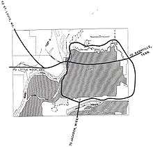
I-240 highlighted in red | ||||
| Route information | ||||
| Maintained by TDOT | ||||
| Length | 19.27 mi[1] (31.01 km) | |||
| Existed | 1970 – present | |||
| Major junctions | ||||
| West end |
| |||
| East end |
| |||
| Location | ||||
| Counties | Shelby | |||
| Highway system | ||||
| ||||

Interstate 240 (I-240) is a 19.27-mile-long (31.01 km) Auxiliary Interstate Highway in the U.S. state of Tennessee. It forms a loop with its parent I-40 around the eastern neighborhoods of Memphis. It travels from an interchange with I-40 east of downtown to an interchange with I-40, US 79, and Sam Cooper Boulevard in East Memphis, providing access to Memphis International Airport and the eastern neighborhoods. The section in East Memphis around Walnut Grove Road is the busiest interstate in Tennessee, with an AADT of just under 200,000 vehicles.[2] The western leg of I-240 has been approved to be signed as I-69.
Route description
I-240 begins east of downtown Memphis at an interchange with I-40. I-240 continues south, running through midtown to an interchange with I-55 in South Memphis, where it changes direction. Continuing east, I-240 travels along the northern bank of Nonconnah Creek, providing access to Memphis International Airport and the eastern neighborhoods of Memphis. At an interchange with SR 385, I-240 turns and proceeds north, ending at an interchange with I-40, US 79, and Sam Cooper Boulevard in East Memphis.
History
I-240 was first planned circa 1955, but it was to have been a 30.8-mile (49.6 km) beltway to completely encircle midtown Memphis, with the exception of the segment between Interstates 40 and 55, which was proposed as Interstate 255. Later, that number was decommissioned in favor of I-240 running in a full loop, with I-40 running from downtown to east Memphis. However, in 1957 citizens collected 10,000 signatures protesting the route, which cut through Overton Park in midtown. The controversy lasted until the 1970s, when the Supreme Court ruled in favor of the citizens. This effectively cancelled the Overton Park routing, shifting I-40 onto the northern leg of I-240. Part of the proposed I-40 route was already built from N. Highland St. east to the I-40/240 junction. The road is now called Sam Cooper Boulevard, and is owned by the city.
In 2000, the City of Memphis built an extension to the former I-40 section of Sam Cooper Blvd. This extension runs west from N. Tillman St. (the former entry/end point for Sam Cooper Boulevard) as a limited access parkway to East Parkway N. (a former exit for the proposed "Overton Park route").
The interstates overlapped around the northern bypass of Memphis for many years, but the northern leg eventually came to be known only as I-40, eliminating the concurrency and turning I-240 into a semi-beltway. Exits were not renumbered.
On January 18, 2008, the Federal Highway Administration authorized the states of Mississippi and Tennessee to extend I-69 from the I-40/TN 300 interchange in north Memphis to the I-55/I-69 interchange in Hernando; however, Tennessee has not yet signed the extension of the route, although Mississippi has already done so.[3]
On March 24, 2010, a sinkhole formed in the two leftmost northbound lanes north of the Walnut Grove interchange. It was initially thought to have been a smaller pothole and had been paved over the day before. It formed around 3:00 in the afternoon and damaged several cars, although no injuries were reported. These two lanes were shut down until March 28 while the sinkhole was filled.
Recent construction
I-240 has seen significant reconstruction over the past decade, as area growth has demanded increased capacity. Both interchanges with I-40 have been reconstructed due to the amount of traffic taking I-40 through Memphis. The portion between Lamar Ave to Mt. Moriah Rd was widened to 8 through lanes in the early 2000s.
A widening project began on the stretch of I-240 from north of TN 385 to north of Walnut Grove Road in April 2011. This was necessary due to increased traffic volumes since the freeway's construction. This included adding a lane to each side (which made it an average of 4 lanes on each side), retaining walls, noise barriers, and a redesigning of the Poplar Avenue interchange: a main source of congestion. The project was completed in late 2014.[4]
In Fall 2013, TDOT began work to reconstruct the I-240/I-40 eastern interchange for a second time. This reconstruction included construction of two additional flyover ramps and the widening of Sam Cooper Boulevard. Construction was completed in summer of 2017. [5]
Exit list
The exits on I-240 run clockwise, reflecting their initial numbering as part of a circumferential beltway. They also pick up I-40's exit numbers. The entire route is in Memphis, Shelby County.
| mi | km | Exit | Destinations | Notes | ||
|---|---|---|---|---|---|---|
| 0.00 | 0.00 | Counterclockwise terminus | ||||
| 12A | No westbound exit | |||||
| 12B | Sam Cooper Boulevard | Sam Cooper Blvd. exits 10A–B | ||||
| 12C | Eastbound exit and westbound entrance; I-40 exit 10A | |||||
| 13 | Walnut Grove Road (SR 23 east) | Signed as exits 13A (west) and 13B (east) westbound | ||||
| 15 | Signed as exits 15A (east) and 15B (west) | |||||
| 16 | Western terminus of SR 385 | |||||
| 17 | Mount Moriah Road | |||||
| 18 | Perkins Road | |||||
| 20 | Signed as exits 20A (south) and 20B (north) eastbound | |||||
| 21 | Westbound exit to northbound Lamar Avenue and second westbound entrance via Prescott Street | |||||
| 23 | Signed as exits 23A (north) and 23B (south) | |||||
| 24 | Millbranch Road / Nonconnah Boulevard | |||||
| 25 | Signed as exits 25A and 25B; I-55 exit 6; south end of future I-69 overlap | |||||
| 26 | Norris Road | |||||
| 28 | South Parkway | Signed as exits 28A (east) and 28B (west) | ||||
| 29 | Lamar Avenue (US 78 / SR 4) / Crump Boulevard | |||||
| 30 | Union Avenue (US 51 / US 64 / US 70 / US 79) | Northbound exit and southbound entrance | ||||
| Madison Avenue | Southbound exit and northbound entrance | |||||
| 31 | Northbound exit and southbound entrance; I-40 exit 1E | |||||
| 32 | Northbound exit and southbound entrance | |||||
| Clockwise terminus; north end of future I-69 overlap | ||||||
1.000 mi = 1.609 km; 1.000 km = 0.621 mi
| ||||||
See also


- Transportation in Memphis, Tennessee
References
- ↑ Staff (October 31, 2002). "Table 2: Auxiliary Routes of the Dwight D. Eisenhower National System Of Interstate and Defense Highways as of October 31, 2002". Route Log and Finder List. Federal Highway Administration.
- ↑ "I-240 Noise Barrier Decision Creates Ruckus in East Memphis". Memphis Commercial Appeal. April 17, 2011. Retrieved September 19, 2011.
- ↑ Capka, J. Richard (January 18, 2008). "Letter to Paul D. Degges]" (PDF). Federal Highway Administration. Retrieved May 28, 2008.
- ↑ "Interstate 240 Widening Project". Tennessee Department of Transportation. Retrieved September 19, 2011.
- ↑ "I-40/I-240 Interchange". Tennessee Department of Transportation. Retrieved October 20, 2014.
External links
Route map:

| ||