Inhacorá
| Inhacorá | |
|---|---|
| Municipality | |
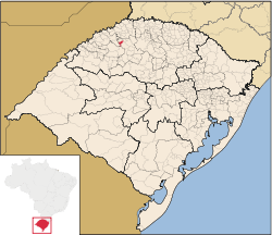 Location in Rio Grande do Sul state | |
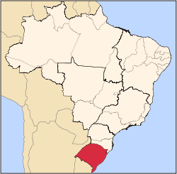
 Inhacorá Location in Brazil | |
| Coordinates: 27°52′59″S 54°1′1″W / 27.88306°S 54.01694°WCoordinates: 27°52′59″S 54°1′1″W / 27.88306°S 54.01694°W | |
| Country |
|
| State | Rio Grande do Sul |
| Area | |
| • Total | 114.11 km2 (44.06 sq mi) |
| Population (2015) | |
| • Total | 2,318 |
| • Density | 20/km2 (53/sq mi) |
| Time zone | UTC-3 (BRT) |
| • Summer (DST) | UTC-2 (BRST) |
| Website |
www |
Inhacorá is a municipality in the northern part of the state of Rio Grande do Sul, Brazil. The population is 2,318 (2015 est.) in an area of 114.11 km².[1] Its elevation is 358 m. It is located 482 km west of the state capital of Porto Alegre, northeast of Alegrete.
Bounding municipalities
References
External links
This article is issued from
Wikipedia.
The text is licensed under Creative Commons - Attribution - Sharealike.
Additional terms may apply for the media files.