Dilermando de Aguiar
| Dilermando de Aguiar | |
|---|---|
| Municipality | |
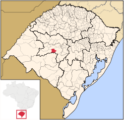 Location within Rio Grande do Sul | |
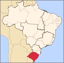
 Dilermando de Aguiar Location in Brazil | |
| Coordinates: 29°42′21″S 54°12′28″W / 29.70583°S 54.20778°WCoordinates: 29°42′21″S 54°12′28″W / 29.70583°S 54.20778°W | |
| Country |
|
| State | Rio Grande do Sul |
| Time zone | UTC-3 (UTC-3) |
| • Summer (DST) | UTC-2 (UTC-2) |
Dilermando de Aguiar is a municipality in the state of Rio Grande do Sul, Brazil.
Paleontology
In this city there are outcrops of Sanga do Cabral Formation, the (Railroad abandoned between Dilermando de Aguiar and São Gabriel). Early Triassic age.
See also
This article is issued from
Wikipedia.
The text is licensed under Creative Commons - Attribution - Sharealike.
Additional terms may apply for the media files.