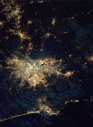
Greater São Paulo
.jpg)
The Greater São Paulo (Portuguese: Grande São Paulo) is a nonspecific term for one of the multiple definitions the large metropolitan area located in the São Paulo state in Brazil.
Definitions
Metropolitan Area
A legally defined specific term, Região Metropolitana de São Paulo (RMSP), one definition for Metropolitan São Paulo, consists of 39 municipalities, including the state capital, São Paulo.[1]
The RMSP of São Paulo is known as a financial and economic centre of Brazil, with a total population of 23,455,256 inhabitants (2017 estimate). The largest municipalities are São Paulo, with a population of 12,138,175, Guarulhos with a population of 1,337,087 people, plus several municipalities with more than 500,000 inhabitants, such as São Bernardo do Campo (822,242 inh.) and Santo André (712,749 inh.) in the ABC Region. The ABC Region (from Santo André, São Bernardo do Campo and São Caetano do Sul) in the south of Grande São Paulo is an important location for industrial corporations, such as Volkswagen and Ford. It represents the "core" cities of the greater region.
Extended Metropolitan Area
The extended metropolitan area of São Paulo (Complexo Metropolitano Estendido de São Paulo) is an agglomeration of five contiguous metropolitan areas that have grown into one another and three microregions, dominated by São Paulo. It has more than 33 million inhabitants, which is 75% of the population of the entire state of São Paulo, and consists of the contiguous entities:
| Legally Defined District | Population (2016 IBGE estimate)[2] | Seat city | Population (2016 IBGE estimate)[3] |
|---|---|---|---|
| Metropolitan Region of São Paulo | 23,455,256 | São Paulo | 12,138,175 |
| Metropolitan Region of Campinas | 3,631,528 | Campinas | 1,173,370 |
| Metropolitan Region of Vale do Paraíba e Litoral Norte | 2,575,879 | São José dos Campos | 695,992 |
| Metropolitan Region of Sorocaba | 2,108,425 | Sorocaba | 652,481 |
| Metropolitan Region of Baixada Santista | 1,913,033 | Santos | 434,359 |
| Piracicaba Urban Agglomeration | 1,552,691 | Piracicaba | 394,419 |
| Jundiaí Urban Agglomeration | 780,927 | Jundiaí | 405,740 |
| Bragança Paulista region | 510,299 | Bragança Paulista | 162,435 |
| CME São Paulo (Extended Metropolitan Complex of São Paulo) | +36,315,721 | ||
RMSP statistics
Municipalities in RMSP
| N° | Municipality (Município) | Area (km2) | 1991 census | Density (Inhab/km2)[6] | 2000 census | Density (Inhab/km2) | Estimate 2008[7][8] | Density (Inhab/km2) | GDP (2005)[9] |
|---|---|---|---|---|---|---|---|---|---|
| 1 | Arujá | 97 | 37,622 | 388 | 59,185 | 610 | 79,000 | 814 | 934,992,000 |
| 2 | Barueri | 64 | 130,799 | 2,044 | 208,281 | 3,254 | 265,000 | 4,140 | 22,430,475,000 |
| 3 | Biritiba-Mirim | 317 | 17,833 | 56 | 24,653 | 78 | 29,000 | 91 | 164,634,000 |
| 4 | Caieiras | 96 | 39,069 | 407 | 71,221 | 742 | 87,000 | 906 | 1,040,734,000 |
| 5 | Cajamar | 128 | 33,736 | 264 | 50,761 | 397 | 63,000 | 492 | 1,915,590,000 |
| 6 | Carapicuíba | 35 | 283,661 | 8,105 | 344,596 | 9,846 | 389,000 | 11,114 | 1,915,285,000 |
| 7 | Cotia | 324 | 107,453 | 332 | 148,987 | 460 | 179,000 | 552 | 3,472,181,000 |
| 8 | Diadema | 31 | 305,287 | 9,848 | 357,064 | 11,518 | 394,000 | 12,709 | 7,344,570,000 |
| 9 | Embu | 70 | 155,990 | 2,228 | 207,663 | 2,967 | 245,000 | 3,500 | 1,834,260,000 |
| 10 | Embu-Guaçu | 155 | 36,277 | 234 | 56,916 | 367 | 62,000 | 400 | 366,844,000 |
| 11 | Ferraz de Vasconcelos | 30 | 96,166 | 3,206 | 142,377 | 4,746 | 176,000 | 5,866 | 793,081,000 |
| 12 | Francisco Morato | 49 | 83,885 | 1,712 | 133,738 | 2,729 | 155,000 | 3,163 | 512,822,000 |
| 13 | Franco da Rocha | 134 | 85,535 | 638 | 108,122 | 807 | 129,000 | 962 | 1,186,777,000 |
| 14 | Guararema | 271 | 17,961 | 66 | 21,904 | 81 | 27,000 | 99 | 364,164,000 |
| 15 | Guarulhos | 318 | 787,866 | 2,478 | 1,072,717 | 3,373 | 1,279,000 | 4,022 | 21,615,314,000 |
| 16 | Itapevi | 91 | 107,976 | 1,187 | 162,433 | 1,785 | 202,000 | 2,219 | 1,809,328,000 |
| 17 | Itapecerica da Serra | 151 | 85,640 | 567 | 129,685 | 859 | 159,000 | 1,052 | 1,925,151,000 |
| 18 | Itaquaquecetuba | 82 | 164,957 | 2,012 | 272,942 | 3,329 | 351,000 | 4,280 | 1,733,662,000 |
| 19 | Jandira | 18 | 62,697 | 3,483 | 91,807 | 5,100 | 110,000 | 6,111 | 1,091,263,000 |
| 20 | Juquitiba | 522 | 19,969 | 38 | 26,459 | 51 | 29,000 | 55 | 176,268,000 |
| 21 | Mairiporã | 321 | 39,937 | 124 | 60,111 | 187 | 77,000 | 239 | 606,428,000 |
| 22 | Mauá | 62 | 294,998 | 4,758 | 363,392 | 5,861 | 413,000 | 6,661 | 4,861,255,000 |
| 23 | Mogi das Cruzes | 714 | 58,374 | 82 | 65,574 | 92 | 371,000 | 519 | 4,425,513,000 |
| 24 | Osasco | 65 | 568,225 | 8,742 | 652,593 | 10,040 | 713,000 | 10,969 | 18,310,452,000 |
| 25 | Pirapora do Bom Jesus | 108 | 7,956 | 74 | 12,395 | 115 | 15,000 | 138 | 110,396,000 |
| 26 | Poá | 17 | 76,302 | 4,488 | 95,801 | 5,635 | 111,000 | 6,529 | 1,459,161,000 |
| 27 | Ribeirão Pires | 99 | 85,085 | 859 | 104,508 | 1,056 | 111,000 | 1,121 | 1,141,011,000 |
| 28 | Rio Grande da Serra | 37 | 29,901 | 808 | 37,091 | 1,002 | 41,000 | 1,108 | 239,390,000 |
| 29 | Salesópolis | 426 | 11,359 | 27 | 14,357 | 34 | 16,000 | 37 | 137,580,000 |
| 30 | Santa Isabel | 361 | 37,975 | 105 | 43,740 | 121 | 47,000 | 130 | 359,216,000 |
| 31 | Santana de Parnaíba | 184 | 37,762 | 205 | 74,828 | 407 | 111,000 | 603 | 2,245,994,000 |
| 32 | Santo André | 175 | 616,991 | 3,526 | 649,331 | 3,710 | 672,000 | 3,840 | 11,426,975,000 |
| 33 | São Bernardo do Campo | 406 | 566,893 | 1,396 | 703,177 | 1,732 | 802,000 | 1,975 | 19,446,018,000 |
| 34 | São Caetano do Sul | 15 | 149,519 | 9,968 | 140,159 | 9,344 | 151,000 | 10,066 | 8,003,490,000 |
| 35 | São Lourenço da Serra | 187 | 7,506 | 40 | 12,199 | 65 | 18,000 | 96 | 120,750,000 |
| 36 | São Paulo | 1,523 | 9,646,185 | 6,334 | 10,434,252 | 6,851 | 10,990,000 | 7,216 | 263,177,148,000 |
| 37 | Suzano | 206 | 158,839 | 771 | 228,690 | 1,110 | 279,000 | 1,354 | 4,289,553,000 |
| 38 | Taboão da Serra | 20 | 160,084 | 8,004 | 197,644 | 9,882 | 225,000 | 11,250 | 3,089,793,000 |
| 39 | Vargem Grande Paulista | 34 | 15,870 | 467 | 32,683 | 961 | 44,000 | 1,294 | 421,724,000 |
| – | Total | 7,943 | 15,230,140 | 1,917 | 17,614,036 | 2,218 | 19,616,000 | 2,469 | 416,499,242,000 |
1,000,000+
500,000–999,999
- São Bernardo do Campo (822,242)
- Santo André (712,749)
- Osasco (696,382)
200,000–499,999
- Mauá (457,696)
- Mogi das Cruzes (429,321)
- Diadema (415,180)
- Carapicuíba (394,256)
- Itaquaquecetuba (356,774)
- Suzano (288,056)
- Taboão da Serra (275,948)
- Barueri (264,935)
- Embu das Artes (264,448)
- Cotia (233,696)
- Itapevi (226,488)
100,000–199,999
- Ferraz de Vasconcelos (176,000)
- Itapecerica da Serra (159,000)
- Francisco Morato (155,000)
- São Caetano do Sul (151,000)
- Franco da Rocha (129,000)
- Poá (112,481)
- Ribeirão Pires (112,020)
- Santana de Parnaíba (111,000)
- Jandira (110,000)
Under 100,000
- Caieiras (87,000)
- Arujá (79,000)
- Mairiporã (77,000)
- Cajamar (63,000)
- Embu-Guaçu (62,000)
- Santa Isabel (47,000)
- Vargem Grande Paulista (44,000)
- Rio Grande da Serra (41,000)
- Biritiba-Mirim (29,000)
- Juquitiba (29,000)
- Guararema (27,000)
- São Lourenço da Serra (18,000)
- Salesópolis (16,000)
- Pirapora do Bom Jesus (15,000)
Transport
Being the most industrialized region of the country as well as the most populated, the transportation plays an important role. The main highways (rodovias) of the area are:
- Rodovia Anhangüera
- Rodovia dos Imigrantes
- Rodovia Anchieta
- Rodovia dos Bandeirantes
- Rodovia Presidente Dutra
- Rodovia Ayrton Senna
- Rodovia Castelo Branco
- Rodovia Fernão Dias
- Rodovia Raposo Tavares
- Rodovia Régis Bittencourt
- Rodoanel Mário Covas
The São Paulo Metro and the Companhia Paulista de Trens Metropolitanos provide rail-based transit within the metropolitan area.
Notes and references
- ↑ Lei Complementar nº 1.139, de 16 de junho de 2011
- ↑ "IBGE divulga as estimativas populacionais dos municípios em 2016". Câmara de Gestão Pública – CGP (in Portuguese). 2016-08-30. Archived from the original on 2016-09-26. Retrieved 2017-01-29.
- ↑ "Cidades | IBGE". cidades.ibge.gov.br. Retrieved 2017-01-29.
- 1 2 S.A, Empresa Paulista de Planejamento Metropolitano. "Região Metropolitana de São Paulo". EMPLASA (in Portuguese). Retrieved 2017-01-29.
- ↑ IBGE (Brazilian Geographic and Statistical Institute) estimate for July 1, 2006
- ↑ IBGE Cidades Archived June 11, 2008, at the Wayback Machine.
- ↑ "Tabela 793 – População residente, em 1º de abril de 2007: Publicação Completa". Sistema IBGE de Recuperação Automática (SIDRA). 14 November 2007. Retrieved 5 July 2008.
- ↑ "Estimativas – Contagem da População 2008". IBGE. Retrieved 11 July 2008.
- ↑ "Produto Interno Bruto dos Municípios 2002–2005" (PDF). Instituto Brasileiro de Geografia e Estatística (IBGE). 19 December 2007. Archived from the original (PDF) on 2 October 2008. Retrieved 5 July 2008.
External links
| Wikivoyage has a travel guide for Grande São Paulo. |
Coordinates: 23°32′52″S 46°38′09″W / 23.54778°S 46.63583°W