Harrold, Bedfordshire
| Harrold | |
|---|---|
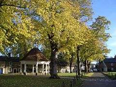 Village green | |
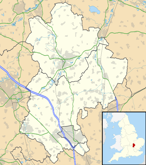 Harrold Harrold shown within Bedfordshire | |
| Population | 1,691 (2011 Census)[1] |
| OS grid reference | SP950567 |
| Unitary authority | |
| Ceremonial county | |
| Region | |
| Country | England |
| Sovereign state | United Kingdom |
| Post town | BEDFORD |
| Postcode district | MK43 |
| Dialling code | 01234 |
| Police | Bedfordshire |
| Fire | Bedfordshire and Luton |
| Ambulance | East of England |
| EU Parliament | East of England |
| UK Parliament | |
Harrold is a civil parish and electoral ward in the Borough of Bedford within Bedfordshire, England, around nine miles north-west of Bedford. The village is on the north bank of the River Great Ouse, and is the site of an ancient bridge, linking the village with Carlton with Chellington on the south bank. Immediately to the east of the village is Odell. Across the bridge is Carlton.[2]
The buttermarket in Harrold has often been an iconic and controversial image in Harrold, along with the bridge. It also used to be the logo for one of the schools in Harrold. Harrold also has a village lock-up that was used to detain drunks and suspected animals. It is no longer in use.[3]
Harrold Primary Academy is a primary school located in the village.[4]
The Church of St Peter is also located in the village.
History
Harrold was recorded in the Domesday Book of 1086 as a parish within the Hundred of Willey.[5]
An early medieval sword mount was unearthed by a metal detectorist in 2006. It is believed the tiny phallic decoration could have adorned the sword belt of a high-ranking Saxon warrior.[6] There are two public houses in Harrold. The Muntjac and the Oakley Arms.
Paul McCartney reputedly gave the first live performance of Hey Jude in the Oakley Arms in Harrold on 30 June 1968.[7]
The village was struck by an F1/T2 tornado on 23 November 1981, as part of the record-breaking nationwide tornado outbreak on that day.[8]
Electoral ward
Today an electoral ward within the Borough of Bedford, is named after Harrold Bishop and contains four civil parishes within its boundaries. Parishes and settlements within the ward, from south to north are Harrold parish, Odell parish, Podington parish including Hinwick and Farndish, and Wymington parish including Little Wymington. Harrold itself is near the southern boundary of its ward which follows some of the River Great Ouse. The ward extends northward from Harrold and fills the northwest corner of Bedfordshire, bordering Northamptonshire.[9]
Gallery
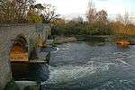 The bridge at Harrold
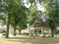 The picture of Harrold Buttermarket, before the new roof tiles.
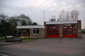 Harrold Fire Station
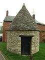 Harrold lock-up
See also
References
- ↑ "Civil Parish population 2011". Neighbourhood Statistics. Office for National Statistics. Retrieved 8 November 2016.
- ↑ The Parish of Harrold in General Archived 15 June 2011 at the Wayback Machine.
- ↑ Fairs and Markets
- ↑ Sources for Education in Harrold Archived 9 December 2010 at the Wayback Machine.
- ↑ British History Online – Parishes and dates
- ↑ Saxon Decoration Article and Photo
- ↑ Through The Door At Apple Corps Ep 2
- ↑ www.eswd.eu/cgi-bin/eswd.cgi
- ↑ Harrold Ward Profile
External links
| Wikimedia Commons has media related to Harrold, Bedfordshire. |