Godmanchester, Quebec
| Godmanchester | |
|---|---|
| Township municipality | |
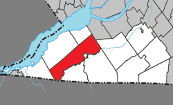 Location within Le Haut-Saint-Laurent RCM | |
 Godmanchester Location in southern Quebec | |
| Coordinates: 45°05′N 74°15′W / 45.08°N 74.25°WCoordinates: 45°05′N 74°15′W / 45.08°N 74.25°W[1] | |
| Country |
|
| Province |
|
| Region | Montérégie |
| RCM | Le Haut-Saint-Laurent |
| Constituted | July 1, 1855 |
| Named for | Godmanchester[1] |
| Government[2][3] | |
| • Mayor | Pierre Poirier |
| • Federal riding | Beauharnois—Salaberry |
| • Prov. riding | Huntingdon |
| Area[2][4] | |
| • Total | 139.20 km2 (53.75 sq mi) |
| • Land | 138.78 km2 (53.58 sq mi) |
| Population (2011)[4] | |
| • Total | 1,417 |
| • Density | 10.2/km2 (26/sq mi) |
| • Pop 2006-2011 |
|
| • Dwellings | 604 |
| Time zone | UTC−5 (EST) |
| • Summer (DST) | UTC−4 (EDT) |
| Postal code(s) | J0S 1H0 |
| Area code(s) | 450 and 579 |
| Highways |
|
| Website |
www |
Godmanchester is a township municipality located in Le Haut-Saint-Laurent Regional County Municipality in the Montérégie region of Quebec, Canada. The population as of the Canada 2011 Census was 1,417. The southeast part of the township is mostly delineated by the Chateauguay River, while the south end borders with Franklin County, New York.
It was named after Godmanchester, England in 1811.[1]
Geography
The municipality is situated along the Canada–United States border.
Communities
The following locations reside within the municipality's boundaries:[1]
- Dewittville (45°06′52″N 74°05′48″W / 45.11444°N 74.09667°W) – a hamlet situated along Route 138 and the Chateauguay River, midway between Huntingdon and Ormstown.
- Lee's Corner (45°03′19″N 74°20′08″W / 45.05528°N 74.33556°W) – a hamlet situated 15 kilometers (9.3 mi) west of Huntingdon.
Lakes & Rivers
The following waterways pass through or are situated within the municipality's boundaries:[1]
- Chateauguay River – runs along the municipality's northeast border.
- Trout River – runs along the municipality's southeastern border.
Several other smaller streams and waterways also exist throughout the municipality.
Demographics
Population
| Canada census – Godmanchester, Quebec community profile | |||
|---|---|---|---|
| 2011 | 2006 | ||
| Population: | 1,417 (-2.7% from 2006) | 1,457 (-4.6% from 2001) | |
| Land area: | 138.78 km2 (53.58 sq mi) | 138.76 km2 (53.58 sq mi) | |
| Population density: | 10.2/km2 (26/sq mi) | 10.5/km2 (27/sq mi) | |
| Median age: | 45.6 (M: 45.8, F: 45.0) | 42.2 (M: 42.8, F: 41.3) | |
| Total private dwellings: | 604 | 602 | |
| Median household income: | $47,249 | $37,530 | |
| References: 2011[5] 2006[6] earlier[7] | |||
| Historical Census Data - Godmanchester, Quebec[8] | ||
|---|---|---|
| Year | Pop. | ±% |
| 1991 | 1,557 | — |
| 1996 | 1,550 | −0.4% |
| 2001 | 1,528 | −1.4% |
| 2006 | 1,457 | −4.6% |
| 2011 | 1,417 | −2.7% |
Language
| Canada Census Mother Tongue - Godmanchester, Quebec[8] | ||||||||||||||||||
|---|---|---|---|---|---|---|---|---|---|---|---|---|---|---|---|---|---|---|
| Census | Total | French |
English |
French & English |
Other | |||||||||||||
| Year | Responses | Count | Trend | Pop % | Count | Trend | Pop % | Count | Trend | Pop % | Count | Trend | Pop % | |||||
2011 |
1,415 |
795 | 56.18% | 545 | 38.52% | 25 | 1.77% | 50 | 3.53% | |||||||||
2006 |
1,465 |
940 | 64.16% | 480 | 32.76% | 10 | 0.68% | 35 | 2.40% | |||||||||
2001 |
1,570 |
700 | 44.59% | 715 | 45.54% | 90 | 5.73% | 65 | 4.14% | |||||||||
1996 |
1,545 |
770 | n/a | 49.84% | 710 | n/a | 45.95% | 35 | n/a | 2.27% | 30 | n/a | 1.94% | |||||
Transportation
The CIT du Haut-Saint-Laurent provides commuter and local bus services.
See also
References
- 1 2 3 4 5 Reference number 25759 of the Commission de toponymie du Québec (in French)
- 1 2 Ministère des Affaires municipales, des Régions et de l'Occupation du territoire: Godmanchester
- ↑ Riding history for Beauharnois—Salaberry, Quebec from the Library of Parliament
- 1 2 2011 Statistics Canada Census Profile: Godmanchester, Quebec
- ↑ "2011 Community Profiles". Canada 2011 Census. Statistics Canada. July 5, 2013. Retrieved 2014-01-27.
- ↑ "2006 Community Profiles". Canada 2006 Census. Statistics Canada. March 30, 2011. Retrieved 2014-01-25.
- ↑ "2001 Community Profiles". Canada 2001 Census. Statistics Canada. February 17, 2012.
- 1 2 Statistics Canada: 1996, 2001, 2006, 2011 census
External links

Adjacent Municipal Subdivisions | |
|---|---|
| Cities | |
|---|---|
| Municipalities | |
| Parishes | |
| Townships | |
| |