Weston, Wyoming
| Weston, Wyoming | |
|---|---|
| Unincorporated community | |
 Weston Location within the state of Wyoming  Weston Weston (the US) | |
| Coordinates: 44°38′13″N 105°20′10″W / 44.63694°N 105.33611°WCoordinates: 44°38′13″N 105°20′10″W / 44.63694°N 105.33611°W | |
| Country | United States |
| State | Wyoming |
| County | Campbell |
| Elevation | 3,802 ft (1,159 m) |
| Time zone | UTC-7 (Mountain (MST)) |
| • Summer (DST) | UTC-6 (MDT) |
| ZIP codes | 82731 |
| GNIS feature ID | 1604109[1] |
Weston is an unincorporated community in northern Campbell County, Wyoming, United States, along the upper Little Powder River on the southeastern edge of the Thunder Basin National Grassland. It lies along WYO 59 north of the city of Gillette, the county seat of Campbell County.[2] Its elevation is 3,802 feet (1,159 m).[1] Although Weston is unincorporated, it has a post office, with the ZIP code of 82731.[3]
Education
Public education in the community of Weston is provided by Campbell County School District #1.
References
- 1 2 "Weston, Wyoming". Geographic Names Information System. United States Geological Survey.
- ↑ Rand McNally. The Road Atlas '08. Chicago: Rand McNally, 2008, p. 116.
- ↑ Zip Code Lookup
Municipalities and communities of Campbell County, Wyoming, United States | ||
|---|---|---|
| City | 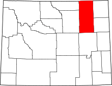 | |
| Town | ||
| CDPs | ||
| Unincorporated communities | ||
This article is issued from
Wikipedia.
The text is licensed under Creative Commons - Attribution - Sharealike.
Additional terms may apply for the media files.