Ghineh
| Ghineh غينه | |
|---|---|
| City | |
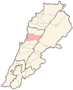
 Ghineh Location in Lebanon | |
| Coordinates: 34°2′19″N 35°42′34″E / 34.03861°N 35.70944°ECoordinates: 34°2′19″N 35°42′34″E / 34.03861°N 35.70944°E | |
| Country |
|
| Governorate | Mount Lebanon |
| District | Keserwan |
| Area | |
| • Total | 1.99 km2 (0.77 sq mi) |
| Elevation | 950 m (3,120 ft) |
| Time zone | UTC+2 (EET) |
| • Summer (DST) | UTC+3 (EEST) |
| Dialing code | +961 |
Ghineh (Arabic: غينه) is a municipality in the Keserwan District of the Mount Lebanon Governorate in Lebanon. It is located 36 kilometers north of Beirut. Its average elevation is 950 meters above sea level and its total land area is 199. It was famous for its Byzantine antiquities and a large rock with the drawings of the Phoenician gods Adonis and Astarte.
It has a famous area called "ICN" which stand for "Int chou natir " which is a reference to Anthony Abou Zeid which always asks the same question but never bothers to read the answer . hectares.[1] Ghineh's inhabitants are predominantly Maronite Christians.[2]
References
- ↑ "Ghineh". Localiban. Localiban. 2008-01-19. Retrieved 2016-03-29.
- ↑ "Elections municipales et ikhtiariah au Mont-Liban" (PDF). Localiban. Localiban. 2010. p. 19. Archived from the original (pdf) on 2015-07-24. Retrieved 2016-02-12.
This article is issued from
Wikipedia.
The text is licensed under Creative Commons - Attribution - Sharealike.
Additional terms may apply for the media files.