Safra, Lebanon
| Safra صفرا | |
|---|---|
| Municipality | |
 Safra Location in Lebanon | |
| Coordinates: 34°2′15″N 35°38′16″E / 34.03750°N 35.63778°E | |
| Country |
|
| Governorate | Mount Lebanon |
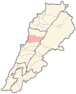
| District | Keserwan |
| Area | |
| • Total | 3.06 km2 (1.18 sq mi) |
| Elevation | 150 m (490 ft) |
| Time zone | UTC+2 (EET) |
| • Summer (DST) | UTC+3 (EEST) |
Safra (Arabic: صفرا) is a Mediterranean Coastal Lebanese Village, located at the middle of the Lebanese coast, its morphology is rich with natural valleys. Safra is known by its strategic location, old houses and beach resorts.It has a Municipality in the Keserwan District of the Mount Lebanon Governorate in Lebanon. It is located 29 kilometers north of Beirut. The village has a total land area of 306 hectares.[1] Safra is perched on a curve on a rocky butte overlooking the Mediterranean Sea, standing at an average elevation of 150 meters above sea level,[1]
The inhabitants are predominantly Maronite Catholics.[2] The main families of Safra are Hawa, El Nar, Tarabay, Abi Sejaan, Khoury, Azzi, Saad and Zgheib. Hawa Chicken, Lebanon's largest poultry production and distribution, has been established in Safra.
References
- 1 2 "Safra". Localiban. Localiban. 2008-01-22. Retrieved 2009-07-24.
- ↑ "Elections municipales et ikhtiariah au Mont-Liban" (PDF). Localiban. Localiban. 2010. p. 19. Archived from the original (pdf) on 2015-07-24. Retrieved 2016-02-12.