Qleiat
| Qleiat قليعات | |
|---|---|
| Municipality | |
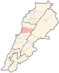
 Qleiat Location within Lebanon | |
| Coordinates: 33°58′21″N 35°42′50″E / 33.972435°N 35.714025°ECoordinates: 33°58′21″N 35°42′50″E / 33.972435°N 35.714025°E | |
| Country |
|
| Governorate | Mount Lebanon |
| District | Keserwan |
| Area | |
| • Total | 6.46 km2 (2.49 sq mi) |
| Elevation | 1,050 m (3,440 ft) |
| Time zone | UTC+2 (EET) |
| • Summer (DST) | UTC+3 (EEST) |
| Dialing code | +961 |
Qleiat (Arabic: قليعات; also spelled Qulaya'at, Qlaiaat, Qliyat or Qleiaat) is a town and municipality in the Keserwan District of the Mount Lebanon Governorate of Lebanon. It is located 28 kilometers north of Beirut. Qleiat's average elevation is 1,050 meters above sea level and its total land area is 646 hectares.[1] Its inhabitants are predominantly Maronite Catholic, with Christians from other denominations in the minority.[2]
References
- ↑ "Qleiaat". Localiban. Localiban. 2008-01-22. Retrieved 2009-07-24.
- ↑ "Elections municipales et ikhtiariah au Mont-Liban" (PDF). Localiban. Localiban. 2010. p. 19. Archived from the original (pdf) on 2015-07-24. Retrieved 2016-02-12.
This article is issued from
Wikipedia.
The text is licensed under Creative Commons - Attribution - Sharealike.
Additional terms may apply for the media files.