Gölpazarı
| Gölpazarı | |
|---|---|
 Gölpazarı | |
| Coordinates: 40°17′5″N 30°19′2″E / 40.28472°N 30.31722°ECoordinates: 40°17′5″N 30°19′2″E / 40.28472°N 30.31722°E | |
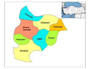
| Country | Turkey |
| Province | Bilecik |
| Area[1] | |
| • District | 591.79 km2 (228.49 sq mi) |
| Population (2012)[2] | |
| • Urban | 6,750 |
| • District | 10,955 |
| • District density | 19/km2 (48/sq mi) |
Gölpazarı is a town and district of Bilecik Province in the Marmara region of Turkey. The mayor is Vedat Kazıcı (CHP).
Features
Gölpazarı is a small town with 11,424 population. Despite its proximity to the most important metropolises of Turkey, and its fertile lands, the town never experienced overpopulation due to its isolated geography by the hills. As a result of archaeological excavations, Phrygians are thought to be the first founders of the town. Roman milestones still exist in the north of the town, passing from the village of Keskin. The town was one of the first Ottoman captured settlements in the region. A caravanserai known as "Taşhan" dated as early as 1412-which is one of the oldest buildings remained from early Ottoman period. Main scripture of the building has also great value on early Ottoman history since it mentions about Köse Mihal.
References
- ↑ "Area of regions (including lakes), km²". Regional Statistics Database. Turkish Statistical Institute. 2002. Retrieved 2013-03-05.
- ↑ "Population of province/district centers and towns/villages by districts - 2012". Address Based Population Registration System (ABPRS) Database. Turkish Statistical Institute. Retrieved 2013-02-27.
- Falling Rain Genomics, Inc. "Geographical information on Gölpazarı, Turkey". Retrieved 2008-10-21.
External links
- District governor's official website (in Turkish)