Éturqueraye
| Éturqueraye | |
|---|---|
| Commune | |
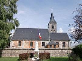 The church in Éturqueraye | |
 Éturqueraye Location within Normandy region  Éturqueraye | |
| Coordinates: 49°22′15″N 0°41′43″E / 49.3708°N 0.6953°ECoordinates: 49°22′15″N 0°41′43″E / 49.3708°N 0.6953°E | |
| Country | France |
| Region | Normandy |
| Department | Eure |
| Arrondissement | Bernay |
| Canton | Bourg-Achard |
| Intercommunality | Roumois Nord |
| Government | |
| • Mayor (2014–2020) | Didier Caillouel |
| Area1 | 6.72 km2 (2.59 sq mi) |
| Population (2012)2 | 280 |
| • Density | 42/km2 (110/sq mi) |
| Time zone | UTC+1 (CET) |
| • Summer (DST) | UTC+2 (CEST) |
| INSEE/Postal code | 27228 /27350 |
| Elevation |
103–139 m (338–456 ft) (avg. 139 m or 456 ft) |
|
1 French Land Register data, which excludes lakes, ponds, glaciers > 1 km2 (0.386 sq mi or 247 acres) and river estuaries. 2 Population without double counting: residents of multiple communes (e.g., students and military personnel) only counted once. | |
Éturqueraye is a commune in the Eure department in the Normandy region in north-western France.
Population
| Historical population | ||
|---|---|---|
| Year | Pop. | ±% |
| 1962 | 225 | — |
| 1968 | 203 | −9.8% |
| 1975 | 200 | −1.5% |
| 1982 | 237 | +18.5% |
| 1990 | 237 | +0.0% |
| 1999 | 245 | +3.4% |
| 2006 | 267 | +9.0% |
| 2007 | 270 | +1.1% |
| 2012 | 280 | +3.7% |
See also
References
| Wikimedia Commons has media related to Éturqueraye. |
| Authority control |
|---|
This article is issued from
Wikipedia.
The text is licensed under Creative Commons - Attribution - Sharealike.
Additional terms may apply for the media files.