Pentridge
| Pentridge | |
|---|---|
 Parish church of Saint Rumbold | |
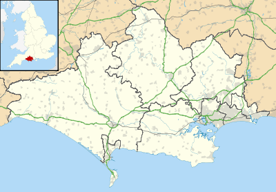 Pentridge Pentridge shown within Dorset | |
| Population | 215 2001 |
| OS grid reference | SU033178 |
| Civil parish |
|
| District | |
| Shire county | |
| Region | |
| Country | England |
| Sovereign state | United Kingdom |
| Post town | SALISBURY |
| Postcode district | SP5 |
| Dialling code | 01725 |
| Police | Dorset |
| Fire | Dorset and Wiltshire |
| Ambulance | South Western |
| EU Parliament | South West England |
| UK Parliament | |
Pentridge is a village and former civil parish, now in the parish of Sixpenny Handley and Pentridge, in the English county of Dorset, lying in the north-east of the county within the East Dorset administrative district. It is situated on the edge of Cranborne Chase down a dead-end minor lane just south of the A354 road between the towns of Blandford Forum (ten miles to the south-west) and Salisbury (twelve miles to the northeast). In 2001 it had a population of 215. The civil parish was abolished on 1 April 2015 and merged with Sixpenny Handley to form Sixpenny Handley and Pentridge.[1]
The village name derives from the Celtic pen ("hill") and twrch ("boar"), and thus means "hill of the wild boar"; its existence was first recorded (as "Pentric") in the eighth century, eighty years before the birth of Alfred the Great.[2]
The village is located amongst many Neolithic, Roman and Saxon earthworks, notably Bokerley Dyke, a long defensive ditch which was dug by the Romano-British to keep out the Saxon invaders.
Nearby is Pentridge Hill, formed by a band of more resistant chalk than the surrounding land.
References
- ↑ "The East Dorset (Reorganisation of Community Governance) Order 2015" (PDF). Lgbce. Retrieved 10 March 2018.
- ↑ Roland Gant (1980). Dorset Villages. Robert Hale Ltd. p. 16. ISBN 0 7091 8135 3.
External links
![]()