Dennison Township, Luzerne County, Pennsylvania
| Dennison Township, Pennsylvania | |
|---|---|
| Township | |
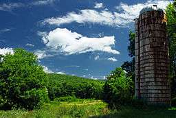 An abandoned silo in Dennison Township | |
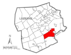 Map of Luzerne County highlighting Dennison Township | |
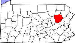 Map of Pennsylvania highlighting Luzerne County | |
| Country | United States |
| State | Pennsylvania |
| County | Luzerne |
| Area[1] | |
| • Total | 35.56 sq mi (92.10 km2) |
| • Land | 35.43 sq mi (91.76 km2) |
| • Water | 0.13 sq mi (0.34 km2) |
| Population (2010) | |
| • Total | 1,125 |
| • Estimate (2016)[2] | 1,118 |
| • Density | 31.56/sq mi (12.18/km2) |
| Time zone | UTC-5 (Eastern (EST)) |
| • Summer (DST) | UTC-4 (EDT) |
| FIPS code | 42-079-18868 |
Dennison Township is a township in Luzerne County, Pennsylvania, United States. The population was 1,125 at the 2010 census.[3]
History
It is believed that Israel Inman was the first white settler in the township. He traveled up Nescopeck Creek from its mouth in 1833. The next party after Inman was the Lehigh Coal & Navigation Company. In 1837, they cut a road through the township in order to get to Wilkes-Barre. This was succeeded by the construction of railroads in the following decades.[4] Dennison Township was formed from a section of the original Hanover Township in 1839. At the time, the new township included what is now Foster Township; it broke away in the 1850s. Logging was a major industry in the area due to the abundance of trees.[5]
Geography
According to the United States Census Bureau, the township has a total area of 35.6 square miles (92.1 km2), of which 35.4 square miles (91.8 km2) is land and 0.12 square miles (0.3 km2), or 0.37%, is water. A vast majority of Dennison Township is made up of thick forests. The township is scarcely populated; most of its residents live in the southeastern portion of the township. A few farms are also located in this section of the community. Many small lakes and streams (e.g., Creasy Creek and Nescopeck Creek) are scattered throughout Dennison. The Lehigh River forms the township's southeastern border. Nescopeck State Park makes up the western part of the township.
Transportation
I-476 travels through the northeastern section of Dennison Township. I-80 travels through the southwestern portion of the community. PA 437 travels through the heart of the township.
Demographics
| Historical population | |||
|---|---|---|---|
| Census | Pop. | %± | |
| 2000 | 908 | — | |
| 2010 | 1,125 | 23.9% | |
| Est. 2016 | 1,118 | [2] | −0.6% |
| U.S. Decennial Census[6] | |||
As of the census[7] of 2000, there were 908 people, 375 households, and 255 families residing in the township. The population density was 26.2 people per square mile (10.1/km2). There were 492 housing units at an average density of 14.2/sq mi (5.5/km2). The racial makeup of the township was 99.01% White, 0.22% African American, 0.22% Native American, and 0.55% from two or more races. Hispanic or Latino of any race were 0.99% of the population.
There were 375 households, out of which 26.9% had children under the age of 18 living with them, 54.4% were married couples living together, 8.3% had a female householder with no husband present, and 32.0% were non-families. 27.5% of all households were made up of individuals, and 12.8% had someone living alone who was 65 years of age or older. The average household size was 2.42 and the average family size was 2.96.
In the township the population was spread out, with 20.4% under the age of 18, 6.1% from 18 to 24, 28.9% from 25 to 44, 28.6% from 45 to 64, and 16.1% who were 65 years of age or older. The median age was 42 years. For every 100 females, there were 105.0 males. For every 100 females age 18 and over, there were 102.5 males.
The median income for a household in the township was $41,875, and the median income for a family was $51,563. Males had a median income of $36,667 versus $24,145 for females. The per capita income for the township was $21,373. About 5.8% of families and 5.7% of the population were below the poverty line, including 5.6% of those under age 18 and 11.6% of those age 65 or over.
Education
Dennison Township is part of Crestwood School District.
Gallery
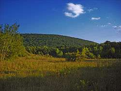 A mountain in Dennison Township
.jpg) A lightly wooded meadow in Dennison Township
A lightly wooded meadow in Dennison Township.jpg) Hemlocks near Nescopeck Creek
Hemlocks near Nescopeck Creek.jpg) Snow-covered mountains in Nescopeck State Park
Snow-covered mountains in Nescopeck State Park Lake Frances in Dennison Township
_(8585827903).jpg) A forest in Dennison Township
A forest in Dennison Township
References
- ↑ "2016 U.S. Gazetteer Files". United States Census Bureau. Retrieved Aug 14, 2017.
- 1 2 "Population and Housing Unit Estimates". Retrieved June 9, 2017.
- ↑ "Profile of General Population and Housing Characteristics: 2010 Demographic Profile Data (DP-1): Dennison township, Luzerne County, Pennsylvania". U.S. Census Bureau, American Factfinder. Archived from the original on September 11, 2013. Retrieved April 16, 2012.
- ↑ http://www.pagenweb.org/~luzerne/patk/dennison.htm
- ↑ http://www.pagenweb.org/~luzerne/patk/dennison.htm
- ↑ "Census of Population and Housing". Census.gov. Retrieved June 4, 2016.
- ↑ "American FactFinder". United States Census Bureau. Archived from the original on 2013-09-11. Retrieved 2008-01-31.
Municipalities and communities of Luzerne County, Pennsylvania, United States | ||
|---|---|---|
| Cities | | |
| Boroughs |
| |
| Townships | ||
| CDPs | ||
| Unincorporated communities |
| |
| Footnotes | ‡This populated place also has portions in an adjacent county or counties | |
Coordinates: 41°05′00″N 75°49′59″W / 41.08333°N 75.83306°W