Buck Township, Luzerne County, Pennsylvania
| Buck Township, Pennsylvania | |
|---|---|
| Township | |
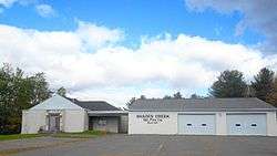 Municipal Building | |
 Map of Luzerne County highlighting Buck Township | |
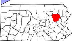 Map of Pennsylvania highlighting Luzerne County | |
| Country | United States |
| State | Pennsylvania |
| County | Luzerne |
| Area[1] | |
| • Total | 16.80 sq mi (43.52 km2) |
| • Land | 16.75 sq mi (43.39 km2) |
| • Water | 0.05 sq mi (0.13 km2) |
| Population (2010) | |
| • Total | 435 |
| • Estimate (2016)[2] | 429 |
| • Density | 25.61/sq mi (9.89/km2) |
| Time zone | UTC-5 (Eastern (EST)) |
| • Summer (DST) | UTC-4 (EDT) |
| FIPS code | 42-079-09760 |
Buck Township is a township in Luzerne County, Pennsylvania, United States. As of the 2010 census, the population was 435, making it the least populous township in the county.
History
The area was first settled in the 1780s by John Nagle. The first sawmill was erected in 1806 by Hugh Conner. Many more sawmills were constructed in the area throughout the 19th century. John Stoddart established the hamlet of Stoddartsville in 1815. The following year (in 1816), he constructed the first church in the village.[3] The Stoddartsville Historic District was added to the National Register of Historic Places in 1998.[4]
Buck Township was formed from Covington Township is 1833. The new township was named after one of its early settlers — George Buck.[5]
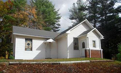 Beaumont Free Methodist Church
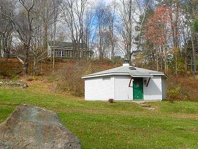 Stoddartsville Preservation Society
Geography
According to the United States Census Bureau, the township has a total area of 17.0 square miles (44 km2), of which, 16.9 square miles (44 km2) of it is land and 0.1 square miles (0.26 km2) of it (0.29%) is water.
The community is scarcely populated; thick forests cover most of Buck Township. PA 115 is the only major highway in the municipality.
Demographics
| Historical population | |||
|---|---|---|---|
| Census | Pop. | %± | |
| 2010 | 435 | — | |
| Est. 2016 | 429 | [2] | −1.4% |
| U.S. Decennial Census[6] | |||
As of the census[7] of 2010, there were 435 people, 178 households, and 120 families residing in the township. The population density was 25.7 people per square mile (10/km2). There were 259 housing units at an average density of 15.3/sq mi (6/km2). The racial makeup of the township was 97% White, 1.6% Black, 0.2% American Indian, 0.7% Asian, 0.5% two or more races.
There were 178 households, out of which 20.2% had children under the age of 18 living with them, 53.9% were married couples living together, 7.9% had a female householder with no husband present, and 32.6% were non-families. 25.8% of all households were made up of individuals, and 7.8% had someone living alone who was 65 years of age or older. The average household size was 2.44 and the average family size was 2.95.
In the township the population was spread out, with 17% under the age of 18, 68.1% from 18 to 64, and 14.9% who were 65 years of age or older. The median age was 45.7 years.
The median income for a household in the township was $35,556, and the median income for a family was $37,813. Males had a median income of $32,361 versus $21,875 for females. The per capita income for the township was $15,123. About 3.4% of families and 7.1% of the population were below the poverty line, including 8.0% of those under age 18 and 14.6% of those age 65 or over.
References
- ↑ "2016 U.S. Gazetteer Files". United States Census Bureau. Retrieved Aug 14, 2017.
- 1 2 "Population and Housing Unit Estimates". Retrieved June 9, 2017.
- ↑ http://www.pagenweb.org/~luzerne/patk/buckstwp.htm
- ↑ National Park Service (2010-07-09). "National Register Information System". National Register of Historic Places. National Park Service.
- ↑ http://www.pagenweb.org/~luzerne/patk/buckstwp.htm
- ↑ "Census of Population and Housing". Census.gov. Retrieved June 4, 2016.
- ↑ "American FactFinder". United States Census Bureau. Archived from the original on 2013-09-11. Retrieved 2011-05-14.
Municipalities and communities of Luzerne County, Pennsylvania, United States | ||
|---|---|---|
| Cities | | |
| Boroughs |
| |
| Townships | ||
| CDPs | ||
| Unincorporated communities |
| |
| Footnotes | ‡This populated place also has portions in an adjacent county or counties | |
Coordinates: 41°07′29″N 75°39′14″W / 41.12472°N 75.65389°W