Cuilapa-Barbarena
| Cuilapa-Barbarena | |
|---|---|
 | |
| Highest point | |
| Elevation | 1,454 m (4,770 ft) [1] |
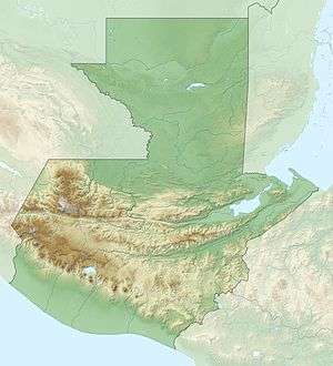
| Coordinates | 14°33′N 90°4′W / 14.550°N 90.067°WCoordinates: 14°33′N 90°4′W / 14.550°N 90.067°W |
| Geography | |
 Cuilapa-Barbarena | |
| Geology | |
| Last eruption | Unknown, possibly Holocene[1] |
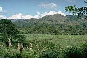
The Cuilapa-Barbarena volcanic field is a field of cinder cones in Guatemala with approximately 70 cones. The field is located over the intersection of the local Jalpatagua fault with the Miocene Santa Rosa de Lima caldera. The youngest cones postdate the last activity phase of Tecuamburro and may be of Holocene age,[1] but with no confirmed evidence.[2]
References
- 1 2 3 "Cuilapa-Barbarena". Global Volcanism Program. Smithsonian Institution. Retrieved 2 July 2015.
- ↑ James H. Reynolds (August 1987). "Timing and sources of neogene and quaternary volcanism in South-Central Guatemala". Journal of Volcanology and Geothermal Research. 33 (1–3): 20. doi:10.1016/0377-0273(87)90052-7 – via ScienceDirect. (Registration required (help)).
See also
| Guatemala |  | |
|---|---|---|
| El Salvador | ||
| Nicaragua | ||
| Costa Rica | ||
| Panama | ||
Note: volcanoes are ordered from north-west to south-east. | ||
This article is issued from
Wikipedia.
The text is licensed under Creative Commons - Attribution - Sharealike.
Additional terms may apply for the media files.