Conchagua (volcano)
| Conchagua | |
|---|---|
 Conchagua volcano towers above sandy beaches along the Gulf of Fonseca at the SE tip of El Salvador. | |
| Highest point | |
| Elevation | 1,225 m (4,019 ft) |
| Coordinates | 13°16′30″N 87°50′42″W / 13.275°N 87.845°WCoordinates: 13°16′30″N 87°50′42″W / 13.275°N 87.845°W |
| Geography | |
 Conchagua Location in El Salvador | |
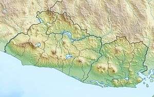
| Location | La Unión Department, El Salvador |
| Geology | |
| Mountain type | Stratovolcano |
| Last eruption | Unknown |
Conchagua (also known as Cochague) is a stratovolcano in southeastern El Salvador, overlooking the Gulf of Fonseca. Cerro del Ocote and Cerro de la Bandera are the two main summits, with Bandera appearing younger and more conical (see photo). There are active fumarolic areas on both peaks, but no confirmed historical eruptions. It is surrounded by forest called Bosque Conchagua.
See also
References
- "Conchagua". Global Volcanism Program. Smithsonian Institution.
- Rapprich V, Erban V, Fárová K, Kopačková V, Bellon H, Hernández W (2010). "Volcanic history of the Conchagua Peninsula (eastern El Salvador)" (PDF). Journal of Geosciences. 55 (2): 95–112. doi:10.3190/jgeosci.069.
| Guatemala |  | |
|---|---|---|
| El Salvador | ||
| Nicaragua | ||
| Costa Rica | ||
| Panama | ||
Note: volcanoes are ordered from north-west to south-east. | ||
This article is issued from
Wikipedia.
The text is licensed under Creative Commons - Attribution - Sharealike.
Additional terms may apply for the media files.