Tecuamburro
| Tecuamburro | |
|---|---|
 Volcán Tecuamburro | |
| Highest point | |
| Elevation | 1,845 m (6,053 ft) |
| Coordinates | 14°9′21″N 90°24′25″W / 14.15583°N 90.40694°WCoordinates: 14°9′21″N 90°24′25″W / 14.15583°N 90.40694°W |
| Geography | |
 Tecuamburro Guatemala | |
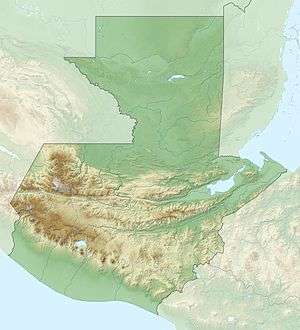
| Location | Santa Rosa, Guatemala |
| Geology | |
| Mountain type | Stratovolcano |
| Last eruption | 960 BCE ± 75 years |
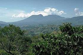
Tecuamburro is a stratovolcano in southern Guatemala, roughly 50 kilometres south east of Guatemala City. The Tecuamburro is an andesitic stratovolcano which formed approximately 38,000 years ago inside a horseshoe-shaped caldera formed by a structural failure in a second, 100,000-year-old stratovolcano, known as Miraflores. At the top of the Tecuamburro is an acidic crater lake around which many hot springs, fumaroles, and boiling mudpots are found.
See also
References
| Guatemala |  | |
|---|---|---|
| El Salvador | ||
| Nicaragua | ||
| Costa Rica | ||
| Panama | ||
Note: volcanoes are ordered from north-west to south-east. | ||
This article is issued from
Wikipedia.
The text is licensed under Creative Commons - Attribution - Sharealike.
Additional terms may apply for the media files.