Cromstrijen
| Cromstrijen | |||
|---|---|---|---|
| Municipality | |||
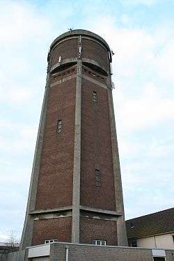 Water tower in Klaaswaal | |||
| |||
.svg.png) Location in South Holland | |||
| Coordinates: 51°44′N 4°26′E / 51.733°N 4.433°ECoordinates: 51°44′N 4°26′E / 51.733°N 4.433°E | |||
| Country | Netherlands | ||
| Province | South Holland | ||
| Established | 1 January 1984 | ||
| Government[1] | |||
| • Body | Municipal council | ||
| • Mayor | Jan Luteijn (SGP) | ||
| Area[2] | |||
| • Total | 70.33 km2 (27.15 sq mi) | ||
| • Land | 54.37 km2 (20.99 sq mi) | ||
| • Water | 15.96 km2 (6.16 sq mi) | ||
| Elevation[3] | 0 m (0 ft) | ||
| Population (August 2017)[4] | |||
| • Total | 12,792 | ||
| • Density | 235/km2 (610/sq mi) | ||
| Time zone | UTC+1 (CET) | ||
| • Summer (DST) | UTC+2 (CEST) | ||
| Postcode | 3280–3281, 3286 | ||
| Area code | 0186 | ||
| Website |
www | ||

![]()
![]()
The municipality of Cromstrijen consists of the communities Klaaswaal and Numansdorp (townhall).
Its population was 12,792 in 2017.
Topography

Dutch topographic map of the municipality of Cromstrijen, June 2015
References
- ↑ "Overzicht collegeleden" [Overview of members of the board]. Bestuur & organisatie (in Dutch). Gemeente Cromstrijen. Retrieved 18 July 2013.
- ↑ "Kerncijfers wijken en buurten" [Key figures for neighbourhoods]. CBS Statline (in Dutch). CBS. 2 July 2013. Retrieved 12 March 2014.
- ↑ "Postcodetool for 3281LK". Actueel Hoogtebestand Nederland (in Dutch). Het Waterschapshuis. Retrieved 18 July 2013.
- ↑ "Bevolkingsontwikkeling; regio per maand" [Population growth; regions per month]. CBS Statline (in Dutch). CBS. 27 October 2017. Retrieved 27 October 2017.
External links
Places adjacent to Cromstrijen | ||||||||||
|---|---|---|---|---|---|---|---|---|---|---|
| ||||||||||

This article is issued from
Wikipedia.
The text is licensed under Creative Commons - Attribution - Sharealike.
Additional terms may apply for the media files.