Binnenmaas
| Binnenmaas | ||
|---|---|---|
| Municipality | ||
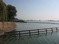 Lake Binnenmaas | ||
| ||
.svg.png) Location in South Holland | ||
| Coordinates: 51°48′N 4°33′E / 51.800°N 4.550°ECoordinates: 51°48′N 4°33′E / 51.800°N 4.550°E | ||
| Country | Netherlands | |
| Province | South Holland | |
| Government[1] | ||
| • Body | Municipal council | |
| • Mayor | André Borgdorff (CDA) | |
| Area[2] | ||
| • Total | 75.57 km2 (29.18 sq mi) | |
| • Land | 69.26 km2 (26.74 sq mi) | |
| • Water | 6.31 km2 (2.44 sq mi) | |
| Elevation[3] | −1 m (−3 ft) | |
| Population (August 2017)[4] | ||
| • Total | 29,136 | |
| • Density | 421/km2 (1,090/sq mi) | |
| Time zone | UTC+1 (CET) | |
| • Summer (DST) | UTC+2 (CEST) | |
| Postcode | 3270–3274, 3295–3299 | |
| Area code | 0186, 078 | |
| Website |
www | |
Binnenmaas (Dutch pronunciation: [ˈbɪnə(n)maːs] (![]()
The municipality was formed on January 1, 1984, by the merger of the municipalities Puttershoek, Maasdam, Mijnsheerenland, Westmaas, and Heinenoord. On January 1, 2007, the municipality 's-Gravendeel was added to Binnenmaas.
The municipality of Binnenmaas consists of the following communities: Blaaksedijk, De Wacht, Goidschalxoord, 's-Gravendeel, Greup, Heinenoord, Kuipersveer, Maasdam, Maasdijk, Mijnsheerenland, Puttershoek, Reedijk, Schenkeldijk, Sint Anthoniepolder, Westdijk, Westmaas and Zwanegat.
Topography
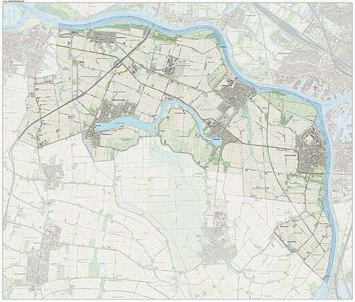
Dutch Topographic map of the municipality of Binnenmaas, June 2015.
References
- ↑ "Samenstelling college van B&W" [Composition board of mayor and aldermen]. Bestuur en Organisatie (in Dutch). Gemeente Binnenmaas. Retrieved 14 July 2013.
- ↑ "Kerncijfers wijken en buurten" [Key figures for neighbourhoods]. CBS Statline (in Dutch). CBS. 2 July 2013. Retrieved 12 March 2014.
- ↑ "Postcodetool for 3299XG". Actueel Hoogtebestand Nederland (in Dutch). Het Waterschapshuis. Retrieved 14 July 2013.
- ↑ "Bevolkingsontwikkeling; regio per maand" [Population growth; regions per month]. CBS Statline (in Dutch). CBS. 27 October 2017. Retrieved 27 October 2017.
External links
| Wikimedia Commons has media related to Binnenmaas. |
Places adjacent to Binnenmaas | |
|---|---|
