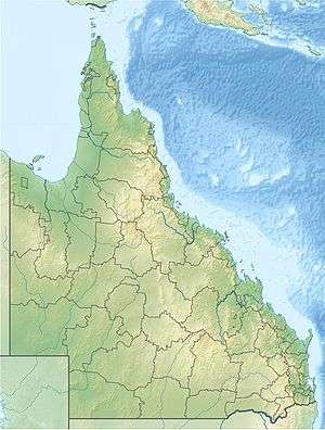
Cedar Bay National Park
| Cedar Bay National Park Queensland | |
|---|---|
|
IUCN category II (national park) | |
|
Cedar Bay National Park | |
 Cedar Bay National Park | |
| Nearest town or city | Cooktown |
| Coordinates | 15°46′37″S 145°20′47″E / 15.77694°S 145.34639°ECoordinates: 15°46′37″S 145°20′47″E / 15.77694°S 145.34639°E |
| Established | 1977 |
| Area | 56.5 km2 (21.8 sq mi) |
| Managing authorities | Queensland Parks and Wildlife Service |
| Website | Cedar Bay National Park |
| See also | Protected areas of Queensland |
Cedar Bay is a 56.5 km2 (21.8 sq mi) national park in the Shire of Cook, Queensland, Australia.[1]
Geography
The park is 1,522 km (946 mi) northwest of Brisbane, 40 km (25 mi) south of Cooktown and accessible only by boat or foot. The park is one of the Wet Tropics World Heritage Area series of national parks, and is a gazetted World Heritage site.[2] It is also known as Mangkal-Mangkalba[3] in the dialect of the local Aboriginal population, the Eastern Kuku Yalanji.[4]
History
The Cedar Bay area was developed in the 1870s for tin mining, and the remains of the tin work can still be seen in the area of Black Snake Rocks.
Cedar Bay gained a degree of notoriety in the 1970s when the Bjelke-Petersen government destroyed a hippie commune that was present. The raid was controversial because of the immense cost ($50,000) and use of a helicopter, light aircraft and a Navy vessel to arrest 12 people on drug and vagrancy charges.[5] At the Cedar Bay inquiry, police were accused of burning huts, smashing personal belongings, destroying clothing, chopping down fruit plantations and, ironically, consuming alcohol at the site following the drug raid. Police, in their defence, tendered evidence of squalid living conditions and described the commune’s inhabitants as “filthy, criminal hippies”.[6]
In 2007, the national park was part of the 2,000 square kilometres (770 sq mi) of land handed over to Cape York's Aboriginal population by the Queensland government.[7] The handover came as a result of a 1994 Native Title claim.[8]
It was known as Mount Finnigan National Park before being enlarged.
Activities
The park contains some of the northernmost tropical rainforests in Australia. Birdwatching is a popular activity with the most common birds including cassowaries, yellow-breasted sunbirds, double-eyed fig-parrots, mangrove kingfishers, beach stone-curlews and pied imperial-pigeons. Bush camping is permitted in the park, however fishing and collecting are prohibited. The sole walking track in the park was a former donkey track used by tin miners. It is inaccessible to all but fit walkers.[9]
See also
References
- ↑ "Cedar Bay National Park - Cook Shire (entry 39416)". Queensland Place Names. Queensland Government. Retrieved 30 June 2017.
- ↑ "Wet Tropics of Queensland". UNESCO World Heritage Centre. Retrieved 2008-01-29.
- ↑ "Cedar Bay (Mangkal-Mangkalba) National Park". Environmental Protection Agency. Archived from the original on 31 December 2007. Retrieved 2008-01-29.
- ↑ "Aborigines Win Back Cape York Land". The Age. 2007-04-11. Retrieved 2008-01-29.
- ↑ "Coming to a place near you Cedar Bay. No police convicted It. There will be repetition(sic)". olddogthoughts. 2014-09-13. Retrieved 2018-04-04.
- ↑ Howes, Ted (13 December 1992). "Killer Hunt In Hippie Commune". The Sun Herald.
- ↑ "Qld Govt to Hand Over Cape York Land". The Age. 2007-04-11. Retrieved 2008-01-29.
- ↑ Marszalek, Jessica (11 April 2007). "Aborigines Win Back Cape York Land". The Daily Telegraph. Archived from the original on 19 September 2007. Retrieved 29 January 2008.
- ↑ "Cedar Bay (Mangkal-Mangkalba) National Park". Environmental Protection Agency. Archived from the original on 31 December 2007. Retrieved 2008-01-29.