Atherton Tableland
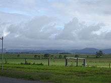
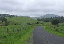
The Atherton Tableland is a fertile plateau which is part of the Great Dividing Range in Queensland, Australia. The Atherton Tablelands is a diverse region, covering an area of 64,768 square kilometres and home to 45,243 people (estimated resident population, Census 2011). The main population centres on the Atherton Tablelands are Mareeba and Atherton. Smaller towns include Malanda, Herberton, Kuranda, Ravenshoe, Millaa Millaa, Chillagoe, Dimbulah, Mt Garnet, Mt Molloy, Tinaroo and Yungaburra.
The principal river flowing across the plateau is the Barron River. It was dammed to form an irrigation reservoir named Lake Tinaroo. Tinaroo Hydro, a small 1.6MW Hydroelectric power station is located near the spillway.
Physiography
This area is a distinct physiographic section of the larger North Queensland Highlands province, which in turn is part of the larger East Australian Cordillera physiographic division. South of the Tablelands is the Bellenden Ker Range.
History
The Atherton Tableland Region has a long history of indigenous occupation[1]. Aspects of traditional Aboriginal land use and culture have been documented from the period of first contact[2][3]to the present[4]. Aboriginal people with ties to the region seek to maintain their culture today[5], despite a long period of forced removal from their lands following European occupation in the late 19th-early 20th century[6]
Atherton was explored by a European, J.V. Mulligan, in 1875. In 1877, John Atherton settled near the town which now bears his name. The area was originally explored for its mining potential where deposits of tin and gold were found.
Industry
Originally a pioneering pastoralist, John Atherton was the first to find tin deposits in Northern Queensland. Local legend has it that Tinaroo Creek received its name from Atherton who shouted, "Tin! Hurroo!" when he first made his discovery. Atherton and his friends, William Jack and John Newell, discovered the famous lode, which became the Great Northern Tin Mine. A rush of miners from the Hodgkinson’s Goldfields followed. The construction of a dray road through the Tableland brought a secondary rush, this time timber cutters to mine the red gold (redcedar) of the rainforest. Redcedar cutters camps were at Rocky Creek, Prior Pocket, Oonda Swamp (Carrington) & Ziggenbein’s Pocket. Although tin was a major part in the Tablelands, timber is what Atherton owes its existence to with large areas of red cedar, kauri, maple, black bean, walnut, white beech and red tulip oak being milled for buildings.
Before the town of Atherton developed, a full-blown Chinatown sprang into existence. The Chinese had moved from the Palmer River Goldfields to the Atherton area, where the big timber stands had been cleared to make way for farming. The Chinese were considered pioneers of agriculture in North Queensland as 80% of crop production on the Tablelands was grown by them and they played a vital role in opening up the area for settlement. After the crops, they turned to dairying. As the population of Chinatown increased, small shops appeared, wells were sunk to supply water, there were cooks, herbalists, doctors and merchants etc. The rough straw huts were replaced by sawn timber houses with verandahs and corrugated iron roofs. By 1909, Chinatown had become the largest concentration of Chinese on the Tablelands with a population of 1100. Today, the Hou Wang Temple remains as one of the few reminders of the former Chinese population of the Atherton Tablelands.
In the Second World War, Australian troops were camped around the district prior to being sent to the front and then again on their return. Many soldiers were interred at the war cemetery in Atherton.
Crops grown in and around Atherton include banana, sugarcane, corn/maize, avocados, strawberries, macadamia nuts and mangoes and citrus. Tobacco was also grown[7] until October 2006 when it was ended by a Government buyout.[8] Dairying, grazing and poultry are also present on the Tableland.
Tourism
Tourism is the second largest economic driver to the Atherton Tablelands economy, with Tinaroo Dam and extensive trail network being the focal point.
Towns
Atherton and Mareeba are the largest towns in the area. Herberton, Kairi, Kuranda, Malanda, Millaa Millaa, Tinaroo, Tolga, Yungaburra, Chillagoe, Walkamin and Ravenshoe are also located on the Atherton Tablelands.
Environment
_at_Sultanpur_I_Picture_151.jpg)
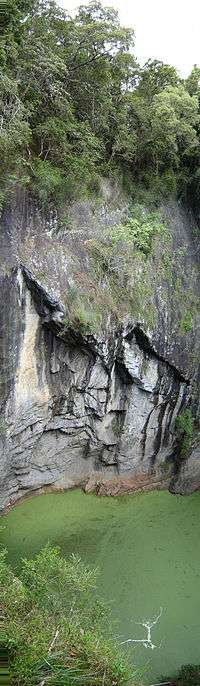
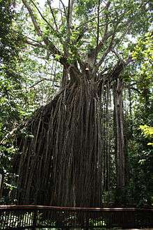
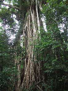
The tableland contains several small remnants of the rainforest which once covered it, many of which are now protected in national parks. It is classified by BirdLife International as one of Australia's Important Bird Areas, supporting over 1% of the world population of the sarus crane and a significant population of the bush stone-curlew.[9] Twelve species of birds are endemic to this area and the mountain ranges immediately south: Atherton scrubwren, Bower's shrikethrush, bridled honeyeater, chowchilla, fernwren, golden bowerbird, grey-headed robin, Macleay's honeyeater, mountain thornbill, pied monarch, tooth-billed bowerbird and Victoria's riflebird.
Places of interest
See also
References
- ↑ Rule, Susan (2012). "The aftermath of Megafaunal Extinction: Ecosystem transformation in Pleistocene Australia". Science. 335: 1483–1486. doi:10.1126/science.1214261.
- ↑ Lumholtz, Carl (2009) [1889]. Among Cannibals: : An Account of Four Years' Travels in Australia and of Camp Life with the Aborigines of Queensland. Cambridge University Press. ISBN 9781108006330.
- ↑ Palmerston, Christie. "Christie Palmeston". Wikipedia. Retrieved 14 February 2018.
- ↑ Bottoms, Timothy (2015). Cairns, City of the South Pacific, A History of Cairns 1770-1995. Cairns: Bunu Bunu Press. ISBN 9780994401205.
- ↑ Bottoms, Timothy (2008). Bama Country. Mission Beach: Fishtail Solutions. ISBN 9781921419034.
- ↑ Bottoms, Timothy. Conspiracy of silence : Queensland's frontier killing-times. Crows Nest NSW: Allen and Unwin. ISBN 9781743313824.
- ↑ Tinaroo Dam Archived October 18, 2009, at the Wayback Machine.
- ↑ The tobacco industry in Australia. Cancer Council Australia
- ↑ "IBA: Atherton Tablelands". Birdata. Birds Australia. Archived from the original on 2011-07-06. Retrieved 2011-05-19.
External links
| Wikimedia Commons has media related to Atherton Tableland. |