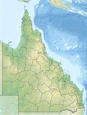
Lake Bindegolly National Park
| Lake Bindegolly National Park Queensland | |
|---|---|
|
IUCN category II (national park) | |
 Lake Bindegolly National Park | |
| Nearest town or city | Thargomindah |
| Coordinates | 28°00′48″S 144°11′37″E / 28.01333°S 144.19361°ECoordinates: 28°00′48″S 144°11′37″E / 28.01333°S 144.19361°E |
| Established | 1991 |
| Area | 140 km2 (54.1 sq mi) |
| Managing authorities | Queensland Parks and Wildlife Service |
| Website | Lake Bindegolly National Park |
| See also | Protected areas of Queensland |
Lake Bindegolly is a national park in Dynevor, Shire of Bulloo, South West Queensland, Australia, 871 km west of Brisbane and 40 km from the town of Thargomindah. It is in the Mulga Lands bioregion and was established to protect a population of the rare plant Acacia ammophila.[1] It has three lakes, two saline and one freshwater.
Birds
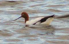
A 318 km2 area of the lake and its surrounds has been identified by BirdLife International as an Important Bird Area (IBA) because it has supported over 1% of the world populations of blue-billed ducks and red-necked avocets as well as populations of the biome-restricted inland dotterel, Bourke's parrot, slaty-backed thornbill, grey-headed honeyeater, black honeyeater, pied honeyeater, Hall's babbler, chirruping wedgebill and chestnut-breasted quail-thrush.[2]
See also
References
- ↑ Morton, S.R.; Short, J.; & Barker, R.D. Refugia for Biological Diversity in Arid and Semi-arid Australia. Biodiversity Series, Paper No.4. Australian Government Dept of the Environment, Water, Heritage and the Arts."Archived copy". Archived from the original on 4 August 2008. Retrieved 13 May 2008.
- ↑ "IBA: Lake Bindegolly". Birdata. Birds Australia. Archived from the original on 6 July 2011. Retrieved 2011-07-19.
External links