Capelle aan den IJssel
| Capelle aan den IJssel | |||
|---|---|---|---|
| Municipality | |||
 Stadsplein square in Capelle | |||
| |||
.svg.png) Location in South Holland | |||
| Coordinates: 51°56′N 4°35′E / 51.933°N 4.583°ECoordinates: 51°56′N 4°35′E / 51.933°N 4.583°E | |||
| Country | Netherlands | ||
| Province | South Holland | ||
| Government[1] | |||
| • Body | Municipal council | ||
| • Mayor | Peter Oskam (CDA) | ||
| Area[2] | |||
| • Total | 15.40 km2 (5.95 sq mi) | ||
| • Land | 14.25 km2 (5.50 sq mi) | ||
| • Water | 1.15 km2 (0.44 sq mi) | ||
| Elevation[3] | −2 m (−7 ft) | ||
| Population (August 2017)[4] | |||
| • Total | 66,712 | ||
| • Density | 4,682/km2 (12,130/sq mi) | ||
| Demonym(s) | Capellenaar | ||
| Time zone | UTC+1 (CET) | ||
| • Summer (DST) | UTC+2 (CEST) | ||
| Postcode | 2900–2909 | ||
| Area code | 010 | ||
| Website |
www | ||


Capelle aan den IJssel [kaːˈpɛlə ʔaːn dɛn ˈɛisəl] (![]()
The town has what is probably the country's smallest museum, the Dief en Duif huis ("House of Thieves and Pigeons"). Now a historical museum, it served as the prison for the castle of Capelle and is all that now remains of the 16th-century castle.
On opposing sides of the A16 motorway are two business parks called Rivium and Brainpark respectively. Companies based in the larger Rivium include Rockwell Automation, Pfizer Nederland, Sodexho Nederland, Royal Dutch Shell, Van Oord, and many more.

Public transport
Capelle aan den IJssel is connected to the Rotterdam Metro system:
- Line C starts at De Terp station, proceeds to Capelle Centrum station and Slotlaan station, then to the cities of Rotterdam, Schiedam and Spijkenisse.
- Connections with the main railway system on line C are at Blaak station and at Schiedam Centrum station. After changing to line A or B (at Capelsebrug station) also at Alexander station, and after changing to line D (at Beurs station), finally also at Rotterdam Centraal station. To and from the direction The Hague the fastest connection is usually with a change at Schiedam Centrum; for other directions it varies.
- Capelle aan den IJssel has its own train station, Capelle Schollevaar. This station is located outside of the city centre in the Schollevaar neighborhood. Local trains from Rotterdam to Gouda and Amsterdam stop at this station.
Topography
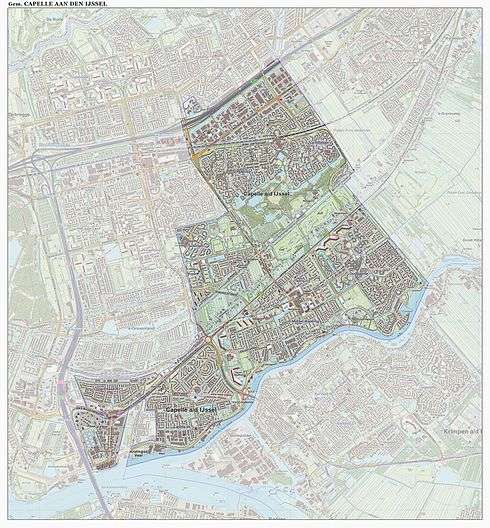
Dutch Topographic map of the municipality of Capelle aan den IJssel, June 2015.
References
- ↑ "Burgemeester" [Mayor]. Bestuur en Organisatie (in Dutch). Gemeente Capelle aan den IJssel. Retrieved 16 July 2013.
- ↑ "Kerncijfers wijken en buurten" [Key figures for neighbourhoods]. CBS Statline (in Dutch). CBS. 2 July 2013. Retrieved 12 March 2014.
- ↑ "Postcodetool for 2903AR". Actueel Hoogtebestand Nederland (in Dutch). Het Waterschapshuis. Retrieved 16 July 2013.
- ↑ "Bevolkingsontwikkeling; regio per maand" [Population growth; regions per month]. CBS Statline (in Dutch). CBS. 27 October 2017. Retrieved 27 October 2017.
External links
Places adjacent to Capelle aan den IJssel | ||||||||||
|---|---|---|---|---|---|---|---|---|---|---|
| ||||||||||
