| Image |
[1] |
Landmark name |
Location |
City or town |
Summary |
|---|
|
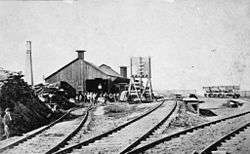
440 |
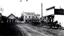
Alameda Terminal of the First Transcontinental Railroad |
Naval Air Station Alameda
37°48′53″N 122°19′02″W / 37.81481°N 122.31726°W / 37.81481; -122.31726 (Alameda Terminal of the First Transcontinental Railroad) |
Alameda |
|
|
908 |
Berkeley City Club |
2315 Durant Ave
37°52′03″N 122°15′46″W / 37.8676°N 122.2628°W / 37.8676; -122.2628 (Berkeley City Club) |
Berkeley |
Also on the NRHP list as NPS-77000282 |
|
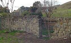
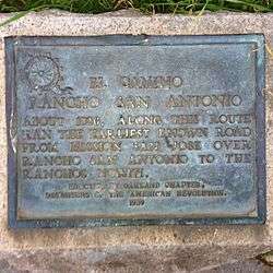
299 |
Camino of Rancho San Antonio |
SW corner of Oakland and Santa Clara Aves.
37°49′28″N 122°15′32″W / 37.82435°N 122.2589°W / 37.82435; -122.2589 (Camino of Rancho San Antonio) |
San Leandro |
|
|
968 |
Site of the China Clipper flight departure |
Alameda Naval Air Station
37°47′10″N 122°19′07″W / 37.786111°N 122.318611°W / 37.786111; -122.318611 (Site of the China Clipper flight departure) |
Alameda |
|
|
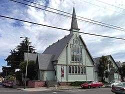
694 |
Church of St. James the Apostle |
1540 12th Ave.
37°47′30″N 122°14′46″W / 37.791693°N 122.246069°W / 37.791693; -122.246069 (Church of St. James the Apostle) |
Oakland |
|
|
1036 |
Coast Guard Lightship WLV 605 |
Jack London Square
37°47′44″N 122°16′50″W / 37.795689°N 122.280592°W / 37.795689; -122.280592 (Coast Guard Lightship WLV 605) |
Oakland |
Also on the NRHP list as NPS-89002462 |
|
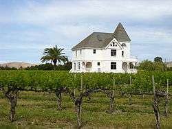
641 |
Concannon Vineyard |
4590 Tesla Rd.
37°40′00″N 121°44′23″W / 37.666767°N 121.739667°W / 37.666767; -121.739667 (Concannon Vineyard) |
Livermore |
|
|
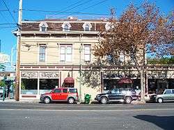
954 |
Croll Building |
1400 Webster St.
37°46′18″N 122°16′36″W / 37.771628°N 122.276586°W / 37.771628; -122.276586 (Croll Building) |
Alameda |
Also on the NRHP list as NPS-82000960 |
|
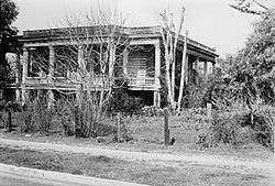
279 |
Estudillo Home |
550 W Estudillo Ave.
37°43′24″N 122°09′36″W / 37.7234°N 122.1601°W / 37.7234; -122.1601 (Estudillo Home) |
San Leandro |
|
|
586 |
Cresta Blanca Winery |
5050 Arroyo Rd.
37°37′24″N 121°45′23″W / 37.623317°N 121.756267°W / 37.623317; -121.756267 (Cresta Blanca Winery) |
Livermore |
|
|
896 |
First Unitarian Church of Oakland |
685 14th St.
37°48′23″N 122°16′36″W / 37.806389°N 122.276667°W / 37.806389; -122.276667 (First Unitarian Church of Oakland) |
Oakland |
Also on the NRHP list as NPS-77000284 |
|
510 |
Francisco Solano Alviso Adobe |
3459 Foothill Rd.
37°39′38″N 121°54′43″W / 37.66063°N 121.91198°W / 37.66063; -121.91198 (Francisco Solano Alviso Adobe) |
Pleasanton |
|
|
107 |
Joaquin Miller Home |
3300 Joaquin Miller Rd.
37°48′45″N 122°11′08″W / 37.8125°N 122.185556°W / 37.8125; -122.185556 (Joaquin Miller Home) |
Oakland |
Also on the NRHP list as NPS-66000204 |
|
642 |
Leland Stanford Winery |
330 Stanford Ave.
|
Fremont |
|
 |
241 |
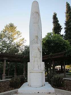
Livermore Memorial Monument |
Portola Park
37°41′28″N 121°46′26″W / 37.69116°N 121.77401°W / 37.69116; -121.77401 (Livermore Memorial Monument) |
Livermore |
|
|
849 |
Mills Hall |
Mills College
37°46′45″N 122°10′57″W / 37.779119°N 122.182525°W / 37.779119; -122.182525 (Mills Hall) |
Oakland |
Also on the NRHP list as NPS-71000132 |
|
334 |
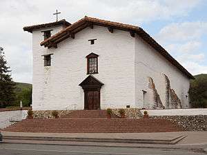
Mission San José |
Mission Blvd at Washington Blvd.
37°32′02″N 121°55′12″W / 37.533933°N 121.92005°W / 37.533933; -121.92005 (Mission San José) |
Fremont |
Also on the NRHP list as NPS-71000131 |
|
884 |
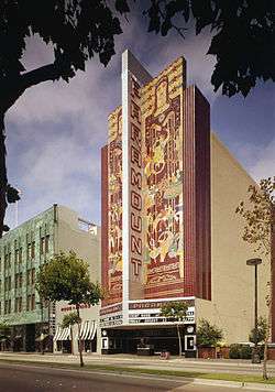
Paramount Theatre |
2025 Broadway
37°48′36″N 122°16′04″W / 37.81°N 122.267778°W / 37.81; -122.267778 (Paramount Theatre) |
Oakland |
Also on the NRHP list as NPS-73000395 |
|
1027 |
Pardee Home |
672 11th St.
37°48′18″N 122°16′35″W / 37.804989°N 122.2764°W / 37.804989; -122.2764 (Pardee Home) |
Oakland |
Also on the NRHP list as NPS-76000476 |
|
925 |
Peralta Hacienda Site |
2465 34th Ave.
37°47′13″N 122°13′03″W / 37.787033°N 122.217367°W / 37.787033; -122.217367 (Peralta Hacienda Site) |
Oakland |
|
|
285 |
Peralta Home |
561 Lafayette
37°43′51″N 122°09′41″W / 37.730733°N 122.1615°W / 37.730733; -122.1615 (Peralta Home) |
San Leandro |
|
|
986 |
Piedmont Way |
Piedmont Ave. between Gayley Rd. and Dwight Way
37°52′04″N 122°15′07″W / 37.867789°N 122.251889°W / 37.867789; -122.251889 (Piedmont Way) |
Berkeley |
|
|
970 |
Rainbow trout species identified |
50 yards past Redwood Gate entrance kiosk, Redwood Regional Park
|
Oakland |
|
|
246 |
Rancho San Antonio (Peralta Grant) |
NW corner of E. 14th and Hays Sts.
37°43′38″N 122°09′29″W / 37.727167°N 122.157917°W / 37.727167; -122.157917 (Rancho San Antonio (Peralta Grant)) |
San Leandro |
|
|
824 |
San Leandro Oyster Beds |
San Leandro Marina
37°41′43″N 122°11′36″W / 37.695339°N 122.193297°W / 37.695339; -122.193297 (San Leandro Oyster Beds) |
San Leandro |
|
|
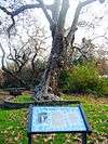
962 |
Site of Blossom Rock Navigation Trees |
Redwood Regional Park, Roberts Regional Recreation Area, near the Madrone Picnic Tables
37°48′41″N 122°10′26″W / 37.81141°N 122.17394°W / 37.81141; -122.17394 (Site of Blossom Rock Navigation Trees) |
Oakland |
|
|
45 |
Site of College of California |
NE corner of 13th & Franklin Sts.
37°48′12″N 122°16′13″W / 37.80325°N 122.270217°W / 37.80325; -122.270217 (Site of College of California) |
Oakland |
|
|
503 |
Site of the First County Courthouse |
30977 Union City Blvd. and Smith St.
37°35′48″N 122°04′52″W / 37.596667°N 122.0811°W / 37.596667; -122.0811 (Site of the First County Courthouse) |
Union City |
|
|
776 |
Site of the First Public School in Castro Valley |
19200 Redwood Rd.
37°42′24″N 122°04′26″W / 37.7067°N 122.073983°W / 37.7067; -122.073983 (Site of the First Public School in Castro Valley) |
Castro Valley |
|
|
768 |
Site of the nation's first successful sugar beet factory |
30849 Dyer St.
37°36′02″N 122°04′14″W / 37.600533°N 122.070517°W / 37.600533; -122.070517 (Site of the nation's first successful sugar beet factory) |
Union City |
|
|
676 |
Site of Saint Mary's College |
3093 Broadway
37°49′14″N 122°15′41″W / 37.820483°N 122.261267°W / 37.820483; -122.261267 (Site of Saint Mary's College) |
Oakland |
|
|
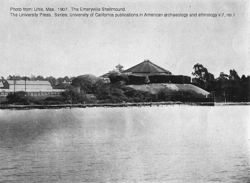
335 |
Site of Shell Mound |
4600 block of Shell Mound St.
37°50′02″N 122°17′33″W / 37.834°N 122.29263°W / 37.834; -122.29263 (Site of Shell Mound) |
Emeryville |
|
|
1025 |
Ukrania, Site of Agapius Honcharenko Farmstead |
Garin Regional Park
|
Hayward |
|
|
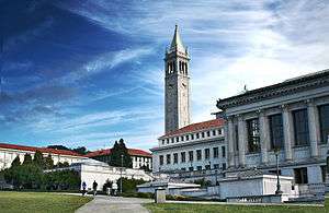
946 |
University of California, Berkeley campus |
University of California, Berkeley
37°52′12″N 122°15′32″W / 37.87°N 122.259°W / 37.87; -122.259 (University of California, Berkeley campus) |
Berkeley |
Also on the NRHP list as NPS-82004638 |
|
1029 |
USS Hornet |
Pier 3 North, Alameda Point, 707 West Hornet Dr.
37°46′22″N 122°18′10″W / 37.77272°N 122.302895°W / 37.77272; -122.302895 (USS Hornet) |
Alameda |
|
|
46 |
Vallejo Flour Mill |
Vallejo Mill Historical Park
37°34′43″N 121°58′39″W / 37.578617°N 121.977417°W / 37.578617; -121.977417 (Vallejo Flour Mill) |
Fremont |
|
|
957 |
Wente Bros. Winery |
5565 Tesla Rd.
37°37′26″N 121°45′25″W / 37.623825°N 121.7569°W / 37.623825; -121.7569 (Wente Bros. Winery) |
Livermore |
|
.JPG)
.JPG)
.JPG)
.JPG)
.JPG)

_underway_at_sea_on_9_August_1968_(USN_1116887).jpg)