Beauregard-l'Évêque
| Beauregard-l'Évêque | |
|---|---|
| Commune | |
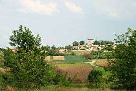 General view of the village | |
 Beauregard-l'Évêque Location within Auvergne-Rhône-Alpes region  Beauregard-l'Évêque | |
| Coordinates: 45°48′42″N 3°18′01″E / 45.8117°N 3.3003°ECoordinates: 45°48′42″N 3°18′01″E / 45.8117°N 3.3003°E | |
| Country | France |
| Region | Auvergne-Rhône-Alpes |
| Department | Puy-de-Dôme |
| Arrondissement | Clermont-Ferrand |
| Canton | Billom[1] |
| Intercommunality | Billom - Saint-Dier / Vallée du Jauron |
| Government | |
| • Mayor (2014–2020) | Alain Néri[2] |
| Area1 | 12.02 km2 (4.64 sq mi) |
| Population (2013)2 | 1,370 |
| • Density | 110/km2 (300/sq mi) |
| Time zone | UTC+1 (CET) |
| • Summer (DST) | UTC+2 (CEST) |
| INSEE/Postal code | 63034 /63116 |
| Elevation |
295–390 m (968–1,280 ft) (avg. 378 m or 1,240 ft) |
|
1 French Land Register data, which excludes lakes, ponds, glaciers > 1 km2 (0.386 sq mi or 247 acres) and river estuaries. 2 Population without double counting: residents of multiple communes (e.g., students and military personnel) only counted once. | |
Beauregard-l'Évêque is a commune in the Puy-de-Dôme department in Auvergne-Rhône-Alpes in central France.
Population
| Historical population | ||
|---|---|---|
| Year | Pop. | ±% |
| 1962 | 648 | — |
| 1968 | 654 | +0.9% |
| 1975 | 634 | −3.1% |
| 1982 | 773 | +21.9% |
| 1990 | 894 | +15.7% |
| 1999 | 1,158 | +29.5% |
| 2006 | 1,306 | +12.8% |
| 2009 | 1,314 | +0.6% |
| 2013 | 1,370 | +4.3% |
| Source: INSEE (1968–2013) | ||
See also
References
- ↑ "Décret 2014-210 du 21 février 2014 portant délimitation des cantons dans le département du Puy-de-Dôme" [2014-210 decree delimiting cantons of Puy-de-Dôme department]. Légifrance (in French). 21 February 2014. Retrieved 29 July 2016.
- ↑ "List of Mayors of Puy-de-Dôme" (PDF). Prefecture of Puy-de-Dôme. 9 April 2014. Archived from the original (PDF) on 6 October 2014. Retrieved 29 July 2016.
| Wikimedia Commons has media related to Beauregard-l'Évêque. |
This article is issued from
Wikipedia.
The text is licensed under Creative Commons - Attribution - Sharealike.
Additional terms may apply for the media files.