Basehor, Kansas
| Basehor, Kansas | |
|---|---|
| City | |
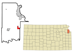 Location within Leavenworth County and Kansas | |
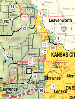 KDOT map of Leavenworth County (legend) | |
| Coordinates: 39°8′18″N 94°56′19″W / 39.13833°N 94.93861°WCoordinates: 39°8′18″N 94°56′19″W / 39.13833°N 94.93861°W | |
| Country | United States |
| State | Kansas |
| County | Leavenworth |
| Founded | 1889 |
| Government | |
| • Type | Mayor–Council |
| • Mayor | David K. Breuer |
| Area[1] | |
| • Total | 6.75 sq mi (17.48 km2) |
| • Land | 6.68 sq mi (17.30 km2) |
| • Water | 0.07 sq mi (0.18 km2) |
| Elevation | 981 ft (299 m) |
| Population (2010)[2] | |
| • Total | 4,613 |
| • Estimate (2016)[3] | 5,651 |
| • Density | 680/sq mi (260/km2) |
| Time zone | UTC-6 (CST) |
| • Summer (DST) | UTC-5 (CDT) |
| ZIP code | 66007 |
| Area code | 913 |
| FIPS code | 20-04400 |
| GNIS ID | 0478554 [4] |
| Website | CityOfBasehor.org |
Basehor is a city in Leavenworth County, Kansas, United States and is a suburb of the Kansas City Metropolitan Area. As of the 2010 census, the city population was 4,613.[5]
History
In exchange for extensive Delaware holdings in the state of Indiana, on September 24, 1829, the United States Government ceded a large tract of land to the Delaware Indians. Basehor is built on a small part of this tract. The Delawares held this land, or at least parts of it, until the 1860s. On July 4, 1866, the Secretary of the Interior of the United States was offered for sale what was left of the Delaware lands, then referred to as the Delaware Diminished Reserve, for not less than $2.50 per acre. The Leavenworth, Pawnee, and Western Railroad Company subsequently bought all of the remaining land on January 7, 1886.
The first individuals to own the land upon which Basehor now stands were Thomas Salem and Mary Z. Towne (though William Henery Lewis, who surveyed for the Railroad,bought an extensive plot on land to the northeast of Basehor around 1861 and homsteaded it right after the civil war) The couple bought it from the railroad in 1873 and mortgaged it to Ephraim Basehor the same year. On January 9, 1874, the Townes sold the 160 acres (0.65 km2) to Basehor.
Basehor was founded in 1889 by Reuben Basehor and his brother Ephraim. They both were of Pennsylvania Dutch descent and came to Kansas in 1854. After living in Lawrence for a time, Ephraim began working as a hired hand for an area farmer. He eventually bought the farm and other land holdings in the area.
In 1889, the railroad was completed and Ephraim plotted his land and began building the town site. It was dedicated on November 30, 1889, and was named after Basehor.
Ephraim Basehor donated the land for the school house around 1900. The old grade school was located north of town and was originally called the Prairie Garden District #32. The first high school classes in the community met in 1905 above the Kemler-Hammond General Store. In 1906, a building was erected to house the high school and grade school. It was built for K–12 on the southeast corner of 155th Street and Leavenworth Road. The high school was upstairs, and K–8 was located in the three classrooms downstairs. In 1929, there were 5 graduates.
Reuben Basehor donated $1,000 to the school to build a library. With this donation, a cement structure was built east of the old school. After many years of non-use, the library building was moved to the city park in June, 2016.[6] A new two-story brick high school was built as a W.P.A. project in 1938. The grade school classes continued to be held in the old building until a new grade school was built in 1955. By 1963, a new high school was built, and the older building was taken over by the top two grades of the grade school. In 2008, the community built a new library on 158th St.
Geography
Basehor is located at 39°8′18″N 94°56′19″W / 39.13833°N 94.93861°W (39.138469, −94.938735).[7] According to the United States Census Bureau, the city has a total area of 6.75 square miles (17.48 km2), of which, 6.68 square miles (17.30 km2) is land and 0.07 square miles (0.18 km2) is water.[1]
Demographics
| Historical population | |||
|---|---|---|---|
| Census | Pop. | %± | |
| 1970 | 724 | — | |
| 1980 | 1,483 | 104.8% | |
| 1990 | 1,591 | 7.3% | |
| 2000 | 2,238 | 40.7% | |
| 2010 | 4,613 | 106.1% | |
| Est. 2017 | 6,015 | [8] | 30.4% |
| U.S. Decennial Census[9] | |||
2010 census
As of the census[2] of 2010, there were 4,613 people, 1,751 households, and 1,337 families residing in the city. The population density was 690.6 inhabitants per square mile (266.6/km2). There were 1,881 housing units at an average density of 281.6 per square mile (108.7/km2). The racial makeup of the city was 94.1% White, 2.5% African American, 0.4% Native American, 0.5% Asian, 0.5% from other races, and 1.9% from two or more races. Hispanic or Latino of any race were 3.6% of the population.
There were 1,751 households of which 37.4% had children under the age of 18 living with them, 62.8% were married couples living together, 9.4% had a female householder with no husband present, 4.1% had a male householder with no wife present, and 23.6% were non-families. 19.3% of all households were made up of individuals and 7.7% had someone living alone who was 65 years of age or older. The average household size was 2.63 and the average family size was 3.02.
The median age in the city was 37.6 years. 26.5% of residents were under the age of 18; 6% were between the ages of 18 and 24; 28.4% were from 25 to 44; 27% were from 45 to 64; and 12.2% were 65 years of age or older. The gender makeup of the city was 48.5% male and 51.5% female.
2000 census
As of the census of 2000, there were 2,238 people, 830 households, and 650 families residing in the city. The population density was 712.3 people per square mile (275.2/km²). There were 848 housing units at an average density of 269.9 per square mile (104.3/km²). The racial makeup of the city was 97.1% White, 0.4% African American, 0.3% Native American, 0.7% Asian, < 0.1% Pacific Islander, 0.5% from other races, and 0.9% from two or more races. Hispanic or Latino of any race were 1.6% of the population.
There were 830 households out of which 36.3% had children under the age of 18 living with them, 64.5% were married couples living together, 11.1% had a female householder with no husband present, and 21.6% were non-families. 19.3% of all households were made up of individuals and 9.0% had someone living alone who was 65 years of age or older. The average household size was 2.70 and the average family size was 3.09.
In the city, the population was spread out with 27.2% under the age of 18, 8.4% from 18 to 24, 28.1% from 25 to 44, 23.8% from 45 to 64, and 12.6% who were 65 years of age or older. The median age was 37 years. For every 100 females, there were 90.8 males. For every 100 females age 18 and over, there were 87.4 males.
The median income for a household in the city was $52,831, and the median income for a family was $60,000. Males had a median income of $40,540 versus $27,708 for females. The per capita income for the city was $20,731. About 2.8% of families and 4.1% of the population were below the poverty line, including 4.7% of those under age 18 and 6.4% of those age 65 or over.
Education
Basehor is served by USD 458 Basehor Linwood. The district high school is Basehor-Linwood High School located in Basehor.[10]
Prior to school unification, the Basehor High School mascot was Bobcats.[11]
References
- 1 2 "US Gazetteer files 2010". United States Census Bureau. Archived from the original on 2012-01-24. Retrieved 2012-07-06.
- 1 2 "American FactFinder". United States Census Bureau. Retrieved 2012-07-06.
- ↑ "Population and Housing Unit Estimates". Retrieved June 9, 2017.
- ↑ "US Board on Geographic Names". United States Geological Survey. 2007-10-25. Retrieved 2008-01-31.
- ↑ "2010 City Population and Housing Occupancy Status". U.S. Census Bureau. Archived from the original on 21 July 2011. Retrieved June 14, 2011.
- ↑ "Old Basehor library moved to city park". Leavenworth Times. Retrieved 12 March 2017.
- ↑ "US Gazetteer files: 2010, 2000, and 1990". United States Census Bureau. 2011-02-12. Retrieved 2011-04-23.
- ↑ "Population and Housing Unit Estimates". Retrieved October 10, 2018.
- ↑ United States Census Bureau. "Census of Population and Housing". Archived from the original on May 12, 2015. Retrieved October 24, 2013.
- ↑ "Basehor Linwood School District, USD 458". USD 458. Retrieved 15 January 2017.
- ↑ "Basehor High School". classmates.com. Retrieved 15 January 2017.
Further reading
- County
- History of Leavenworth County Kansas; Jesse Hall and LeRoy Hand; Historical Publishing; 684 pages; 1921. (Download 27MB PDF eBook)
- Kansas
- History of the State of Kansas; William G. Cutler; A.T. Andreas Publisher; 1883. (Online HTML eBook)
- Kansas : A Cyclopedia of State History, Embracing Events, Institutions, Industries, Counties, Cities, Towns, Prominent Persons, Etc; 3 Volumes; Frank W. Blackmar; Standard Publishing Co; 944 / 955 / 824 pages; 1912. (Volume 1 – download 54MB PDF eBook),(Volume 2 – download 53MB PDF eBook), (Volume 3 – download 33MB PDF eBook)
External links
Municipalities and communities of Leavenworth County, Kansas, United States | ||
|---|---|---|
| Cities | 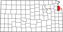 | |
| CDPs | ||
| Unincorporated communities | ||
| Townships | ||
| Ghost town | ||
| Footnotes | ‡This populated place also has portions in an adjacent county or counties | |
Kansas City metropolitan area's cities and counties | ||
|---|---|---|
| Central city |  | |
| Largest cities (over 100,000 in 2000) | ||
| Medium-sized cities (10,000 to 100,000 in 2000) | ||
| Smaller Cities (between 5,000 and 9,900 in 2010) | ||
| Counties | ||