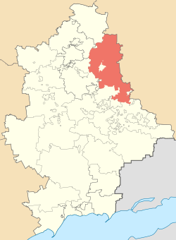
Bakhmut Raion
| Bakhmut Raion Бахмутський район | |||
|---|---|---|---|
| Raion | |||
| |||
 | |||
| Coordinates: 48°51′17.1858″N 38°6′15.4584″E / 48.854773833°N 38.104294000°ECoordinates: 48°51′17.1858″N 38°6′15.4584″E / 48.854773833°N 38.104294000°E | |||
| Country |
| ||
| Region | Donetsk Oblast | ||
| Established | N/A | ||
| Admin. center | Bakhmut | ||
| Subdivisions |
List
| ||
| Area | |||
| • Total | 1,687 km2 (651 sq mi) | ||
| Population | |||
| • Total | 108,637 | ||
| • Density | 64/km2 (170/sq mi) | ||
| Time zone | UTC+2 (EET) | ||
| • Summer (DST) | UTC+3 (EEST) | ||
| Postal index | N/A | ||
| Area code | 380 | ||
| Website | Verkhovna Rada website | ||


Bakhmut Raion (Ukrainian: Бахмутський район) is a raion (district) within the northeastern part of Donetsk Oblast in eastern Ukraine. Its administrative center is Bakhmut, but the city itself administratively does not belong the raion. Its area is 1,687 km2 (651 sq mi), and its population is approximately 108,637 (2017 est.)[1].
Created in 1923, in 1924 - 2016 it was known as Artemivsk Raion after its administrative center. Due to the War in Donbass, three smaller municipalities were transferred away from Yenakiieve municipality and transferred to Bakhmut Raion (at that time Artemivsk Raion), among which are Vuhlehirsk municipality, Olkhovatka municipality, and Bulavynske municipality. On 4 February 2016, the Verkhovna Rada renamed raion to Bakhmut Raion.[2]
Within the Bakhmut Raion there are one city (Siversk), one urban-type settlement (Luhanske), 19 selsovets, and 104 settlements. Also included within the raion are 21 kolhozy, 14 sovhozy, 4 industrial organisations, 43 libraries, and a movie theater.
Settlements
- Siversk or Seversk (Ukrainian: Сіверськ; Russian: Северск; since 1913-1793 Yama) is a city of raion subordination located on 48°52′N 38°07′E / 48.87°N 38.11°E with a population of 14,393. There are some industrial factories located within the raion, namely the brick factory Stroidetal. Siversk is a former sovhoz by the name of Yamskyi. It was founded in 1913 and received city status in 1961.
- Luhanske (Ukrainian: Луганське; since 1701-1922 Piatnadtsatia Rota) is an urban-type settlement (town) with a population of 2,604. Since 1772 the town is populated with Moldovans and Romanians. To the town's administration also belong the following adjacent villages: Krasnyi Pakhar, Krynychne, Lozove, Myronivka, Rozsadky as well as rural settlements of Roty and Skeleve.
Demographics
As of the 2001 Ukrainian census:[3]
- Ethnicity
- Ukrainians: 78.7%
- Russians: 18.4%
- Belarusians: 0.7%
- Turks: 0.6%
- Armenians: 0.2%
See also
References
- ↑ "Чисельність наявного населення України (Actual population of Ukraine)" (in Ukrainian). State Statistics Service of Ukraine. Retrieved 26 August 2017.
- ↑ "Rada de-communized Artemivsk as well as over hundred cities and villages" (in Ukrainian). Pravda.com.ua. 4 February 2016. Retrieved 4 February 2016.
- ↑ Національний склад та рідна мова населення Донецької області. Розподіл постійного населення за найбільш численними національностями та рідною мовою по міськрадах та районах (in Ukrainian), Archived from the original on 2012-11-27
External links
- (in Ukrainian) Verkhovna Rada website - Administrative divisions of the Artemivsk Raion
| Raions | |||||
|---|---|---|---|---|---|
| Cities |
| ||||
| |||||