Mariupol
| Mariupol Маріу́поль Мариу́поль Μαριούπολη Pavlovsk Zhdanovsk | |||
|---|---|---|---|
| City of regional significance | |||
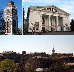 Old Fire Tower, Mariupol City Theater, Skyline | |||
| |||
 Mariupol Mariupol shown within Ukraine  Mariupol Mariupol (Ukraine) | |||
| Coordinates: 47°5′45″N 37°32′58″E / 47.09583°N 37.54944°ECoordinates: 47°5′45″N 37°32′58″E / 47.09583°N 37.54944°E | |||
| Country |
| ||
| Oblast |
| ||
| Raion | Mariupol City Municipality | ||
| Founded | 1778 | ||
| Government | |||
| • Mayor | Vadym Boychenko | ||
| Area | |||
| • Total | 244 km2 (94 sq mi) | ||
| Population (2013) | |||
| • Total | 461,810 | ||
| • Density | 2,058/km2 (5,330/sq mi) | ||
| Postal code | 87500—87590 | ||
| Area code(s) | +380 629 | ||
| Climate | Dfa | ||
| Website | Official site of the city council | ||

Mariupol (Ukrainian: Маріу́поль [mɑrʲiˈupɔlʲ], also Ukrainian: Маріюпіль, translit. Mariiupil [mɑrʲiˈjupilʲ];[1] Russian: Мариу́поль [mərʲɪˈupəlʲ]; Greek: Μαριούπολη, translit. Marioupoli) is a city of regional significance in south eastern Ukraine, situated on the north coast of the Sea of Azov at the mouth of the Kalmius river, in the Pryazovia region. It is the tenth-largest city in Ukraine,[2] and the second largest in the Donetsk Oblast[3] with a population of 449,498 (2017 est.)[4]. The city is largely and traditionally Russophone, while ethnically the population is divided about evenly between Russians and Ukrainians. Mariupol was founded on the site of a former Cossack encampment named Kalmius[5] and granted city rights in 1778. It has been a centre for the grain trade, metallurgy, and heavy engineering, including the Illich Steel & Iron Works and Azovstal. Mariupol has played a key role in the industrialization of Ukraine.
Due to the Soviet authorities frequently renaming cities after Communist leaders,[6] the city was known as Zhdanov, after the Soviet functionary Andrei Zhdanov, between 1948 and 1989. Today, Mariupol remains a centre for industry, as well as higher education and business.
Following the Russian invasion of Ukraine and capture of Donetsk city by pro-Russian insurgents associated with the Donetsk People's Republic in 2014, Mariupol was made the provisional administrative centre of the Donetsk Oblast. The city was secured on June 13, 2014 by Ukrainian troops, and has been under attack several times since.
History
Pre-settlement
During the late Middle Ages through the early modern period, here taken from the 12th through the 16th century, Mariupol lay within a broader region that was largely devastated and depopulated by the intense conflict among the surrounding peoples, including the Crimean Tatars, the Nogai Horde, the Grand Duchy of Lithuania, and Muscovy. By the middle of the 15th century much of the region north of the Black Sea and Azov Sea was annexed to the Crimean Khanate and became a dependency of the Ottoman Empire. East of the Dnieper river marked a desolate steppe, stretching to the sea of Azov, where the lack of water made early settlement precarious.[7] Moreover, lying near the Kalmius trail, the region was subject to frequent raids and plundering by the Tatar tribes which prevented the area's permanent settlement, keeping it sparsely populated or an entirely uninhabited no-man's land under Tatar rule. Hence it was known as the Wild Fields or the 'Deserted Plains ' (Lat. Campi Deserti).[8][9]
In this region of the Eurasian steppes, the Cossacks emerged as a distinct people in the late fifteenth and early sixteenth centuries. Below the Dnieper Rapids were the Zaporozhian Cossacks, composed of freebooters organized into small, loosely-knit, and highly mobile groups that practised both pastoral and nomadic living. The Cossacks would regularly penetrate the steppe for fishing and hunting, as well as for migratory farming and herding of livestock. Their independence from governmental and landowner authority attracted and enlisted large numbers of fugitive peasants and serfs fleeing the Polish–Lithuanian Commonwealth and Muscovy.
The isolation of the region was increased further by the Treaty of Constantinople (1700), which provided that there should be no settlements or fortifications on the coast of the Azov Sea to the mouth of the Mius River. Moreover, in 1709 in response to a Cossack alliance with Sweden against Russia, Tsar Peter the Great ordered the destruction of the Zaporozhian central stockade (Sich) and their complete expulsion from the area, without allowance for their return.[10] In 1733, however, Russia was preparing for a new military campaign against the Ottoman Empire so it allowed the return of the Zaporozhians, although the territory officially belonged to Turkey. Under the terms of the Agreement of Lubny of 1734, the Zaporozhians regained all their former lands and, in return, they were to serve in the Russian army during wartime. They were also permitted to build a new stockade on the Dnieper River (called New Sich), though the terms prohibited them from erecting fortifications, allowing only for living quarters (kureni).[11]
Upon their return, the Zaporozhian population in these lands was extremely sparse, and in an effort to establish a measure of control, they introduced a structure of districts (palankas).[12] The nearest to modern Mariupol was the Kalmiusskya district, but its border did not extend to the mouth of the Kalmius River,[13] although this area had been part of its migratory territory. After 1736, the Zaporozhian and the Don Cossacks (whose capital was at nearby Novoazovsk) came into conflict over the area, resulting in Tsarina Elizabeth issuing a decree in 1746 marking the Kalmius River as the divide between the two Cossack hosts.[14]
Sometime after 1738,[15][16] the treaties of Belgrade (1739), Niš (1739), and the Russian-Turkish convention of 1741,[17] and likely concurrent or following the land survey of 1743–1746 (resulting in the demarcation decree of 1746), the Zaporzhian Cassocks established a military outpost on "the high promontory right [west] bank of the Kalmius river."[18] Though the details of its construction and history are obscure, excavations revealed Cossack and other artifacts within the enclosure of approximately 120m by 120m.[19] The outpost was likely a modest structure in that it lay within the territory of the Ottoman Empire, and the constructions of fortifications on the Sea of Azov were prohibited by the Treaty of Niš.
The last Tatar raid, launched in 1769, covered a vast area, overrunning the New Russia province with a huge army in severe winter weather.[20][21] It destroyed the Kalmius fortifications and burned all the Cassock winter lodgings.[18] In 1770, the Russian government, not waiting for the end of the war with Turkey, moved its border with the Crimean Khanate southwest by more than two hundred kilometres, initiating the Dnieper fortified line (running from the today's locations of Zaporozhye to Novopetrovka),[22] thereby laying claim to the region, including the site of the future Mariupol, from the Ottoman Empire.
Following the victory of the Russian forces in the Russo-Turkish War (1768–74), the Treaty of Küçük Kaynarca eliminated the endemic threat from the Crimea and thereby terminated the historical justification of the Ukraine as a borderland (okraina).[23][24] In 1775, Zaporizhia was incorporated into the New Russia Governorate, and part of the land claimed by the establishment of the Dnieper fortified line (including modern Mariupol) was incorporated in the newly reestablished Azov Governorate.
Settlement
After the Russo-Turkish War (1768–1774), the governor of the Azov Governorate, Vasily A. Chertkov, reported to Grigory Potemkin on 23 February 1776 that at this location existed the ruins of ancient domakha (homes), and in 1788 he planned the new town of Pavlovsk.[25] However, on 29 September 1779, the city of Marianοpol (Greek: Μαριανόπολη) of Kalmius County was founded on the site. For the Russian authorities the city was named after the Russian Empress Maria Feodorovna; but the city was named de facto after the Greek settlement of Mariampol, a suburb of Bakhchisaray. The name was derived from the Hodegetria icon of the Holy Theotokos and Virgin Mary.[26][27] Subsequently, in 1780 Russian authorities forcefully relocated great number of Orthodox Greeks from Crimea to the Mariupol area.[28]
In 1782 it was an administrative seat of the county in the Azov Governorate of the Russian Empire, with a population of 2,948 inhabitants. In the early 19th century the customs house, a church-parish school, the port authorities building, a county religious school, and two privately founded girls' schools appeared in the city. In the 1850s the population grew to 4,600 and the city had 120 shops and 15 wine cellars.
After construction of the railway line from Yuzovka in 1882, much of the wheat grown in the Yekaterinoslav Governorate and coal from the Donets Basin were exported via the port of Mariupol (the second largest after Odessa in the South Russian Empire), which served as a key funding source for opening a hospital, public library, electric power station and urban water supply system.
Mariupol remained a local trading centre until 1898, when the Belgian subsidiary SA Providence Russe opened a steelworks in Sartana near Mariupol (now the Ilyich Steel & Iron Works). The company incurred heavy losses and by 1902 went into bankruptcy, owing 6 million francs to the Providence company and needing to be re-financed by the Banque de l'Union Parisienne.[29] The mills brought cultural diversity to Mariupol as immigrants,mostly peasants from all over the empire, moved to the city looking for a job and a better life. The number of workers employed increased to 5,400 persons.
In 1914 the population of Mariupol reached 58,000. However, the period from 1917 onwards saw a continuous decline in population and industry due to the February Revolution and the Civil War. In 1933 a new steelworks (Azovstal) was built along the Kalmius river.
During World War II, the city was occupied by Nazi Germany from 8 October 1941 to 10 September 1943. During this time there was tremendous damage to the city and many people were killed. The Jewish population was wiped out by two operations specifically aimed at murdering them.
In 1948 Mariupol was renamed Zhdanov after Soviet politician Andrei Zhdanov who had been born there in 1896, but with the collapse of the USSR, the name reverted to Mariupol in 1989.
Current conflict
Following the 2014 Ukrainian revolution, pro-Russian and anti-revolution protests erupted across eastern Ukraine. This unrest later evolved into a war between the Ukrainian government and the separatist forces of the Donetsk People's Republic (DPR). In May of that year, a battle between the two sides broke out in Mariupol after it briefly came under DPR control.[30] The city was eventually recaptured by government forces, and on 13 June Mariupol was proclaimed the temporary capital of Donetsk Oblast until the city of Donetsk could be recaptured.[31]
The city remained peaceful until the end of August, when an offensive by pro-Russian forces from the east came within 16 kilometres (10 mi) of it.[32] A ceasefire between the two sides was agreed to on 5 September, halting that offensive. Despite this ceasefire, minor skirmishes continued on the outskirts of Mariupol in the following months. To protect the city, government forces established three defence lines on its outskirts, deployed heavy artillery, and large amounts of army and national guard troops.[32]
An assault on Mariupol was launched on 24 January 2015 by the Donetsk People's Republic rebel forces. The city was defended by the Ukrainian government forces.
According to OSCE Special Monitoring Mission to Ukraine, on January 24 Grad rockets fired from positions occupied by rebel forces dropped on populated areas of Mariupol killing 30 people. "...the Grad rockets originated from a northeasterly direction... and the Uragan rockets from an easterly direction, both controlled by the 'Donetsk People's Republic'..." [33]
On 1 January 2017 Russian News Agency TASS reported that the separatists claimed that Ukrainian forces had launched a massive artillery barrage at the "Donetsk People's Republic" amid the trip of Ukrainian President Petro Poroshenko and US Senator John McCain to Mariupol.[34]
Geography and ecology
Geography
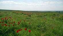
Mariupol is located to the south of the Donetsk Oblast, on the coast of Sea of Azov and at the mouth of Kalmius River. It is located in an area of Azov Lowland that is extension of the Ukrainian Black Sea Lowland. To the east of Mariupol is located the Khomutov Steppe which is also part of the Azov Lowland located on the border with the Russian Federation.
The city occupies an area of 166.0² (64 mi²) [with suburbs, i.e., the territories subordinated to the Mariupol city council, 244.0 km² (94.2 mi²)]. The downtown area is 106.0 km² (40.9 mi²), while the area of parks and gardens is 80.6 km² (31.1 mi²).
The city is mainly built on land that is made of solonetzic (sodium enriched) chernozems, with a significant amount of underground subsoil water that frequently leads to landslides.
Climate
Mariupol has a humid continental climate (Köppen climate classification Dfa) with warm summers and cold winters. The average annual precipitation is 511 millimetres (20 in). Agroclimatic conditions allow the cultivation in the suburbs of Mariupol thermophilic agricultural crops having long vegetative periods (sunflower, melons, grapes, etc.). However water resources in the region are insufficient, and consequently ponds and water basins are used for the needs of the population and industry.
In the winter, the wind direction is mainly east, while in the summer, the wind is from the north.
| Climate data for Mariupol (1955–2011) | |||||||||||||
|---|---|---|---|---|---|---|---|---|---|---|---|---|---|
| Month | Jan | Feb | Mar | Apr | May | Jun | Jul | Aug | Sep | Oct | Nov | Dec | Year |
| Record high °C (°F) | 10.0 (50) |
15.0 (59) |
18.6 (65.5) |
29.2 (84.6) |
32.7 (90.9) |
35.0 (95) |
37.2 (99) |
37.2 (99) |
32.2 (90) |
27.1 (80.8) |
18.0 (64.4) |
14.1 (57.4) |
37.2 (99) |
| Average high °C (°F) | −0.2 (31.6) |
0.2 (32.4) |
5.1 (41.2) |
13.1 (55.6) |
19.8 (67.6) |
24.5 (76.1) |
27.4 (81.3) |
26.9 (80.4) |
20.9 (69.6) |
13.6 (56.5) |
5.8 (42.4) |
1.0 (33.8) |
13.2 (55.8) |
| Daily mean °C (°F) | −2.8 (27) |
−2.7 (27.1) |
1.8 (35.2) |
9.5 (49.1) |
15.9 (60.6) |
20.3 (68.5) |
23.0 (73.4) |
22.3 (72.1) |
16.6 (61.9) |
10.1 (50.2) |
3.2 (37.8) |
−1.2 (29.8) |
9.7 (49.5) |
| Average low °C (°F) | −4.9 (23.2) |
−5.1 (22.8) |
−0.5 (31.1) |
6.2 (43.2) |
11.8 (53.2) |
15.9 (60.6) |
18.3 (64.9) |
17.7 (63.9) |
12.5 (54.5) |
6.8 (44.2) |
0.9 (33.6) |
−3.5 (25.7) |
6.3 (43.3) |
| Record low °C (°F) | −27.2 (−17) |
−25 (−13) |
−20 (−4) |
−7.3 (18.9) |
0.5 (32.9) |
5.6 (42.1) |
8.9 (48) |
5.0 (41) |
−1.1 (30) |
−8 (18) |
−17 (1) |
−24.5 (−12.1) |
−27.2 (−17) |
| Average precipitation mm (inches) | 35.1 (1.382) |
33.0 (1.299) |
37.5 (1.476) |
44.5 (1.752) |
44.0 (1.732) |
52.9 (2.083) |
44.2 (1.74) |
43.0 (1.693) |
39.4 (1.551) |
28.6 (1.126) |
47.8 (1.882) |
60.5 (2.382) |
510.5 (20.098) |
| Average precipitation days | 17.7 | 14.9 | 15.4 | 10.4 | 8.1 | 8.0 | 5.2 | 4.1 | 6.9 | 9.5 | 12.7 | 15.9 | 128.8 |
| Average relative humidity (%) | 89.0 | 86.2 | 83.0 | 73.9 | 70.0 | 67.5 | 65.6 | 61.2 | 67.4 | 79.0 | 86.7 | 88.9 | 76.5 |
| Source #1: Pogoda.ru.net (temperatures and record high and low)[35] | |||||||||||||
| Source #2: Climatebase.ru (precipitation and humidity)[36] | |||||||||||||
Ecology

Mariupol leads Ukraine in the volume of emissions of harmful substances by industrial enterprises. Recently, the city's leading enterprises have begun to address the ecological problems. Thus, over the last 15 years industrial emissions have fallen nearly in half.
Due to stable production by the majority of the large industrial enterprises, the city constantly experiences environmental problems. At the end of the 1970s, Zhdanov (Mariupol) ranked third in the USSR (after Novokuznetsk and Magnitogorsk) in the quantity of industrial emissions. In 1989, including all enterprises, the city had 5,215 sources of atmospheric pollution producing 752,900 tons of harmful substances a year (about 98% from metallurgical enterprises and "Markokhim"). Even given some easing of the maximum-permissible concentrations (maximum concentration limit) in the state's industrial activity (in the mid-1990s), many pollution limits were still exceeded:
- 1.3 times for ammonia
- 1.3 times for phenol
- 2.0 times for formaldehyde
In the residential areas adjoining the industrial giants, concentrations of benzapiren reach 6–9 times the maximum concentration limits; fluoric hydrogen, ammonia, and formaldehyde reach 2–3 to 5 times the maximum concentration limits; dust and oxides of carbon, and hydrogen sulphide are 6-8 times the maximum concentration limits; and dioxides of nitrogen are 2-3 times the maximum concentration limits. The maximum concentration limit has been exceed on phenol by 17x, and on benzapiren by 13-14x.
Ill-considered arrangements of the construction platforms of Azovstal and Markokhim (an economy in transport charges was assumed, both during construction in the 1930s and during the subsequent operation) have led to extensive wind-borne emissions into the central areas of Mariupol. Wind intensity and geographical "flatness" offer relief from the accumulation of long-standing pollutants, somewhat easing the problem.
The nearby Sea of Azov is in distress. The catch of fish in the area has been reduced by orders of magnitude over the last 30–40 years.
The environmental protection activity of the leading industrial enterprises in Mariupol costs millions of hrivnas, but it appears to have little effect on the city's long-standing environmental problems.
Governance
City administration and local politics
The Mariupol electorate traditionally supports left wing (socialist and communist) and pro-Russian political parties. At the turn of the 21st century the Party of Regions numerically prevailed in the City Council followed by the Socialist Party of Ukraine.
In the presidential elections of 2004, 91.1% of the city voted for Viktor Yanukovych and 5.93% for Viktor Yuschenko. In the 2006 parliamentary elections, the city voted for the Party of Regions–with 39.72% of the votes, the Socialist Party of Ukraine–20.38%, the Natalia Vitrenko Block–9.53%, and the Communist Party of Ukraine–3.29%.
In the 2014 parliamentary elections the Opposition Bloc won more than 50% of the votes.[37] The seats of the city's two electoral districts were won by Serhiy Matviyenkov and Serhiy Taruta.[38]
The Mayor ("head", chairman of executive committee of the city council) is Yuri Khotlubey.
Administrative division
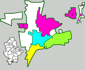
Mariupol is divided into four neighborhoods or "raions".
- Kalmiuskyi Raion (until June 2016 named Illichivsk Raion after Vladimir Ilyich Lenin[39]) is the northern part of the city, the largest and most industrialized neighborhood in the city. It is commonly known as the Zavod ("Factory") of Ilyich.
- Livoberezhnyi Raion (until June 2016 named after Sergo Ordzhonikidze[39]) is the eastern part of the city, on the left bank of the river Kalmius. Its name means the "Left Bank".
- Prymorsky Raion is the southern area of the city, on the coast of the Azov Sea. The everyday name of the central part this neighbourhood is simply "the Port".
- Tsentralnyi Raion is the central city raion. Its everyday name is simply "the Centre" or "the City". Formerly it was known as Zhovtnevyi Raion (October Raion) commemorating the 1917 Bolshevik coup-d'état.
The Kalmius river separates the Livoberezhnyi Raion from the remaining three raions. The population is mostly concentrated in the Tsentralnyi and Prymorsky Raions. The Kalmiuskyi Raion houses the large Illich Steel and Iron Works and the Azovmash manufacturing plant. The Livoberezhnyi (Left Bank) is home to the Azovstal metallurgic combine and the Koksokhim (Coke and Chemical) factory. The settlements of Stary Krym and Sartana are located in close proximity to the city limits of Mariupol (see map).
Coat of arms
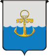
The modern coat of arms of Mariupol was confirmed in 1989. It is described in heraldic terms as: Per fess wavy argent and azure, on an anchor or, accompanied by the figure 1778 of the last. The gold anchor has a ring on top. The number 1778 indicates the year of the city's founding. The argent represents steel; the azure, the sea; the anchor, the port; and the ring, metallurgy.
City holidays
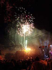
Holidays exclusive to Mariupol include:
- Day of liberation of the city from fascist aggressors (on September 10)
- Day of the city (the Sunday after the day of liberation of Mariupol in September)
- Day of the metallurgist – a professional holiday for many citizens
- Day of the machine engineer
- Day of the seaman and other professional holidays
Demographics
As of December 1, 2014, the city's population was 477,992. Over the last century the population has grown nearly twelvefold. The city is populated by Ukrainians, Russians, Pontic Greeks (including Caucasus Greeks and Tatar- and Turkish-speaking but Greek Orthodox Christian Urums), Belarusians, Armenians, Jews, etc. The main language is Russian.
| Historical Populations | ||||
|---|---|---|---|---|
| Year | City proper | Change | Metropolitan | Change |
| 1778 | 168 | – | 168 | – |
| 1782 | 2,948 | +1,655% | 2,948 | +1,655% |
| 1850 | 4,579 | +55.33% | 4,579 | +55.33% |
| 1897 | 31,800 | +594.47% | 31,800 | +594.47% |
| 1913 | 58,000 | +82.39% | 58,000 | +82.39% |
| 1939 | 221,500 | +281.90% | 221,500 | +281.90% |
| 1941 | 241,000 | +8.80% | 241,000 | +8.80% |
| 1943 | 85,000 | −64.73% | 85,000 | −64.73% |
| 1959 | 283,600 | +233.65% | 299,100 | +251.88% |
| 1979 | 502,600 | +77.22% | 525,000 | +75.53% |
| 1987 | 529,000 | +5.25% | 552,300 | +5.20% |
| 1989 | 518,900 | −1.91% | 541,000 | −2.05% |
| 1994 | 520,700 | 0.35% | 543,600 | 0.48% |
| 1998 | 499,800 | −4.01% | 521,300 | −4.10% |
| 2001 | 492,200 | −1.52% | 514,500 | −1.30% |
| 2002 | 489,700 | −0.51% | 510,800 | −0.72% |
| 2005 | 481,600 | −1.65% | 502,800 | −1.57% |
| 2006 | 477,900 | -0.77% | ||
| 2007 | 477,600 | -0.06% | 499,600 | - |
| 2008 | 496,600 | -0.60% | ||
| 2009 | 471,975 | 493,962 | -0.53% | |
| 2010 | 469,336 | -0.56% | 491,295 | -0.54% |
| 2011 | 466,665 | -0.57% | 488,541 | -0.56% |
| 2012 | 464,457 | -0.47% | 486,320 | -0.45% |
| 2013 | 461,810 | -0.57% | 483,679 | -0.54% |
| 2014 | 458,533 | -0.71% | 480,406 | -0.68% |
The average annual population decline of city from 2010 to 2014 is 0.6%. The death rate is 15.5%.
Ethnic structure
In 2002, ethnic Ukrainians made up the largest percentage (48.7%) but less than half of the population; the second greatest ethnicity was Russian (44.4%). A June-July 2017 survey indicated that Ukrainians had grown to 59% of Mariupol's population and the Russian share had dropped to 33%.[40]
The city is home to the largest population of Pontic Greeks in Ukraine ("Greeks of Priazovye") at 21,900, with 31,400 more in the six nearby rural areas, totaling about 70% of the Pontic Greek population of the area and 60% for the country.
Ethnic structure in 2002
| Ethnicity | Number of people | Percent of population |
|---|---|---|
| Ukrainian | 248,683 | 48.7 |
| Russian | 226,848 | 44.4 |
| Pontic Greeks (including Caucasus Greeks and Urums) | 21,923 | 4.3 |
| Belarusian | 3,858 | 0.8 |
| Armenian | 1,205 | 0.2 |
| Jews | 1,176 | 0.2 |
| Bulgarian | 1,082 | 0.2 |
| other | 6,060 | 1.2 |
| All population | 510,835 | 100 |
Language structure
There is a large number of Greek-speaking people in the city, but the city is predominantly Russian speaking. From 60% to 80% of Ukrainian-language dwellers communicate through so-called Surzhyk, due to the large influence of Russian culture.
Most Greek-speaking villages in the region speak a dialect called Rumeíka, that is, a branch of Pontic Greek. About 17 villages speak this language today. Modern scholars distinguish five subdialects of Rumeíka according to their similarity to standard Modern Greek. This was derived from the dialect of the original Pontic settlers from the Crimea. Although Rumeíka is often described as a Pontic dialect, the situation is more nuanced.
Arguments can be brought both for Rumeíka's similarity to Pontic Greek and to the Northern Greek dialects.
In the view of Maxim Kisilier, while the Rumeíka dialect shares some features with both the Pontic Greek and the Northern Greek dialects, it is better considered on its own terms as a separate Greek dialect, or even a group of dialects.[41]
The village of Anadol speaks Pontic proper, being settled from the Pontos in the 19th century.
Native languages of the population as of the All-Russian Empire Census in 1897:[42]
| Language | The city of Mariupol |
|---|---|
| Russian | 19,670 |
| Ukrainian | 3,125 |
| Pontic Greek | 1,590 |
| Turkish | 922 |
| Total Population | 31,116 |
Along with those speaking Rumeíka, there were and are a number of Tatar speaking Orthodox villages, the so-called Urums, which is the Tatar term for Romaios or Rumei. This subdivision had already occurred in Crimea before the settlement of the Azov Sea steppe region by Pontic Greeks which began following the fall of the Empire of Trebizond in northeastern Anatolia in 1461 but on a larger scale after the end of the Russo-Turkish War in 1779, as part of the Russian policy to populate and develop the region while depriving the Crimea of an economically active part of its population.
Though Greek and Tatar-speaking settlers lived separately, the language of the Urums was the lingua franca of the region for a long time, being called the language of the bazaar. There are also a number of settlements of other ethnic communities, including Germans, Bulgarians, and Albanians (though the meanings of all such terms in this context is open to dispute).
After the October Revolution of 1917, a Rumaiic revival occurred in the region. The Soviet administration established a Greek-Rumaiic theater, several magazines and a newspaper, and a number of Rumaiic language schools. The best Rumaiic poet Georgi Kostoprav created a Rumaiic poetic language for his work. This process was reversed in 1937 as Kostoprav and many other Rumaiics and Urums were killed as part of Joseph Stalin's national policies. A large percentage of the population was transported to Gulags.
A new attempt to preserve a sense of ethnic Rumaiic identity started in the mid-1980s. The Ukrainian scholar Andriy Biletsky created a new Slavonic alphabet for Greek speakers. Though a number of writers and poets make use of this alphabet, the population of the region rarely uses it. The Rumaiic language is declining rapidly, most endangered by the standard Modern Greek which is taught in schools and the local university. The latest investigations by Alexandra Gromova demonstrate that there is still hope that elements of the Rumaiic population will continue to use the dialect.[43]
Language structure in 2002
| Language | Number (person) | Densities (%) |
|---|---|---|
| Russian | 457,931 | 89.64 |
| Ukrainian | 50,656 | 9.92 |
| Pontic Greek | 1,046 | 0.20 |
| Armenian | 372 | 0.07 |
| Belarusian | 266 | 0.05 |
| Bulgarian | 55 | 0.01 |
| other | 509 | 0.10 |
| All population | 510,835 | 100 |
Religious communities
.jpg)
.jpg)
- 11 churches of the Ukrainian Orthodox Church of the Moscow Patriarchy.
- 3 churches of the Ukrainian Orthodox Church of the Kiev Patriarchy.
- 52 various religious communities.
The city is adorned by the St. Nicholas Cathedral (in the Tsentralnyi borough) and other churches of the city, namely:
- St. Nicholas (Primorsky borough)
- St. Michael (Livoberezhnyi borough)
- St. Preobrazheniye ("Holy Transfiguration") (Primorsky borough)
- St. Ilya (Ilyichevsky borough)
- Uspensky ("Assumption") (Livoberezhnyi borough)
- St. Vladimir (Livoberezhnyi borough)
- St. Amvrosy Optinsky (Illyichevsky borough, Volonterobvka)
- St. Varlampy (Illyichevsky borough, Mirny)
- St. George (Illyichevsky borough, Sartana)
- Nativity of the Virgin Mary (Illyichevsky borough, Talakovka)
- St. Boris & Gleb (Prymorsky borough, Moryakov)
- St. Crimeajewel
In addition to churches, there are 3 Mosques around the city.
Economy
Employment
About 59% of the people whose occupation is in the national economy work in industry and 11% of them in transportation. As of July 1, 2009, the official rate of unemployment in the city stood at 2%.[44] The figure, however, only includes people registered as "unemployed" in the local job centre. The real unemployment rate is therefore higher.
Historic Unemployment Rate in Mariupol (year end)[44][45][46][47]
| Year | Unemployment (% of labor force) |
|---|---|
| 2006 | 0.4 |
| 2007 | 0.4 |
| 2008 | 1.2 |
| 2009* | 2.0 |
* – as of July 1
Industry
.jpg)
There are 56 industrial enterprises in Mariupol under various plans of ownership. The city's industry is diverse, with heavy industry dominant. Mariupol is home to major steel mills (including some of global importance) and chemical plants; there is also an important seaport and a railroad junction. The largest enterprises are Ilyich Iron and Steel Works, Azovstal, Azovmash Holding, and the Mariupol Sea Trading Port. There are also shipyards, fish canneries, and various educational institutions with studies in metallurgy and science.
The total industrial production of the city for eight months in 2005 (January – August) was 21378.2 million hryvnas (US$4.233 billion), compared to 1999 – 6169.806 million hryvnas (US$1.222 billion). This is 37.5% of the total production for Donetsk Oblast. The leading business of the city is ferrous metallurgy, which makes up 93.5% of the city's income from industrial production. The annual output estimates are in millions of tonnes of iron, steel, rolled iron, and agglomerate.
- Illich Steel and Iron Works (Mariupol Metallurgical Combine named Ilyich) is an integrated mill, with all the facilities for a full metallurgical cycle. Housing around 100 thousand workers, it is the second largest in Ukraine, after Kryvorizhstal. The company is the collective property of the Society of Tenants (Joint-Stock Company "Ilyich-steel"; with about 37,000 worker-shareholders). The head of the board of enterprise is the People's Deputy, Volodymyr Boyko. The enterprise has multiple structural divisions: Management of Public Catering and Trade ("УОПТ", a network of 52 enterprises), a chemist's network Ilyich-Pharm, more than 50 agro shops (former collective farms of the south of Donetsk and Zaporizhia Oblasts), the office of the Komsomol Mines, various machine-building enterprises in the Cherkasy Oblast, Mariupol International Airport, and the Mariupol Television Network (locally known as MTV).
- Azovstal is another integrated mill ("Combine"), the third largest in Ukraine in terms of gross revenue. Its production varies in millions of tonnes of pig-iron, steel, and rolled iron annually. The company's general director is Oleksiy Bilyi. Azovstal is closely connected with the Mariupol coke works "Markokhim" which serves as the supplier of coke.
- Open Society Azovmash (Holding) is the largest machine-building enterprise in Ukraine specialising in production of equipment for mining-metallurgical complexes, tank cars, port cranes, boilers, fuel-fillers, etc. The President is Oleksandr Savchuk. The enterprise was formerly owned by the state and was privatised by System Capital Management, a Donetsk financial and economic group.
.jpg)
- Azov ship-repair factory (АСРЗ) is the largest enterprise of its class on the Sea of Azov, also owned by System Capital Management.
- Open Society Mariupol sea trading port is the largest sea port in eastern Ukraine through which is transported large quantities of various products such as coal, metal, mechanical engineering products, varieties of ores and grains from and to various cities such as Donetsk, Kharkiv, Luhansk, and the near regions of the Russian Federation.
- Azov sea shipping company which was owned until 2003 by the Donbass Merchant Marine fleet, is now also under the ownership of System Capital Management. Donbass Merchant Marine is now a bankrupt enterprise which formerly operated out of ports on the Sea of Azov such as Mariupol, Berdyansk, and Taganrog (Russia).
The above-mentioned enterprises, along with a plethora of others not mentioned, are located in the free economic zone of Azov.
Finances
The GDP of the city in 2004 was ₴22,769,400 ($4,510,400); it is listed in the state budget as ₴83,332,000 ($16,507,400). The city is one of the largest contributors to the Ukrainian national budget (after Kiev and Zaporizhia).
The GPA of the city is ₴1,262.04 (~US$250.00) a month, one of the highest in the country. The average pension in the city is ₴423.15 ($83.82). Commercial debts in the city were reduced in 2005 to 1.1% or ₴5.1 million ($1.01 million).
Income from services rendered for 9 months of 2005 was ₴860.4 million ($107.4 million) and the volume of retail trade for the same period was ₴838.7 million ($166.1 million). The city's enterprises for 9 months of 2005 recorded a positive financial result (profit) of ₴3.2 billion ($634 million), which is 23.6% more than in the prior year (2004).
Culture
Cultural institutions

Theatres:
- Donetsk Regional Drama Theatre. In 2003 the oldest theater in the region celebrated its 125th anniversary. For its contribution to the spiritual education of theater, in 2000 it was awarded the laureate in the competition «Gold Scythian»
Cinemas:
- Pobeda ("Victory")
- Savona
- Multiplex
Palaces of Culture (Recreation centres) (together with so-called clubs – 16 units):
- Metallurgov ("Metallurgists") of Ilyich Steel & Iron Works
- Azovstal of Azovstal Steel & Iron Works
- Iskra ("Spark") of Azovmash Machine-builder Concern
- MarKokhim (Mariupol Coke Chemistry)
- Moryakov ("Sailors")
- Stroitel ("Builders")
- Palace of children's and youth art ("Palace of Children art")
- Municipal Palace of Culture
Showrooms and museums:
- Mariupol Museum of Regional
- Kuindzhi Art Exhibition
- Museum of Ethnography (formerly, the museum of Andrey Zhdanov)
- Museum halls of the industrial enterprises and their divisions, establishments and the organisations of city, and others.
Libraries (only 35 units):
- Korolenko Central Library;
- Gorky Central Children's Library;
- Serafimovich Library (The oldest library of the city);
- And also: Gaydar Library, Honchar Library, Hrushevsky Library, Krupskaya Library, Kuprin Library, Lesya Ukrainka Library, Marshak Library, Morozov Library, Novikov-Priboy Library, Pushkin Library, Svetlov Library, Turgenev Library, Franko Library, Chekhov Library, Chukovsky Library, the libraries of industrial enterprises, establishments, and the organisations of the city.
In the surrounding environs of city, on the shore of Sea of Azov, archaeology monuments were excavated from neolithic burial grounds dating from the end of the third millennium BC. During excavations over 120 skeletons were discovered. Found near them were stone and bone instruments, beads, shell-works from shellfishes, and animal teeth.
Art and literature
Creative Organisations of Artists, Union of Journalists of Mariupol, the Literary Union «Azovye» (from 1924, about 100 members), and others. Works of Mariupol poets and writers: N. Berilov, A. Belous, G. Moroz, A. Shapurmi, A. Savchenko, V. Kior, N. Harakoz, L. Kiryakov, L. Belozerova, P. Bessonov, and A. Zaruba are written in the Russian, Ukrainian, and Greek languages. Presently, 10 members of the National Union of Writers of Ukraine live in the city.
Tourism and attractions
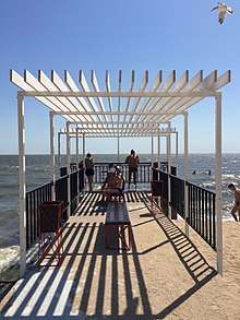
Tourist interest are mainly on the coast of the Sea of Azov. Around the city the strip of resort settlements was pulled: Melekino, Urzuf, Yalta, Sedovo, Bezymennoye, Sopino, Belosaray Kosa, etc. Travel companies operating are («Azov-voyag-tour», «Azovintur»,«Limpopo» and others).
The first resorts were opened in the city in 1926. Along a sea here during 16 the narrow bar of sandy beaches stretches for one km. Water temperature in the summer ranges from 22 to 24 °C (72–75 °F). The duration of the bathing season is 120 days.
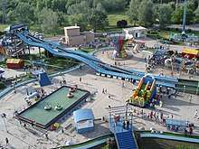
Parks
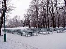
- City Square (« the Theatrical Square »)
- Extreme Park (new attractions near to the biggest in city of the Palace of Culture of Metallurgists)
- Gurov's Meadow-park (former Meadow-park a name of the 200-anniversary of Mariupol)
- City Garden ("Children's Central Public Garden")
- Veselka Park (Livoberezhnyi Raion), named as the rainbow
- Azovstal Park (Livoberezhnyi Raion)
- Petrovsky Park (near the modern Volodymyr Boiko Stadium and constructions of "Azovmash" basketball club, Kalmiuskyi Raion)
- Primorsky Park (Prymorsky Raion)
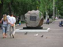
Monuments
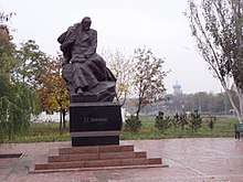
Mariupol has monuments to Taras Shevchenko, Vladimir Vysotsky, Arkhip Kuindzhi, and many other famous persons. Monuments in honour of the liberation of Donbass, the metallurgists, and others can also be found in the city.
There are also monuments to Makar Maza, Hryhoriy Yuriyovych Horban, K.P. Apatov, and Tolya Balabukha, to seamen–commandos, to pilots V.G. Semenyshyn and N.E. Lavytsky, to soldiers of the Soviet 9th Aviation Division, to victims of political repressions of 1930–1950, etc. During the Soviet period the central square of the city featured a monument to Andrei Zhdanov, after whom the city was named from 1948–1990. The artists V. Konstantynov and L. Kuzminkov are the sculptors of some of the monuments, including the monument to Metropolitan Ignatiy, the founder of Mariupol.
Hotels and night clubs
Hotels in the city include Grand Hotel, Spartak, Guest Villa "Horosho", Nash Kutochok, Moryak, Chaika, Iris Hotel, and Brigantina.
Night-clubs in the city include Barbaris, Zebra, Coral, Imperial, Private club "Yes", Egoist, El Gusto, Holiday Romance, Ledo, Crazy Maam, and Divan.
Sports
Mariupol is the hometown of the nationally famous swimmer Oleksandr Sydorenko who lives in the city.
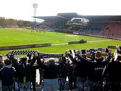
FC Mariupol is a football club, with a great sport traditions and a history of participation at the European level competitions.
The water polo team, the «Ilyichevets», is the undisputed champion of Ukraine. It has won the Ukrainian championship 11 times. Every year it plays in the European Champion Cup and Russian championship.
Azovstal' Canoeing Club on the river Kalmius. Vitaly Yepishkin – 3rd place in the World Cup in the 200m K-2.
Azovmash Basketball Club, similarly to the "Ilichevets" Water-polo Club, has numerous national championship titles. Significant successes were obtained as well by the Mariupol schools of boxing, Greco-Roman wrestling, artistic gymnastics, and other types of sport.
Sport building of city (count 585):
- «Volodymyr Boiko» stadium
- «Azovstal» sports complex
- «Azovets» stadium (in the past the «Locomotive»)
- «Azovmash» sports complex
- «Sadko» Sports complex
- «Vodnik» Sports complex
- «Neptune» public pool
- «Azovstal» chess club, etc.
Infrastructure
Mariupol is the second most populous city in the Donetsk Oblast (after Donetsk), and is amongst the ten most populous cities in Ukraine. See the list of cities in Ukraine.
Architecture and Construction
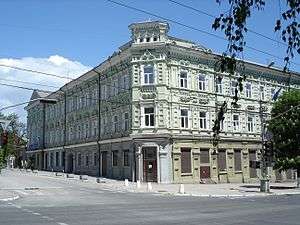
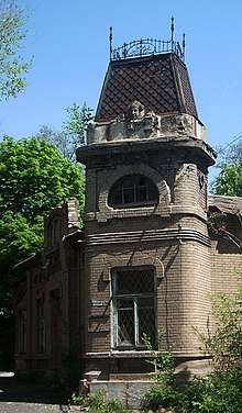
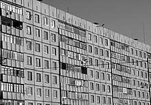
Old Mariupol is an area defined by the coast of the Sea of Azov to the south, by the Kalmius River to the east, to the north by Shevchenko Boulevard, and to the west by Metalurhiv Avenue. It is built up mainly of a few storey houses and has kept its pre-revolutionary architecture. Only Artem Street and Miru Avenue were built after World War II and are considered modern constructions.
The central area of Mariupol (from Metalurhiv Avenue up to Budivelnykiv Avenue) is made up almost entirely of administrative and commercial buildings, including a city council building, post office, the Lukov cinema, Mariupol Humanitarian University, Priazov State Technical University, the Korolenko central city library, and many large shops.
The architecture of other residential areas ("Zakhidny", "Skhidny", "Kirov", "Cheremushky", 5th, 17th catchment area, etc.) is not particularly distinct or original and consists of typical 5- or 9-storey houses. The term "Cheremushki" carries a special meaning in Russian culture and now also in Ukrainian; it usually refers to the newly settled parts of a city.
The city's residential area covers 9.82 million square meters. The population density is 19.3 square meters per inhabitant. The share of privatized housing in 2003 was 76.3%.
Industrial construction prevails. The mass building of habitable quarters within the city ended in the 1980s. Mainly under construction now are comfortable habitations . The city's construction industry for nine months of 2005 executed a volume of civil contract and building works of 304.4 million hrivnas (US$60 million). The city density on this parameter is 22.1%.
Main streets
- Avenues: Miru, Metalurhiv, Budivelnykiv, Ilyich, Nakhimov, Peremohy, Lunin, and Leningradsky (in Livoberezhnyi Raion)
- Streets: Artem, Torhova, Apatov, Kuprin, Uritsky, Bakhchivandzhi, Gagarin, Karpinsky, Mamin-Sibiryak, Taganrog, Olympic, Azovstal, Makar Mazay, Karl Libknekht
- Boulevards: Shevchenko, Morskyi, Prymore, Khmelnytsky, etc.
- Squares: Administrative, Nezalezhnosti, Peremohy, Mashinobudivnykiv, Vioniv, Vyzvolennia.
In December 1991, by a decision of the city council of Mariupol, the following streets in an old part of the city reverted to their pre-revolutionary names:
- First of May Street to Heorhiyevska Street
- Third International Street to Torhova Street
- Apatov Street (a part – east of Metalurhiv Avenue) to Italian Street
- Donbass Street to Mykolaivska Street
- Ivan Franko Street to Fontanna Street
- Karl Libknekht Street (a part – east of Avenue) to Mitropolit Street
- Karl Marx Street to Greek Street
- Komsomol Street to Yevpatoriya Street
- Krasnoarmeyskaya Street to Gotfeyska Street
- Kuindzhi Street to Karasivska Street
- Proletarian Street to Kaffayska Street
- Rose Luxembourg Street to Zemska Street
- Soviet Street to Harlampiy Street
Between 1990 and 2000 the following streets and areas were renamed:
- Sergo Street to Jacob Gugel' Street (in Livoberezhnyi Raion) – in honour of the head of construction and the first director of "Azovstal"
- Republic Lane to University Street (in city centre)
- Constitution Square to Mashinobudivnykiv ("Mechanical engineers") Square
- Square near "Neptune" swimming pool to Nezalezhnosti ("Independence") Square
See also the list of streets and squares of Mariupol.
Transportation
- Railway station Mariupol. The city is connected by the railway to Donbass (the Direction of trains being: Moscow, Kiev, Lviv, Saint Petersburg, Minsk, Bryansk, Voronezh, Kharkiv, Poltava, Slavyansk-na-Kubani).
- A marina in the area of Port of Mariupol.
- Mariupol International Airport (the property Ilyich Mariupol steel and iron works).
City transport
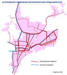
Mariupol has transportation including bus transportation, trolley-buses, trams, and fixed-route taxis. The city is connected by railways, a seaport and the airport to other countries and cities.
- Urban electric transport (MTTU, Mariupol Tram-trolleybus management):
- A trams, street-cars (since 1933) – 12 routes (machines of type КТМ-5 and КТМ-8 work),
- Trolley buses (since 1970) – 14 routes (machines of type: Škoda 14Тr, ZiU-10, ZiU-9, YuMZ T-1, YuMZ T-2, de:MAN SL 172 HO).
- Buses – mainly the private minibuses which are carrying out transportation in city, on suburban and long-distance routes.
- Road service station (which includes transportations to Taganrog, Rostov-upon-Don, Krasnodar, Kiev, Odessa, Yalta, Dnipro are carried out, etc.) and a suburban auto station (with routes mainly to Pershotravnevy, Volodarsky and areas of Donetsk oblast).
Communications
In the city all leading Ukrainian mobile communications carriers are operational. During Soviet times in the city, ten automatic telephone exchanges were operational; six digital automatic telephone exchanges were recently added.
Health service
There are 70 medical and medical-health establishments in a city — hospitals, polyclinics, the station of blood transfusion, station of urgent medicare, sanatoriums, sanatoriums-preventive clinics, regional centre of social maintenance of pensionaries and invalids, city centres: gastroenterology, thoracic surgery, bleedings, pancreatic, microsurgery of the eye. Central pool-hospital on a water-carriage.
Education
81 general educational establishment are operational, including: 67 comprehensive schools (48,500 students), 2 grammar schools, 3 lyceums, 4 evening replaceable schools, 3 boarding schools, 2 private schools, 11 professional educational institutions (6,274 students), and 94 children's preschool establishments (12,700 children).
Three higher education establishments:
- Priazovsky State Technical University
- Mariupol State University
- Azovsky Institute of Marine Transport
Local media
More than 20 local newspapers work mostly Russian language-based, including:
- «Priazovsky Rabochy» («Priazovsky worker»)
- «Mariupolskaya Zhizn» («Mariupol life»)
- «Mariupolskaya Nedelya» («Mariupol week»)
- «Ilyichevets»
- «Azovstalets»
- «Azovsky Moryak» («Azov Seaman»)
- «Azovsky Mashinostroitel» («Azov Machine-builder»)
12 wireless stations, 7 regional television companies and channels:
- Broadcasting Company «Sigma»
- Broadcasting Company «MTV» («Mariupol television»)
- Broadcasting Company «TV 7»
- Broadcasting Company «Inter-Mariupol»
- Broadcasting Company «Format» and others
Retransmitting about 15 state channels («Inter», «1+1», «STB», «NTN», «5 Channel», «ICTV», «First National TV», «New Channel», TV Company «Ukraina», etc.)
Public organizations
There are about 300 public associations, including 22 trade-union organizations, about 40 political parties, 16 youth groups, 4 women's organizations, 37 associations of veterans and disabled, and 134 national and cultural societies.
There is a General Consulate of the Republic of Greece as well as the Republic of Cyprus in Mariupol.
Notable people
- Arkhip Kuindzhi (1842–1910), Russian landscape painter of Greek ethnicity
- Vyacheslav Polozov (born 1950), Soviet opera singer, born in Mariupol
- Igor Radivilov (born 1992), Ukraine gymnastics team member at the London 2012 Olympics and Men's Vault Bronze medallist
- Alexander Sacharoff (1886–1963), Jewish dancer, teacher, and choreographer
- Voron Viacheslav (born 1967), Russian and Ukrainian singer-songwriter, singer, composer, music producer
- Anna Zatonskih (born 1978), chess player
- Andrei Zhdanov (1896–1948), Soviet politician
- Nikki Benz (born Dec 11th, 1981), actress
- Diana Hajiyeva (born 1989), represented Azerbaijan at the Eurovision Song Contest 2017
See also
References
- ↑ Collection of laws and orders of the Workers-Peasants Government of Ukraine Archived 2013-12-11 at the Wayback Machine.. "Radianske Budivnytstvo i Pravo". State archives. February 29, 1932
- ↑ List of cities in Ukraine – List of cities in Ukraine
- ↑ Ukrcensus.org.ua - All-Ukrainian population census '2001
- ↑ "Чисельність наявного населення України (Actual population of Ukraine)" (in Ukrainian). State Statistics Service of Ukraine. Retrieved 26 August 2017.
- ↑ "Mariupol". Encyclopædia Britannica. Retrieved 9 February 2015.
- ↑ "Mariupol". The Free Dictionary.
- ↑ LeDonne John P. The territorial reform of the Russian Empire, 1775-1796 [II. The borderlands, 1777-1796]. In: Cahiers du monde russe et soviétique. Vol. 24 No. 4. October–December, 1983. p. 422.
- ↑ Magocsi, Paul R. "A History of Ukraine: The Land and Its Peoples," p. 197
- ↑ Wilson, Andrew. "The Donbas between Ukraine and Russia: The Use of History in Political Disputes," Journal of Contemporary History 1995 30: 265 "
- ↑ Magocsi, Paul R. "A History of Ukraine: The Land and Its Peoples," p. 197.
- ↑ N. D. Polons’ka –Vasylenko, "The Settlement of Southern Ukraine (1750-1775)," The Annals of the Ukrainian Academy of Arts and Sciences in the U.S., Inc., 1955, p. 16.
- ↑ Magocsi, Paul R. 2010. "A History of Ukraine: The Land and Its People," University of Toronto Press. Second edition. P. 283.
- ↑ LeDonne John P. The territorial reform of the Russian Empire, 1775-1796 [II. The borderlands, 1777-1796]. In: Cahiers du monde russe et soviétique. Vol. 24 No. 4. October–December, 1983. pp. 420-422.
- ↑ Wilson, Andrew. "The Donbas between Ukraine and Russia: The Use of History in Political Disputes," Journal of Contemporary History 1995 30: 273
- ↑ Gorbov V.N., Bozhko, R.P., Kushnir V.V. 2013. "Археологические комплексы на территории крепости Кальмиус и ее окрестностий," ("Archaeological complexes on the territory of the Kalmius fortress and its surroundings") Donetsk Archaeological Collection, No. 17, pp. 138-139, 141.
- ↑ Clark, George B. "Irish Soldiers in Europe: 17th - 19th Century," Mercier Press, October 12, 2010. Pp. 272, 274, 276.
- ↑ LeDonne John P. The territorial reform of the Russian Empire, 1775-1796 [II. The borderlands, 1777-1796]. In: Cahiers du monde russe et soviétique. Vol. 24 No. 4. October–December, 1983. p. 420-421
- 1 2 Section "Kalmius and the Kalmiusskaya Palanka", referencing A. A. Skalkowski, no citation.
- ↑ Gorbov V.N., Bozhko, R.P., Kushnir V.V. 2013. "Археологические комплексы на территории крепости Кальмиус и ее окрестностий," ("Archaeological complexes on the territory of the Kalmius fortress and its surroundings") Donetsk Archaeological Collection, No. 17, p. 133
- ↑ N. D. Polons’ka –Vasylenko, "The Settlement of Southern Ukraine (1750-1775)," The Annals of the Ukrainian Academy of Arts and Sciences in the U.S., Inc., 1955, p. 278
- ↑ Mikhail Kizilov. "Slave Trade in the Early Modern Crimea From the Perspective of Christian, Muslim, and Jewish Sources". Oxford University., p. 7 with n. 11
- ↑ Reenactor.ru p. 521
- ↑ Le Donne, John P. 1983. "The Territorial Reform of the Russian Empire », Cahiers du monde russe et soviétique. Vol. 24, No. 4. Octobre-Décembre 1983. p. 419.
- ↑ Posun’ko, Andriy, "After the Zaporizhia. Dissolution, reorganization, and transformation of borderland military in 1775-1835, Central European University, Budapest, Hungary, 2012, p. 35
- ↑ Verenikin, V. Yet how old is our city? Vecherniy Mariupol Newspaper website.
- ↑ Plotnikov, S. Mariupol icon of Theotokos "Hodegetria". Saint-Trinity Temple of Mariupol website. 9 August 2012
- ↑ Dzhuvaha, V. One of the first deportation of the Empire. How Crimean Greeks populated Wild Fields. Ukrayinska Pravda. 17 February 2011
- ↑ Crimean Tatars (КРИМСЬКІ ТАТАРИ). Encyclopedia of History of Ukraine.
- ↑ John P. McKay (1970). Pioneers for profit; foreign entrepreneurship and Russian industrialization, 1885-1913. University of Chicago Press. pp. 170, 230, 393.
- ↑ Blair, David (10 May 2014) Ukraine: Security forces abandon Mariupol ahead of referendum Telegraph.co.uk.
- ↑ "The President instructed the Head of the Donetsk Regional State Administration to relocate temporarily the administration office to Mariupol". president.gov.ua. Archived from the original on 18 March 2015. Retrieved 9 February 2015.
- 1 2 "U.S. Weapons Aren't Smart for Ukraine". Bloomberg. 21 November 2014. Retrieved 26 November 2014.
- ↑ "Rockets fired on Ukraine's Mariupol from rebel territory: OSCE". Yahoo News. 24 January 2015. Retrieved 9 February 2015.
- ↑ "DPR: situation in southern Donetsk republic deteriorates after McCain's trip". Retrieved 3 January 2017.
- ↑ "КЛИМАТ МАРИУПОЛЯ" (in Russian). Weather and Climate (Погода и климат). Retrieved 30 November 2015.
- ↑ "Mariupol Ukraine Climate Data". Climatebase. Retrieved 29 September 2012.
- ↑ Telegraph.co.uk
- ↑ Data on vote counting at percincts within single-mandate districts Extraordinary parliamentary election on 26.10.2014 Archived 2014-10-29 at the Wayback Machine., Central Election Commission of Ukraine
(in Ukrainian) Candidates and winners for the seat of the constituencies in the 2014 Ukrainian parliamentary election Vibori2014.rbc.ua Archived 2015-02-05 at the Wayback Machine., RBK Ukraine - 1 2 (in Ukrainian) On Amending Resolution of the Central Election Commission on April 28, 2012 № 82, Verkhovna Rada (3 June 2016)
- ↑ "Public Opinion Survey of Residents of UkraineJune 9 – July 7, 2017" (PDF). iri.org. August 2017. p. 86. Archived from the original (PDF) on August 22, 2017.
- ↑ Kisilier, Maxim, Is Rumeíka a Pontic or a Northern Greek Dialect?
- ↑ "Demoscope Weekly - Annex. Statistical indicators reference". demoscope.ru. Retrieved 9 February 2015.
- ↑ Kissilier, Maxim, ed. (2009), Language and Ethno-Cultural Situation in Greek Villages of Azov Region (PDF), St. Petersburg . The work is based on field research in the Greek villages in the Mariupol region. The expeditions were organised by St. Petersburg State University and carried out from 2001–2004.
- 1 2 "City's Economy in H1 2009" (in Russian). Mariupol City Council home page. Archived from the original on 2009-02-20. Retrieved 2009-08-25.
- ↑ "City's Economy in 2006" (in Russian). Mariupol City Council home page. Archived from the original on 2009-02-18. Retrieved 2009-01-12.
- ↑ "City's Economy in 2007" (in Russian). Mariupol City Council home page. Archived from the original on 2009-02-18. Retrieved 2009-01-12.
- ↑ "City's Economy in 2008" (in Russian). Mariupol City Council home page. Archived from the original on 2009-02-18. Retrieved 2009-07-09.
External links
| Wikimedia Commons has media related to Mariupol. |
| Wikivoyage has a travel guide for Mariupol. |
- in English
- (in English) welcome-to-mariupol.org.ua – Welcome to Mariupol! – support and assistance for foreign visitors
- (in English) Ilyich Mariupol steel and iron works
- (in English) photos of Mariupol
- (in English) photo Mariupol: panoramic photos of Mariupol in 360 degrees
- (in English) The murder of the Jews of Mariupol during World War II, at Yad Vashem website.
- in Ukrainian
- (in Ukrainian) Historical buildings in Mariupol Old Town
- in Russian
- (in Russian) Entertaining-information portal of Mariupol
- (in Russian) Mariupol' city catalog of shops
- (in Russian) Mariupol' city catalog
- (in Russian) Bab B Melёkino and others (Hits of 80s–90s) on YouTube, modern cultural background of Azov coastal area.
| Raions | |||||
|---|---|---|---|---|---|
| Cities |
| ||||
| |||||
| Districts |
| ||||
|---|---|---|---|---|---|
| Neighborhoods1 |
| ||||
| |||||