Washtenaw County, Michigan
| Washtenaw County, Michigan | ||
|---|---|---|
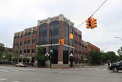
.jpg) Washtenaw County Courthouse | ||
| ||
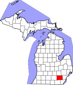 Location in the U.S. state of Michigan | ||
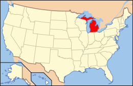 Michigan's location in the U.S. | ||
| Founded |
1822 (created) 1826 (organized)[1][2] | |
| Seat | Ann Arbor | |
| Largest city | Ann Arbor | |
| Area | ||
| • Total | 722 sq mi (1,870 km2) | |
| • Land | 706 sq mi (1,829 km2) | |
| • Water | 16 sq mi (41 km2), 2.3% | |
| Population | ||
| • (2010) | 344,791 | |
| • Density | 488/sq mi (188/km2) | |
| Congressional districts | 7th, 12th | |
| Time zone | Eastern: UTC−5/−4 | |

Washtenaw County (/ˈwɒʃtɪnɔː/) is a county located in the U.S. state of Michigan. As of the 2010 census, the population was 344,791.[3] The county seat is Ann Arbor.[4] The county was authorized by legislation in 1822, and was organized as a county in 1826.[1]
Washtenaw County comprises the Ann Arbor Metropolitan Statistical Area and is included in the Detroit-Warren-Ann Arbor Combined Statistical Area.
The county is home to the University of Michigan, Eastern Michigan University, Washtenaw Community College, and Concordia University Ann Arbor.
History
The earliest histories mention French trappers and traders conducting trade in the area at the Potawatomi Trail and Pontiac Trail crossings of the Huron River, and later English then American settlers. The first successful settlement was established at the present site of Ypsilanti about 1809 by French traders.[5]
In 1822, the Legislative Council of the Michigan Territory government defined the name and boundaries of the county, but attached it to Wayne County for revenue, taxation, and judicial affairs. The word: Washtenaw is a variant of the Ojibwe word: "Wash-ten-ong," meaning what is now called the "Grand River".[6] At the time of the official naming of the county in 1822, the headwaters of the Grand River fell within the original boundaries of Washtenaw County, which encompassed a much larger area than the present county.[1] In the Ojibwe language, "Wash-ten-ong" literally translates as "far away waters", and was then used by the Ojibwe as the name for the Grand River due to its great length.[7] Thus "Washtenaw" could mean "far away waters".[1]
Four years after the first platting out of the county, Washtenaw county was established as a separate self-administered county by an act of the Michigan Territorial Legislature, in 1826.[5] It was attached for administrative purposes to Wayne County until {before 1829} when county government was seated. Ingham and other counties were formed from portions of territorial Washtenaw County.
Swamps were drained and farms were tiled to lower the water table. The swamp northwest of the I-94 and US-23 intersection, and areas within Waterloo Recreation Area still appear as they did to early settlers. As productive farms became established, the local deer herds grew. In the 1820s and 1830s, the events surrounding the independence of Greece from Turkey inspired construction of Greek Revival buildings, and the names of townships, towns, and children.
The "frostbitten constitutional convention" was held at Ann Arbor, the county seat, in 1835. Following resolution of the Toledo War (1835-1836), in which Michigan Territory ceded its claim to the Toledo strip in exchange for most of the Upper Peninsula, Michigan became a state on 26 January 1837. The University of Michigan, founded at Detroit in 1817, was moved by the state to Ann Arbor in 1839 as a consolation for the city's not being named the state capital, as it had sought. The University subsequently became and remains Washtenaw County's largest employer.
In 1849, the Michigan State Normal School (now Eastern Michigan University) was established in Washtenaw's oldest settlement, Ypsilanti.
Geography
According to the U.S. Census Bureau, the county has a total area of 722 square miles (1,870 km2), of which 706 square miles (1,830 km2) is land and 16 square miles (41 km2) (2.3%) is water.[8]
Adjacent counties
- Livingston County (north)
- Oakland County (northeast)
- Wayne County (east)
- Monroe County (southeast)
- Lenawee County (southwest)
- Jackson County (west)
- Ingham County (northwest)
Major highways


Demographics
| Historical population | |||
|---|---|---|---|
| Census | Pop. | %± | |
| 1830 | 4,042 | — | |
| 1840 | 23,571 | 483.2% | |
| 1850 | 28,567 | 21.2% | |
| 1860 | 35,686 | 24.9% | |
| 1870 | 41,434 | 16.1% | |
| 1880 | 41,848 | 1.0% | |
| 1890 | 42,210 | 0.9% | |
| 1900 | 47,761 | 13.2% | |
| 1910 | 44,714 | −6.4% | |
| 1920 | 49,520 | 10.7% | |
| 1930 | 65,530 | 32.3% | |
| 1940 | 80,810 | 23.3% | |
| 1950 | 134,606 | 66.6% | |
| 1960 | 172,440 | 28.1% | |
| 1970 | 234,103 | 35.8% | |
| 1980 | 264,748 | 13.1% | |
| 1990 | 282,937 | 6.9% | |
| 2000 | 322,895 | 14.1% | |
| 2010 | 344,791 | 6.8% | |
| Est. 2016 | 364,709 | [9] | 5.8% |
| US Decennial Census[10] 1790-1960[11] 1900-1990[12] 1990-2000[13] 2010-2013[3] | |||
As of the 2010 United States Census, there were 344,791 people residing in the county. 74.5% were White, 12.7% Black or African American, 7.9% Asian, 0.3% Native American, 1.2% of some other race and 3.4% of two or more races. 4.0% were Hispanic or Latino (of any race). 16.0% were of German, 7.6% English, 7.5% Irish, 6.3% American and 5.0% Polish ancestry.[14]
Washtenaw has the highest proportion of Asian-American residents of any Michigan county.
As of the census[15] of 2000, 17.4% of county residents were of German ancestry; 9.0% cited English, 8.4% Irish, 5.3% Polish and 5.0% American ancestry. According to Census 2000, 87.1% spoke only English at home; 2.7% spoke Spanish and 1.7% Chinese or Mandarin.
There were 125,327 households out of which 29.20% had children under the age of 18 living with them, 46.40% were married couples living together, 9.30% had a female householder with no husband present, and 41.20% were non-families. 29.50% of all households were made up of individuals and 5.90% had someone living alone who was 65 years of age or older. The average household size was 2.41 and the average family size was 3.02.
In the county, the population was spread out with 22.10% under the age of 18, 17.10% from 18 to 24, 32.10% from 25 to 44, 20.60% from 45 to 64, and 8.10% who were 65 years of age or older. The median age was 31 years. For every 100 females, there were 98.90 males. For every 100 females age 18 and over, there were 97.10 males.
The median income for a household in the county was $51,990, and the median income for a family was $70,393 (these figures had risen to $59,887 and $80,779 respectively as of a 2007 estimate.[16]) Males had a median income of $49,304 versus $33,598 for females. The per capita income for the county was $27,173. About 5.10% of families and 11.10% of the population were below the poverty line, including 8.60% of those under age 18 and 5.80% of those age 65 or over.
Government
Elected officials
- Prosecuting Attorney: Brian L. Mackie (Democrat)
- Sheriff: Jerry Clayton (Democrat)
- County Clerk/Register of Deeds: Lawrence Kestenbaum (Democrat)
- County Treasurer: Catherine McClary (Democrat)
- Water Resources Commissioner: Evan Pratt (Democrat)
The Board of Commissioners has nine members, elected from single member districts, on a partisan ballot, in November of even-numbered years. The term is two years. Information as of May 2017.
| District | Commissioner | Party | Positions |
|---|---|---|---|
| 1 | Kent Martinez-Kratz | Democrat | |
| 2 | Michelle Deatrick | Democrat | Vice Chair of Board |
| 3 | Alicia Ping | Republican | |
| 4 | Felicia Brabec | Democrat | Ways & Means Chair |
| 5 | Ruth Ann Jamnick | Democrat | |
| 6 | Ricky Jefferson | Democrat | |
| 7 | Andy LaBarre | Democrat | Board Chair |
| 8 | Jason Morgan | Democrat | Working Session Chair |
| 9 | Conan Smith | Democrat | |
Government services
Parks and recreation
Washtenaw county operates 10 parks and one recreation center (gymnasium). One park has a water sprinkler area, one has a substantial water park component, and there is one golf course. The recreation center has a swimming pool, indoor track, basketball courts, complete set of resistance machines, a weight room, and several multipurpose rooms.
Washtenaw county is in the process of acquiring land for natural preservation. The program started in 2001, was renewed in 2010, and will end in 2021. Eight parcels of land had been purchased by July 2007. These parcels are of special ecological, recreational, and educational benefits. They are preserved in a natural unimproved state and are open to the public during daylight hours.
Wireless communication
In partnership with private enterprise, the county maintains a wireless network which is currently available to approximately 50% of county residents. This is the Wireless Washtenaw Project; its stated aim of this project is to provide wireless access to all county residents.
Miscellaneous
The county government operates the jail, maintains rural roads (through a largely independent road commission), operates the major local courts, records deeds and mortgages, maintains vital records, administers public health regulations, and participates with the state in providing welfare and social services. The county board of commissioners controls the budget and has limited authority to make laws or ordinances. In Michigan, most local government functions – police and fire, building and zoning, tax assessment, street maintenance, etc. – are the responsibility of individual cities and townships.
Politics
| Year | Republican | Democratic | Third Parties |
|---|---|---|---|
| 2016 | 26.6% 50,631 | 67.6% 128,483 | 5.8% 10,965 |
| 2012 | 31.3% 56,412 | 67.0% 120,890 | 1.7% 3,035 |
| 2008 | 28.8% 53,946 | 69.6% 130,578 | 1.6% 3,024 |
| 2004 | 35.5% 61,455 | 63.5% 109,953 | 1.1% 1,856 |
| 2000 | 36.2% 52,459 | 59.8% 86,647 | 4.0% 5,834 |
| 1996 | 32.3% 40,097 | 58.9% 73,106 | 8.7% 10,825 |
| 1992 | 30.1% 41,386 | 53.3% 73,325 | 16.6% 22,755 |
| 1988 | 46.7% 55,029 | 52.4% 61,799 | 0.9% 1,092 |
| 1984 | 51.3% 58,736 | 48.1% 55,084 | 0.7% 749 |
| 1980 | 41.9% 48,699 | 43.9% 51,013 | 14.2% 16,467 |
| 1976 | 50.9% 56,807 | 45.6% 50,917 | 3.6% 3,965 |
| 1972 | 47.0% 50,535 | 51.5% 55,350 | 1.6% 1,690 |
| 1968 | 46.8% 36,432 | 42.5% 33,073 | 10.7% 8,309 |
| 1964 | 37.7% 25,595 | 62.0% 42,089 | 0.3% 206 |
| 1960 | 61.0% 39,632 | 38.7% 25,129 | 0.3% 225 |
| 1956 | 66.9% 38,911 | 32.9% 19,124 | 0.2% 141 |
| 1952 | 66.6% 35,826 | 32.9% 17,671 | 0.5% 262 |
| 1948 | 63.8% 24,588 | 33.0% 12,721 | 3.3% 1,258 |
| 1944 | 62.0% 24,740 | 37.4% 14,922 | 0.6% 244 |
| 1940 | 64.3% 21,664 | 35.0% 11,802 | 0.8% 253 |
| 1936 | 50.8% 14,986 | 46.1% 13,589 | 3.2% 935 |
| 1932 | 52.8% 15,368 | 43.1% 12,552 | 4.1% 1,180 |
| 1928 | 78.4% 19,676 | 21.2% 5,308 | 0.4% 109 |
| 1924 | 72.2% 14,326 | 18.2% 3,603 | 9.6% 1,901 |
| 1920 | 74.5% 14,082 | 23.6% 4,468 | 1.9% 362 |
| 1916 | 54.1% 6,505 | 43.9% 5,279 | 2.0% 242 |
| 1912 | 23.6% 2,495 | 39.5% 4,164 | 36.9% 3,897 |
| 1908 | 54.6% 5,845 | 41.5% 4,441 | 4.0% 423 |
| 1904 | 62.0% 6,566 | 35.7% 3,779 | 2.3% 238 |
| 1900 | 50.1% 5,369 | 47.3% 5,072 | 2.6% 275 |
| 1896 | 49.7% 5,671 | 46.9% 5,348 | 3.4% 384 |
| 1892 | 42.0% 4,362 | 53.0% 5,508 | 5.0% 518 |
| 1888 | 43.0% 4,549 | 51.8% 5,482 | 5.3% 557 |
| 1884 | 40.5% 4,049 | 53.2% 5,315 | 6.3% 626 |
One of the most liberal counties in the United States,[18] Washtenaw has long been a Democratic stronghold in local and national elections.
Communities
Washtenaw County was formed from a portion of Wayne County. It is one of many Michigan counties which has a name not borne by any other county in the United States. As the population increased, townships were formed. Amongst the townships, communities have grown from hamlets into villages and cities. Some of the townships have elected to incorporate as charter townships.
Cities
Villages
Charter townships
General law townships
Census-designated place
- Whitmore Lake (part)[19]
Other unincorporated communities
- Bridgewater
- Dixboro
- Delhi Mills
- Geddes
- Mooreville
- Rawsonville
- Salem
- Stoney Creek
- Whittaker
- Willis
Also see: Official Washtenaw County website page listing localities
See also
References
- 1 2 3 4 "Bibliography on Washtenaw County". Clarke Historical Library, Central Michigan University. Archived from the original on 6 October 2014. Retrieved 23 January 2013.
- ↑ "About —". ewashtenaw.org. Archived from the original on 28 October 2012.
- 1 2 "State & County QuickFacts". US Census Bureau. Archived from the original on 22 July 2011. Retrieved 29 August 2013.
- ↑ "Find a County". National Association of Counties. Archived from the original on 31 May 2011. Retrieved 7 June 2011.
- 1 2 Chas. C. Chapman & Co. (1881). History of Washtenaw County, Michigan, Vol. 1, pp. 116-24. Chicago: Chas. C. Chapman & Co.
- ↑ "Washtenaw County Historical Society: Etymology of the Name". 2013. Retrieved 23 January 2013. Washtenaw County Historical Society detail of etymology of the county's name.
- ↑ Publications of the Historical Society of Grand Rapids, Vol. 1, Parts 1-7. 2013. Retrieved 23 January 2013. Ojibwe etymology of the word: Wash-ten-ong".
- ↑ "2010 Census Gazetteer Files". US Census Bureau. 22 August 2012. Archived from the original on 13 November 2013. Retrieved 28 September 2014.
- ↑ "Population and Housing Unit Estimates". Archived from the original on 29 May 2017. Retrieved 9 June 2017.
- ↑ "US Decennial Census". US Census Bureau. Archived from the original on 12 May 2015. Retrieved 28 September 2014.
- ↑ "Historical Census Browser". University of Virginia Library. Archived from the original on 16 August 2012. Retrieved 28 September 2014.
- ↑ "Population of Counties by Decennial Census: 1900 to 1990". US Census Bureau. Archived from the original on 15 February 2015. Retrieved 28 September 2014.
- ↑ "Census 2000 PHC-T-4. Ranking Tables for Counties: 1990 and 2000" (PDF). US Census Bureau. Archived (PDF) from the original on 18 December 2014. Retrieved 28 September 2014.
- ↑ Data Access and Dissemination Systems (DADS). "American FactFinder". census.gov. Archived from the original on 17 February 2012.
- ↑ "American FactFinder". US Census Bureau. Archived from the original on 11 September 2013. Retrieved 31 January 2008.
- ↑ Bureau, US Census. "American FactFinder - Community Facts". factfinder.census.gov. Retrieved 7 May 2018.
- ↑ Leip, David. "Dave Leip's Atlas of U.S. Presidential Elections". uselectionatlas.org. Archived from the original on 23 March 2018. Retrieved 7 May 2018.
- ↑ "America's top 20 most liberal-friendly counties". dailycaller.com. Archived from the original on 30 December 2017. Retrieved 7 May 2018.
- ↑ Washtenaw Co./Whitmore Lake
External links
| Wikivoyage has a travel guide for Washtenaw County. |
- Foodloose in Washtenaw: A Foodie's Guide to Washtenaw County, 2018
- Dexter District Library
- Washtenaw County Government
- Past and present of Washtenaw County, Michigan by Samuel W. Beakes Chicago: The S.J. Clarke publishing co., 1906
- Washtenaw Community Cafe An online discussion group for the county of Washtenaw
- Ypsilanti Historical Society
Places adjacent to Washtenaw County, Michigan | ||||||||||
|---|---|---|---|---|---|---|---|---|---|---|
| ||||||||||
Municipalities and communities of Washtenaw County, Michigan, United States | ||
|---|---|---|
| Cities | | |
| Villages | ||
| Charter townships | ||
| General law townships | ||
| CDPs | ||
| Unincorporated communities | ||
| Ghost Towns | ||
| Footnotes | ‡This populated place also has portions in an adjacent county or counties | |