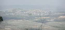
Fahma
| Fahma | |
|---|---|
| Other transcription(s) | |
| • Arabic | فحمة |
 Fahma | |
 Fahma Location of Fahma within Palestine | |
| Coordinates: 32°23′00″N 35°10′46″E / 32.38333°N 35.17944°ECoordinates: 32°23′00″N 35°10′46″E / 32.38333°N 35.17944°E | |
| Palestine grid | 167/198 |
| Governorate | Jenin |
| Government | |
| • Type | Village council |
| Population (2006) | |
| • Jurisdiction | 2,439 |
| Name meaning | The charcoal[1] |
Fahma (Arabic: فحمة) is a Palestinian town in the Jenin Governorate in the Western area of the West Bank, located 15 kilometers Southwest of Jenin.According to the Palestinian Central Bureau of Statistics, the town had a population of 2,439 inhabitants in mid-year 2006.[2]
History
Pottery sherds from early and late Roman, Byzantine, and early Muslim eras have been found here.[3]
In 1105, Abd el-Ghani, a Moslem traveler, passed by Famah on his pilgrimage.[4]
In 1179 the village was mentioned together with Ajjah (named Casale Age) in Crusader sources as being among the villages whose revenue were given to the Zion Abbey by Pope Alexander III.[5][6]
In the Mamluk era, it was a station on the road between Damascus and Cairo, used for the express bringing of snow. It also had beacons for conveying messages.[7]
Ottoman era
Fahma, like the rest of Palestine, was incorporated into the Ottoman Empire in 1517, and in the census of 1596 it was a part of the nahiya ("subdistrict") of Jabal Sami which was under the administration of the liwa ("district") of Nablus. The village had a population of 21 households and 2 bachelors, all Muslim. The villagers paid a fixed tax-rate of 33,3% on agricultural products, such as wheat, barley, summer crops, olive trees, beehives and/or goats, in addition to occasional revenues, a tax for people of liwa Nablus, and a press for olive oil or grape syrup; a total of 6,000 akçe.[8] Pottery sherd from the early Ottoman era have also been found here.[3]
In 1838, Fahmeh was noted as being in the District of esh-Sha'rawiyeh esh-Shurkiyeh, the eastern part.[9][10]
In 1882, the Palestine Exploration Fund's Survey of Western Palestine described Fahmeh as: "A small adobe hamlet on a saddle beneath the hill (Batnen Nury). It has a well and a fig garden towards the north."[11]
British Mandate era
In the 1922 census of Palestine, conducted by the British Mandate authorities, Fahmeh had a population of 187; all Muslims,[12] increasing in the 1931 census to 238; still all Muslims, in a total of 38 houses.[13]
In 1945 Fahma had a population of 350 Muslims,[14] and the jurisdiction of the village was 4,498 dunams of land, according to an official land and population survey.[15] Of this, 210 dunams were used for plantations and irrigable land, 2,173 dunams for cereals,[16] while 14 dunams were built-up (urban) land.[17]
Jordanian era
In the wake of the 1948 Arab–Israeli War, and after the 1949 Armistice Agreements, Faqqua came under Jordanian rule.
The Jordanian census of 1961 found 541 inhabitants in Fahma.[18]
Post 1967
After the Six-Day War in 1967, Fahma has been under Israeli occupation.
The village mosque is a former church, and it includes some elements (a stone door), possibly from a 3rd or 4th century Samaritan synagogue.[19]
References
- ↑ Palmer, 1881, p. 182
- ↑ Projected Mid -Year Population for Jenin Governorate by Locality 2004- 2006 Archived September 20, 2008, at the Wayback Machine. Palestinian Central Bureau of Statistics
- 1 2 Zertal, 2016, p. 410
- ↑ Cited in Zertal, 2016, p. 409
- ↑ Zertal, 2004, p. 254
- ↑ Rey, 1883, pp. 282, 426; Röhricht, 1887, p. 223; Röhricht, 1893, RRH, pp. 153-154, No. 576; all cited in Pringle, 1993, p. 207
- ↑ Volney, cited in Zertal, 2016, p. 409
- ↑ Hütteroth and Abdulfattah, 1977, p. 130
- ↑ Robinson and Smith, 1841, vol 3, 2nd app, p. 129
- ↑ Robinson and Smith, 1841, vol 3, p. 150
- ↑ Conder and Kitchener, 1882, SWP II, p. 154
- ↑ Barron, 1923, Table IX, Sub-district of Jenin, p. 29
- ↑ Mills, 1932, p. 68
- ↑ Government of Palestine, Department of Statistics, 1945, p. 16
- ↑ Government of Palestine, Department of Statistics. Village Statistics, April, 1945. Quoted in Hadawi, 1970, p. 54
- ↑ Government of Palestine, Department of Statistics. Village Statistics, April, 1945. Quoted in Hadawi, 1970, p. 98
- ↑ Government of Palestine, Department of Statistics. Village Statistics, April, 1945. Quoted in Hadawi, 1970, p. 148
- ↑ Government of Jordan, Department of Statistics, 1964, p. 25
- ↑ Pringle, 1993, pp. 205, 206
Bibliography
- Barron, J. B., ed. (1923). Palestine: Report and General Abstracts of the Census of 1922. Government of Palestine.
- Conder, C. R.; Kitchener, H. H. (1882). The Survey of Western Palestine: Memoirs of the Topography, Orography, Hydrography, and Archaeology. 2. London: Committee of the Palestine Exploration Fund.
- Government of Jordan, Department of Statistics (1964). First Census of Population and Housing. Volume I: Final Tables; General Characteristics of the Population (PDF).
- Government of Palestine, Department of Statistics (1945). Village Statistics, April, 1945.
- Hadawi, S. (1970). Village Statistics of 1945: A Classification of Land and Area ownership in Palestine. Palestine Liberation Organization Research Center.
- Hütteroth, Wolf-Dieter; Abdulfattah, Kamal (1977). Historical Geography of Palestine, Transjordan and Southern Syria in the Late 16th Century. Erlanger Geographische Arbeiten, Sonderband 5. Erlangen, Germany: Vorstand der Fränkischen Geographischen Gesellschaft. ISBN 3-920405-41-2.
- Mills, E., ed. (1932). Census of Palestine 1931. Population of Villages, Towns and Administrative Areas. Jerusalem: Government of Palestine.
- Palmer, E. H. (1881). The Survey of Western Palestine: Arabic and English Name Lists Collected During the Survey by Lieutenants Conder and Kitchener, R. E. Transliterated and Explained by E.H. Palmer. Committee of the Palestine Exploration Fund.
- Pringle, Denys (1993). The Churches of the Crusader Kingdom of Jerusalem: A-K (excluding Acre and Jerusalem). Cambridge University Press.
- Rey, E. G. (1883). Les colonies franques de Syrie aux XIIme et XIIIme siècles (in French). Paris: A. Picard.
- Robinson, E.; Smith, E. (1841). Biblical Researches in Palestine, Mount Sinai and Arabia Petraea: A Journal of Travels in the year 1838. 3. Boston: Crocker & Brewster.
- Röhricht, R. (1887). "Studien zur mittelalterlichen Geographie und Topographie Syriens". Zeitschrift des Deutschen Palästina-Vereins (in German). Leipzig: K. Baedeker. 10: 195–344.
- Röhricht, R. (1893). Regesta regni Hierosolymitani (MXCVII-MCCXCI) (in Latin). Berlin: Libraria Academica Wageriana.
- Zertal, A. (2004). The Manasseh Hill Country Survey. 1. Boston: BRILL. ISBN 9004137564.
- Zertal, A. (2016). The Manasseh Hill Country Survey. 3. Boston: BRILL. ISBN 9004312307.
External links
- Welcome To Fahma
- Survey of Western Palestine, Map 11: IAA, Wikimedia commons
| Cities |  | |
|---|---|---|
| Municipalities |
| |
| Villages |
| |