Araqah
| Araqah | |
|---|---|
| Other transcription(s) | |
| • Arabic | عرقه |
| • Also spelled |
al-Araqa (official) ’Araqa (unofficial) |
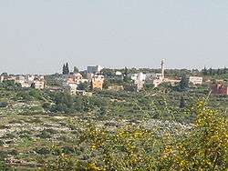 Araqah as seen from the Shahak Industrial Park | |
 Araqah Location of Araqah within Palestine | |
| Coordinates: 32°28′16″N 35°12′02″E / 32.47111°N 35.20056°ECoordinates: 32°28′16″N 35°12′02″E / 32.47111°N 35.20056°E | |
| Palestine grid | 169/208 |
| Governorate | Jenin |
| Government | |
| • Type | Village council |
| Population (2006) | |
| • Jurisdiction | 2,124 |
| Name meaning | The cliffs[1] |
Araqah (Arabic: عرقه) is a Palestinian town in the Jenin Governorate in the Northern area of the West Bank, located 15 kilometers West of Jenin. According to the Palestinian Central Bureau of Statistics, the town had a population of over 2,124 inhabitants in mid-year 2006.[2]
History
Pottery remains from the late Roman,[3] Byzantine,[3][4] early Muslim and the Middle Ages have been found here.[3]
Ottoman era
Pottery remains from the Ottoman era have also been found here.[3]
In 1870, Victor Guérin described it as a small village, situated on a small hill, and divided into two quarters.[5]
In 1882 the Palestine Exploration Fund's Survey of Western Palestine found that it was "a village of moderated size on a hill side, with a well to the south."[6]
British Mandate era
In the 1922 census of Palestine, conducted by the British Mandate authorities, the village had a population of 168 Muslims,[7] increasing slightly in the 1931 census to 219 Muslims, with 36 houses.[8]
In 1944/5 the population was 350 Muslims,[9] with a total of 5,675 dunams of land, according to an official land and population survey.[10] Of this, 462 dunams were used for plantations and irrigable land, 1,191 dunams for cereals,[11] while 27 dunams were built-up (urban) land.[12]
Jordanian era
After the 1948 Arab-Israeli War, Araqah came under Jordanian rule.
Post-1967
Araqah has been under Israeli occupation along with the rest of the West Bank after the 1967 Six-Day War.
On 27 April 2015 an eighteen-year-old youth from the village died after being shot the previous day by Israeli soldiers.[14]
See also
References
- ↑ Palmer, 1881, p. 144
- ↑ Projected Mid -Year Population for Jenin Governorate by Locality 2004- 2006 Palestinian Central Bureau of Statistics
- 1 2 3 4 Zertal, 2016, p. 215
- ↑ Dauphin, 1998, p. 750
- ↑ Guérin, 1874, p. 224
- ↑ Conder and Kitchener, 1882, SWP II, p. 44
- ↑ Barron, 1923, Table IX, Sub-district of Jenin, p. 30
- ↑ Mills, 1932, p. 67
- ↑ Government of Palestine, Department of Statistics, 1945, p. 16
- ↑ Government of Palestine, Department of Statistics. Village Statistics, April, 1945. Quoted in Hadawi, 1970, p. 54
- ↑ Government of Palestine, Department of Statistics. Village Statistics, April, 1945. Quoted in Hadawi, 1970, p. 98
- ↑ Government of Palestine, Department of Statistics. Village Statistics, April, 1945. Quoted in Hadawi, 1970, p. 148
- ↑ Government of Jordan, Department of Statistics, 1964, p. 25
- ↑ Palestinian Man Shot in West Bank Dies of Wounds Ha'aretz 27/4/2015
Bibliography
- Barron, J. B., ed. (1923). Palestine: Report and General Abstracts of the Census of 1922. Government of Palestine.
- Conder, C.R.; Kitchener, H. H. (1882). The Survey of Western Palestine: Memoirs of the Topography, Orography, Hydrography, and Archaeology. 2. London: Committee of the Palestine Exploration Fund.
- Dauphin, Claudine (1998). La Palestine byzantine, Peuplement et Populations. BAR International Series 726 (in French). III : Catalogue. Oxford: Archeopress. ISBN 0-860549-05-4.
- Government of Jordan, Department of Statistics (1964). First Census of Population and Housing. Volume I: Final Tables; General Characteristics of the Population (PDF).
- Government of Palestine, Department of Statistics (1945). Village Statistics, April, 1945.
- Guérin, V. (1875). Description Géographique Historique et Archéologique de la Palestine (in French). 2: Samarie, pt. 2. Paris: L'Imprimerie Nationale.
- Hadawi, S. (1970). Village Statistics of 1945: A Classification of Land and Area ownership in Palestine. Palestine Liberation Organization Research Center.
- Mills, E., ed. (1932). Census of Palestine 1931. Population of Villages, Towns and Administrative Areas. Jerusalem: Government of Palestine.
- Palmer, E. H. (1881). The Survey of Western Palestine: Arabic and English Name Lists Collected During the Survey by Lieutenants Conder and Kitchener, R. E. Transliterated and Explained by E.H. Palmer. Committee of the Palestine Exploration Fund.
- Zertal, A. (2016). The Manasseh Hill Country Survey. 3. Boston: BRILL. ISBN 9004312307.
External links
- Welcome To 'Araqa
- Araqa, Welcome to Palestine
- Survey of Western Palestine, Map 8: IAA, Wikimedia commons
| Cities |  | |
|---|---|---|
| Municipalities |
| |
| Villages |
| |