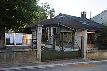
Ailleville
| Ailleville | |
|---|---|
| Commune | |
 | |
 Ailleville Location within Grand Est region  Ailleville | |
| Coordinates: 48°15′12″N 4°40′55″E / 48.2533°N 4.6819°ECoordinates: 48°15′12″N 4°40′55″E / 48.2533°N 4.6819°E | |
| Country | France |
| Region | Grand Est |
| Department | Aube |
| Arrondissement | Bar-sur-Aube |
| Canton | Bar-sur-Aube |
| Intercommunality | Région Bar-sur-Aube |
| Government | |
| • Mayor (2014-2020) | Gérard Carrier |
| Area1 | 5.01 km2 (1.93 sq mi) |
| Population (2014)2 | 265 |
| • Density | 53/km2 (140/sq mi) |
| Time zone | UTC+1 (CET) |
| • Summer (DST) | UTC+2 (CEST) |
| INSEE/Postal code | 10002 /10200 |
| Elevation |
156–296 m (512–971 ft) (avg. 164 m or 538 ft) |
|
1 French Land Register data, which excludes lakes, ponds, glaciers > 1 km2 (0.386 sq mi or 247 acres) and river estuaries. 2 Population without double counting: residents of multiple communes (e.g., students and military personnel) only counted once. | |
Ailleville is a French commune in the Aube department in the Grand Est region of northern-central France.
The inhabitants are known as Aillevillois or Aillevilloises.
Geography
Ailleville is located in the valley of the Aube river some 2 km north-west of Bar-sur-Aube. The commune is traversed from Bar-sur-Aube in the south-east crossing the heart of the commune and the town to exit towards Arsonval in the north-west. There are no other highways in the commune other than small country lanes. There are no villages or hamlets other than Ailleville. The north-east of the commune is dominated by the forests of Envers de Bretonvau and Bois de Val Joudry. The rest of the commune is farmland. The southern part of the commune is traversed by a railway line running from Bar-sur-Aube railway station in the south-east to the next station at Arret-de-Jessains in the north-west. There is no station in the commune with the nearest station at Bar-sur-Aube. The nearest cities are Chaumont some 40 km to the south-east and Troyes some 40 km west.
The Aube river crosses the southern boundary of the commune and forms a small portion of the southern border of the commune. There are no discernible streams in the commune.[1]
Neighbouring Communes and Villages[1]
Places adjacent to Ailleville | ||||||||||
|---|---|---|---|---|---|---|---|---|---|---|
| ||||||||||
History
The village was founded in 6 A.D. with the name "Aquilavilla" (a villa belonging to a Roman legionnaire in Latin). This villa was undoubtedly given to a Roman soldier at the end of his military service next to the famous Agrippa Roman road (Boulogne/Langres/Lyon/Turin). The name of the village changed many times:
- Alivilla in 1152
- Aquilevilla in 1170
- Aillevilla in 1222
- Aquilavilla in 1253
- Aileville in 1270
- Ailleville in 1306.
The Merovingians established themselves in the Roman village and in 1076 the village changed dramatically with its attachment, along with all the County of Bar sur Aube, to the County of Champagne. With the reputation of the fairs in Champagne and its proximity to Bar sur Aube, the village increased in importance. A Church, an Abbey (the Abbey of Val des Vignes), and a Chateau were built. The old vineyards planted by the Romans became reputable under Louis XIV.
The history of Ailleville was relatively peaceful until the Napoleonic Campaign of 1814. In February, during the Bar-sur-Aube battle, the village was devastated as many others in the area. Twenty-two families in all, most of the inhabitants, were sheltered in the castle. They rebuilt the village afterwards, although several, who were destitute, deprived and helpless, had to depart.[2]
There are some remains of the Gallo-Roman era in the commune. The inhabitants were once known as "Braments."
Administration
List of Successive Mayors of Ailleville[3]
| From | To | Name | Party | Position |
|---|---|---|---|---|
| 1857 | Poignee | |||
| 2001 | 2008 | Jean Beaumont | ||
| 2008 | 2014 | Gérard Carrier[4] |
(Not all data is known)
Demography
In 2010 the commune had 276 inhabitants. The evolution of the number of inhabitants is known through the population censuses conducted in the town since 1793. From the 21st century, a census of municipalities with fewer than 10,000 inhabitants is held every five years, unlike larger towns that have a sample survey every year.[Note 1] [Note 2]
| 1793 | 1800 | 1806 | 1821 | 1831 | 1836 | 1841 | 1846 | 1851 |
|---|---|---|---|---|---|---|---|---|
| 234 | 247 | 244 | 184 | 220 | 228 | 241 | 256 | 234 |
| 1856 | 1861 | 1866 | 1872 | 1876 | 1881 | 1886 | 1891 | 1896 |
|---|---|---|---|---|---|---|---|---|
| 224 | 252 | 240 | 217 | 197 | 217 | 206 | 204 | 179 |
| 1901 | 1906 | 1911 | 1921 | 1926 | 1931 | 1936 | 1946 | 1954 |
|---|---|---|---|---|---|---|---|---|
| 172 | 199 | 182 | 195 | 180 | 157 | 193 | 202 | 220 |
| 1962 | 1968 | 1975 | 1982 | 1990 | 1999 | 2006 | 2009 | 2010 |
|---|---|---|---|---|---|---|---|---|
| 214 | 202 | 230 | 220 | 232 | 218 | 270 | 273 | 276 |
Sources : Ldh/EHESS/Cassini until 1962, INSEE database from 1968 (population without double counting and municipal population from 2006)


Sites and Monuments


- A Chateau from the time of Henry IV
- A Roman road from Langres to Chalons-en-Champagne
- The Presence of Merovingian sarcophagi from the 6th-7th century around the Lavoir. These sarcophagi were found in the 1970s by the local historian Roger Rubaud at a place called Les Longues-Roies above the village.[5]
- A Cistercian Cross next to the church from the 16th century in Corinthian style proving the existence of a Cistercian Abbey in the valley founded by the Lords of Jaucourt in 1215 at Gué de Ternant. Destroyed then rebuilt in 1309 at the foot of Côte Jobert. After being in severe decline in the 18th century it was entirely destroyed in the French Revolution.[5]
- A Château from the 17th century flanked by four turrets.
- A Dovecote
- The Church of Saint Martin. The church is a simple Romanesque building from the 12th century. The choir is narrower than the nave. The building formerly depended on the chapter of Saint-Maclou of Bar-sur-Aube.[6] The church contains many items that are registered as historical objects:
- A Statuette: Education of the Virgin (18th century)

- 4 Bas-reliefs: the Evangelists (17th century)
- A Statue: Saint Nicholas (19th century)
- A Statuette: Saint Martin (18th century)
- An Altar, Retable, and Tabernacle (18th century)
- A Tombstone of Jean de Lauparet (disappeared) (1552)
- A Tombstone for the Guillard family (1703)
- A Ciborium (1821)
- A Chalice (1821)
- A Chalice (19th century)
- A Paten (19th century)
- An Incense lamp (1821)
- A Monstrance (19th century)
- A Statue: Saint Ambroise (18th century)
- A Statue: Saint Radegonde (16th century)
- A Statue: Christ on the Cross (17th century)
- A Stoup (stolen) (18th century)
- The Furniture in the Church (17th century)
- A Statuette: Education of the Virgin (18th century)
See also
External links
- Ailleville on the old IGN website (in French)
- Ailleville on Lion1906
- Ailleville on Google Maps
- Ailleville on Géoportail, National Geographic Institute (IGN) website (in French)
- Ailleville on the 1750 Cassini Map
- Ailleville on the INSEE website (in French)
- INSEE (in French)
Notes and references
Notes
- ↑ At the beginning of the 21st century, the methods of identification have been modified by law No. 2002-276 of 27 February 2002 Archived 2016-03-06 at the Wayback Machine., the so-called "law of local democracy" and in particular Title V "census operations" which allow, after a transitional period running from 2004 to 2008, the annual publication of the legal population of the different French administrative districts. For municipalities with a population greater than 10,000 inhabitants, a sample survey is conducted annually, the entire territory of these municipalities is taken into account at the end of the period of five years. The first "legal population" after 1999 under this new law came into force on 1 January 2009 and was based on the census of 2006.
- ↑ In the census table and the graph, by convention in Wikipedia, and to allow a fair comparison between five yearly censuses, the principle has been retained for subsequent legal populations since 1999 displayed in the census table and the graph that shows populations for the years 2006, 2011, 2016, etc., as well as the latest legal population published by INSEE
References
- 1 2 Google Maps
- ↑ Peudon, Jean-Louis (2014-07-18). La campagne de 1814 récit et lieux de mémoire: Le jugement de Clausewitz - Les rapports entre populations et troupes alliées (in French). Books on Demand. ISBN 9782322028658.
- ↑ List of Mayors of France (in French)
- ↑ Consul General of Aube consulted on 10 April 2008
- 1 2 Sign on the Church
- ↑ Marguerite Beau: Essay on the Religious Architecture of Southern Champagne of Aube near Troyes (1991)
- ↑ Ministry of Culture, Palissy PM10004539 Statuette: Education of the Virgin
(in French)

- ↑ Ministry of Culture, Palissy PM10004538 4 Bas-reliefs: the Evangelists
(in French)
- ↑ Ministry of Culture, Palissy PM10004537 Statue: Saint Nicholas
(in French)
- ↑ Ministry of Culture, Palissy PM10004536 Statuette: Saint Martin
(in French)
- ↑ Ministry of Culture, Palissy PM10004535 Altar, Retable, and Tabernacle
(in French)
- ↑ Ministry of Culture, Palissy PM10000001 Tombstone of Jean de Lauparet (in French)
- ↑ Ministry of Culture, Palissy IM100011605 Tombstone for the Guillard family
(in French)
- ↑ Ministry of Culture, Palissy IM100011266 Ciborium
(in French)
- ↑ Ministry of Culture, Palissy IM100011265 Chalice
(in French)
- ↑ Ministry of Culture, Palissy IM100011264 Chalice
(in French)
- ↑ Ministry of Culture, Palissy IM100011263 Paten
(in French)
- ↑ Ministry of Culture, Palissy IM100011262 Incense lamp
(in French)
- ↑ Ministry of Culture, Palissy IM100011261 Monstrance
(in French)
- ↑ Ministry of Culture, Palissy IM100011260 Statue: Saint Ambroise
(in French)
- ↑ Ministry of Culture, Palissy IM100011259 Statue: Saint Radegonde
(in French)
- ↑ Ministry of Culture, Palissy IM100010975 Statue: Christ on the Cross
(in French)
- ↑ Ministry of Culture, Palissy IM100010914 Stoup
(in French)
- ↑ Ministry of Culture, Palissy IM100011696 Furniture in the Church (in French)
| Wikimedia Commons has media related to Ailleville. |