Rigny-le-Ferron
| Rigny-le-Ferron | |
|---|---|
| Commune | |
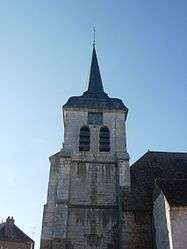 | |
 Rigny-le-Ferron Location within Grand Est region  Rigny-le-Ferron | |
| Coordinates: 48°12′33″N 3°37′57″E / 48.2092°N 3.6325°ECoordinates: 48°12′33″N 3°37′57″E / 48.2092°N 3.6325°E | |
| Country | France |
| Region | Grand Est |
| Department | Aube |
| Arrondissement | Troyes |
| Canton | Aix-en-Othe |
| Intercommunality | Pays d'Othe aixois |
| Government | |
| • Mayor (2008–2014) | Jannick Deraeve |
| Area1 | 19.05 km2 (7.36 sq mi) |
| Population (2008)2 | 374 |
| • Density | 20/km2 (51/sq mi) |
| Time zone | UTC+1 (CET) |
| • Summer (DST) | UTC+2 (CEST) |
| INSEE/Postal code | 10319 /10160 |
|
1 French Land Register data, which excludes lakes, ponds, glaciers > 1 km2 (0.386 sq mi or 247 acres) and river estuaries. 2 Population without double counting: residents of multiple communes (e.g., students and military personnel) only counted once. | |
Rigny-le-Ferron is a commune in the Aube department in north-central France.
Population
| Historical population | ||
|---|---|---|
| Year | Pop. | ±% |
| 1962 | 488 | — |
| 1968 | 501 | +2.7% |
| 1975 | 379 | −24.4% |
| 1982 | 347 | −8.4% |
| 1990 | 296 | −14.7% |
| 1999 | 337 | +13.9% |
| 2008 | 374 | +11.0% |
See also
References
| Wikimedia Commons has media related to Rigny-le-Ferron. |
This article is issued from
Wikipedia.
The text is licensed under Creative Commons - Attribution - Sharealike.
Additional terms may apply for the media files.