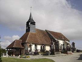
Rouilly-Sacey
| Rouilly-Sacey | |
|---|---|
| Commune | |
 | |
 Rouilly-Sacey Location within Grand Est region  Rouilly-Sacey | |
| Coordinates: 48°20′49″N 4°15′47″E / 48.3469°N 4.2631°ECoordinates: 48°20′49″N 4°15′47″E / 48.3469°N 4.2631°E | |
| Country | France |
| Region | Grand Est |
| Department | Aube |
| Arrondissement | Troyes |
| Canton | Brienne-le-Château |
| Intercommunality | Forêts, lacs, terres en Champagne |
| Government | |
| • Mayor (2008–2014) | Patrick Dyon |
| Area1 | 19.48 km2 (7.52 sq mi) |
| Population (2008)2 | 328 |
| • Density | 17/km2 (44/sq mi) |
| Time zone | UTC+1 (CET) |
| • Summer (DST) | UTC+2 (CEST) |
| INSEE/Postal code | 10328 /10220 |
| Elevation |
113–188 m (371–617 ft) (avg. 118 m or 387 ft) |
|
1 French Land Register data, which excludes lakes, ponds, glaciers > 1 km2 (0.386 sq mi or 247 acres) and river estuaries. 2 Population without double counting: residents of multiple communes (e.g., students and military personnel) only counted once. | |
Rouilly-Sacey is a commune in the Aube department in north-central France.
Population
| Historical population | ||
|---|---|---|
| Year | Pop. | ±% |
| 1962 | 243 | — |
| 1968 | 254 | +4.5% |
| 1975 | 296 | +16.5% |
| 1982 | 361 | +22.0% |
| 1990 | 342 | −5.3% |
| 1999 | 341 | −0.3% |
| 2008 | 328 | −3.8% |
See also
References
| Wikimedia Commons has media related to Rouilly-Sacey. |
This article is issued from
Wikipedia.
The text is licensed under Creative Commons - Attribution - Sharealike.
Additional terms may apply for the media files.