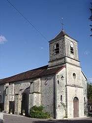
Éguilly-sous-Bois
| Éguilly-sous-Bois | ||
|---|---|---|
| Commune | ||
 | ||
| ||
 Éguilly-sous-Bois Location within Grand Est region  Éguilly-sous-Bois | ||
| Coordinates: 48°08′25″N 4°32′14″E / 48.1403°N 4.5372°ECoordinates: 48°08′25″N 4°32′14″E / 48.1403°N 4.5372°E | ||
| Country | France | |
| Region | Grand Est | |
| Department | Aube | |
| Arrondissement | Troyes | |
| Canton | Bar-sur-Seine | |
| Intercommunality | L'Arce et l'Ource | |
| Government | ||
| • Mayor (2008–2014) | Marcel Amblard | |
| Area1 | 10.11 km2 (3.90 sq mi) | |
| Population (2008)2 | 117 | |
| • Density | 12/km2 (30/sq mi) | |
| Time zone | UTC+1 (CET) | |
| • Summer (DST) | UTC+2 (CEST) | |
| INSEE/Postal code | 10136 /10110 | |
|
1 French Land Register data, which excludes lakes, ponds, glaciers > 1 km2 (0.386 sq mi or 247 acres) and river estuaries. 2 Population without double counting: residents of multiple communes (e.g., students and military personnel) only counted once. | ||

Éguilly-sous-Bois is a commune in the Aube department in north-central France.
Population
| Historical population | ||
|---|---|---|
| Year | Pop. | ±% |
| 1962 | 140 | — |
| 1968 | 111 | −20.7% |
| 1975 | 96 | −13.5% |
| 1982 | 105 | +9.4% |
| 1990 | 104 | −1.0% |
| 1999 | 98 | −5.8% |
| 2008 | 117 | +19.4% |
See also
References
| Wikimedia Commons has media related to Éguilly-sous-Bois. |
This article is issued from
Wikipedia.
The text is licensed under Creative Commons - Attribution - Sharealike.
Additional terms may apply for the media files.