Longsols
| Longsols | |
|---|---|
| Commune | |
 | |
 Longsols Location within Grand Est region  Longsols | |
| Coordinates: 48°25′55″N 4°17′14″E / 48.4319°N 4.2872°ECoordinates: 48°25′55″N 4°17′14″E / 48.4319°N 4.2872°E | |
| Country | France |
| Region | Grand Est |
| Department | Aube |
| Arrondissement | Troyes |
| Canton | Arcis-sur-Aube |
| Government | |
| • Mayor | Jean-Luc Wagnon |
| Area1 | 12.61 km2 (4.87 sq mi) |
| Population (2008)2 | 127 |
| • Density | 10/km2 (26/sq mi) |
| Time zone | UTC+1 (CET) |
| • Summer (DST) | UTC+2 (CEST) |
| INSEE/Postal code | 10206 /10240 |
|
1 French Land Register data, which excludes lakes, ponds, glaciers > 1 km2 (0.386 sq mi or 247 acres) and river estuaries. 2 Population without double counting: residents of multiple communes (e.g., students and military personnel) only counted once. | |
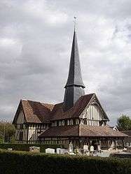
Longsols is a commune in the Aube department in north-central France.
Population
| Historical population | ||
|---|---|---|
| Year | Pop. | ±% |
| 1962 | 179 | — |
| 1968 | 181 | +1.1% |
| 1975 | 169 | −6.6% |
| 1982 | 147 | −13.0% |
| 1990 | 137 | −6.8% |
| 1999 | 131 | −4.4% |
| 2008 | 127 | −3.1% |
See also
References
| Wikimedia Commons has media related to Longsols. |
This article is issued from
Wikipedia.
The text is licensed under Creative Commons - Attribution - Sharealike.
Additional terms may apply for the media files.