Vendeuvre-sur-Barse
| Vendeuvre-sur-Barse | ||
|---|---|---|
| Commune | ||
 | ||
| ||
 Vendeuvre-sur-Barse Location within Grand Est region  Vendeuvre-sur-Barse | ||
| Coordinates: 48°14′21″N 4°28′07″E / 48.2392°N 4.4686°ECoordinates: 48°14′21″N 4°28′07″E / 48.2392°N 4.4686°E | ||
| Country | France | |
| Region | Grand Est | |
| Department | Aube | |
| Arrondissement | Bar-sur-Aube | |
| Canton | Vendeuvre-sur-Barse | |
| Intercommunality | Rivières | |
| Government | ||
| • Mayor (2008–2014) | Claude Ruelle | |
| Area1 | 51.94 km2 (20.05 sq mi) | |
| Population (2012)2 | 2,395 | |
| • Density | 46/km2 (120/sq mi) | |
| Time zone | UTC+1 (CET) | |
| • Summer (DST) | UTC+2 (CEST) | |
| INSEE/Postal code | 10401 /10140 | |
| Elevation |
144–233 m (472–764 ft) (avg. 177 m or 581 ft) | |
|
1 French Land Register data, which excludes lakes, ponds, glaciers > 1 km2 (0.386 sq mi or 247 acres) and river estuaries. 2 Population without double counting: residents of multiple communes (e.g., students and military personnel) only counted once. | ||

Vendeuvre-sur-Barse is a commune in the Aube department in north-central France.
Geography
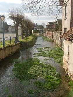
The Barse has its source in the commune, under the chateau.
Population
| Historical population | ||
|---|---|---|
| Year | Pop. | ±% |
| 1962 | 1,803 | — |
| 1968 | 1,821 | +1.0% |
| 1975 | 2,613 | +43.5% |
| 1982 | 2,940 | +12.5% |
| 1990 | 2,793 | −5.0% |
| 1999 | 2,623 | −6.1% |
| 2008 | 2,385 | −9.1% |
| 2012 | 2,395 | +0.4% |
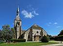 Saint-Pierre church
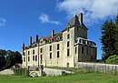 The castle
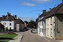 Street in the village
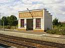 Train station: shelter
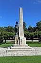 War memorial
See also
References
| Wikimedia Commons has media related to Vendeuvre-sur-Barse. |
This article is issued from
Wikipedia.
The text is licensed under Creative Commons - Attribution - Sharealike.
Additional terms may apply for the media files.