Dienville
| Dienville | ||
|---|---|---|
| Commune | ||
 | ||
| ||
 Dienville Location within Grand Est region  Dienville | ||
| Coordinates: 48°21′05″N 4°32′04″E / 48.3514°N 4.5344°ECoordinates: 48°21′05″N 4°32′04″E / 48.3514°N 4.5344°E | ||
| Country | France | |
| Region | Grand Est | |
| Department | Aube | |
| Arrondissement | Bar-sur-Aube | |
| Canton | Brienne-le-Château | |
| Government | ||
| • Mayor (2008–2014) | Jacky Harmant | |
| Area1 | 20.34 km2 (7.85 sq mi) | |
| Population (2008)2 | 809 | |
| • Density | 40/km2 (100/sq mi) | |
| Time zone | UTC+1 (CET) | |
| • Summer (DST) | UTC+2 (CEST) | |
| INSEE/Postal code | 10123 /10500 | |
| Elevation |
120–186 m (394–610 ft) (avg. 128 m or 420 ft) | |
|
1 French Land Register data, which excludes lakes, ponds, glaciers > 1 km2 (0.386 sq mi or 247 acres) and river estuaries. 2 Population without double counting: residents of multiple communes (e.g., students and military personnel) only counted once. | ||

Dienville is a commune in the Aube department in north-central France.
History
The village of Dienville is mentioned in 864 under the name Dienvilla. There remains an Ancient Roman road, a vestige of that era.
Population
Dienville was the home of Abbé Courtalon Delestre (1735-1786), a historian and poet, and fr:Jean-Baptiste Courtalon (1740-1797), Cleric of the Chapel for Louis XV and Chaplain of Louis XVI.
| Historical population | ||
|---|---|---|
| Year | Pop. | ±% |
| 1962 | 844 | — |
| 1968 | 844 | +0.0% |
| 1975 | 812 | −3.8% |
| 1982 | 781 | −3.8% |
| 1990 | 796 | +1.9% |
| 1999 | 747 | −6.2% |
| 2008 | 809 | +8.3% |
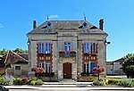 Town hall
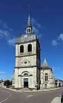 Saint Quentin church
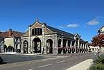 Market hall
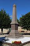 War memorial
See also
References
| Wikimedia Commons has media related to Dienville. |
This article is issued from
Wikipedia.
The text is licensed under Creative Commons - Attribution - Sharealike.
Additional terms may apply for the media files.