Ramerupt
| Ramerupt | ||
|---|---|---|
| Commune | ||
| ||
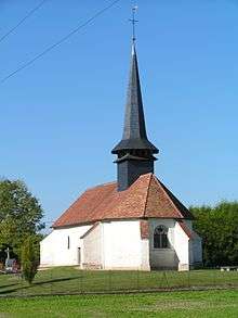
 Ramerupt Location within Grand Est region  Ramerupt | ||
| Coordinates: 48°31′12″N 4°17′35″E / 48.52°N 4.2931°ECoordinates: 48°31′12″N 4°17′35″E / 48.52°N 4.2931°E | ||
| Country | France | |
| Region | Grand Est | |
| Department | Aube | |
| Arrondissement | Troyes | |
| Canton | Arcis-sur-Aube | |
| Government | ||
| • Mayor (2008–2014) | Gérald Tarin | |
| Area1 | 13.6 km2 (5.3 sq mi) | |
| Population (2012)2 | 375 | |
| • Density | 28/km2 (71/sq mi) | |
| Time zone | UTC+1 (CET) | |
| • Summer (DST) | UTC+2 (CEST) | |
| INSEE/Postal code | 10314 /10240 | |
| Elevation |
93–164 m (305–538 ft) (avg. 101 m or 331 ft) | |
|
1 French Land Register data, which excludes lakes, ponds, glaciers > 1 km2 (0.386 sq mi or 247 acres) and river estuaries. 2 Population without double counting: residents of multiple communes (e.g., students and military personnel) only counted once. | ||

Ramerupt is a commune in the Aube department in north-central France.
Population
| Historical population | ||
|---|---|---|
| Year | Pop. | ±% |
| 1962 | 368 | — |
| 1968 | 370 | +0.5% |
| 1975 | 329 | −11.1% |
| 1982 | 362 | +10.0% |
| 1990 | 347 | −4.1% |
| 1999 | 357 | +2.9% |
| 2008 | 385 | +7.8% |
| 2012 | 375 | −2.6% |
Personalities
- Rashbam, medieval rabbi and scriptural commentator
- Rabbeinu Tam, medieval rabbi
See also
References
| Wikimedia Commons has media related to Ramerupt. |
This article is issued from
Wikipedia.
The text is licensed under Creative Commons - Attribution - Sharealike.
Additional terms may apply for the media files.