Agostinho Neto, São Tomé and Príncipe
| Agostinho Neto | |
|---|---|
| Village | |
.jpg) Roça Rio do Ouro along the village's main street | |
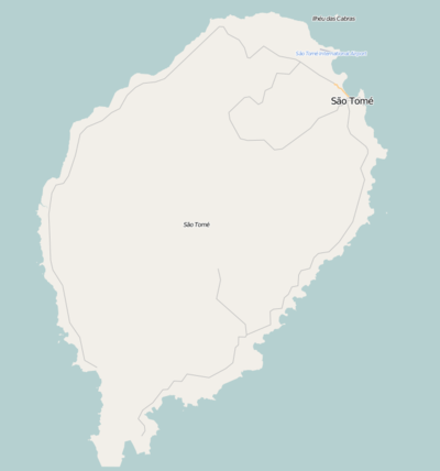 Agostinho Neto Location on São Tomé Island | |
| Coordinates: 0°22′00″N 6°38′36″E / 0.3667°N 6.6434°ECoordinates: 0°22′00″N 6°38′36″E / 0.3667°N 6.6434°E | |
| Country |
|
| Province | São Tomé |
| District | Lobata |
| Population (2008) | |
| • Total | 869 |
| Time zone | UTC+0 (UTC) |
Agostinho Neto is a small mountain and a settlement in Lobata District on São Tomé Island in São Tomé and Príncipe. Its population is 869 (2008 est.).[1] The locality is located nearly southeast of Guadalupe and has two accessed roads connecting the EN-1 which links with São Tomé to the east and Neves to the west. Also northeast is the village of Conde.
The settlement had a different name before São Tomé and Príncipe became independent in 1975, the name was Rio do Ouro meaning the golden river. After independence, the settlement and the plantation were named after the founding father of Angola, Agostinho Neto. It functions today as a hotel.
Roça Rio do Ouro is a nearby former factory and warehouse for coffee and cocoa. The landmark is classified as Heritage of Portuguese Influence of Foreign Countries.[2]
Population history
| Historical population | ||
|---|---|---|
| Year | Pop. | ±% |
| 2001 (census) | 762 | — |
| 2008 (estimate) | 869 | +14.0% |
About the village
Agriculture is the dominant industry. Cocoa and coffee have been the dominant crops and cover most of the village's and the area's production.
Sports
The football (soccer) club of the village is Amador, they play at a nearby field.
References
- ↑ INE Archived 2017-02-09 at the Wayback Machine., Evolução da população São-Tomense por localidades, 2001/2007-08
- ↑ "Roça Rio do Ouro" (in Portuguese). SIPA. Retrieved 2017-11-30.
External links
- Roça Rio do Ouro - As Roças de São Tomé
| Communities | 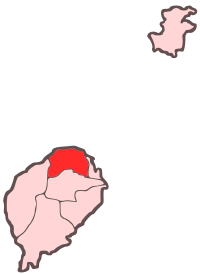 | |
|---|---|---|
| Geography | ||
| Landmarks | ||
| Culture | ||