Santo Amaro, São Tomé and Príncipe
| Santo Amaro | |
|---|---|
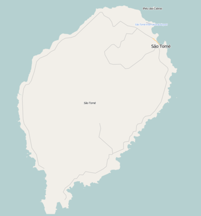 Santo Amaro Location on São Tomé Island | |
| Coordinates: 0°22′0″N 6°41′20″E / 0.36667°N 6.68889°ECoordinates: 0°22′0″N 6°41′20″E / 0.36667°N 6.68889°E | |
| Country |
|
| Province: | São Tomé |
| District | Lobata |
| Population (2008) | |
| • Total | 563 |
| Time zone | UTC0 (GMT) |
Santo Amaro is a town in São Tomé and Príncipe. It is located in Lobata District, northern São Tomé Island. Its population is 563 (2008 est.)[1] and is connected with Route 2 connecting the capital and Neves. It also serves as a subdistrict (municipality) of its own covering the southeast of the district.
Nearby places includes Laranjeiras, Desejada, Aguâ Casada, Bela Vista and Nova Sintra (Nova Cintra).
Population history
| Historical population | ||
|---|---|---|
| Year | Pop. | ±% |
| 2001 (census) | 494 | — |
| 2008 (estimate) | 563 | +14.0% |
References
Bibliography
- Great World Atlas, Reader's Digest Issues, 1st. Edition, September 2006, p. 223 ISBN 972-609-471-2
- Grande Atlas Mundial, Selecções do Reader´s Digest, 1ª Edc. setembro, 2006, Pág. 223.
- Grande Dicionário Enciclopédico Ediclube (Great Encyclopedic Dictionary) Vol. XVI, p. 5574 and 5575. 1996. ISBN 972-719-056-1
| Communities | 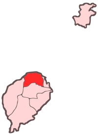 | |
|---|---|---|
| Geography | ||
| Landmarks | ||
| Culture | ||
This article is issued from
Wikipedia.
The text is licensed under Creative Commons - Attribution - Sharealike.
Additional terms may apply for the media files.